
Kirovske / Isliam-Terek
Іслям-Терек — Ислям-Терек — İslâm Terek | |
|---|---|
 | |
 Flag  Coat of arms | |
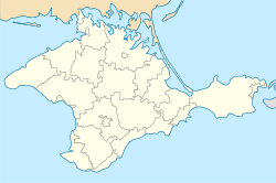 Kirovske / Isliam-Terek Location of Isliam-Terek in Crimea | |
| Coordinates: 45°13′25″N 35°12′19″E / 45.22361°N 35.20528°E | |
| Republic | Crimea |
| District | Kirovske Raion |
| First mentioned | 1783 |
| Town status | 1957 |
| Government | |
| • Mayor | Aleksandr Evseyev[1] |
| Area | |
| • Total | 5.99 km2 (2.31 sq mi) |
| Elevation | 23 m (75 ft) |
| Population (2014) | |
| • Total | 6,883 |
| • Density | 1,100/km2 (3,000/sq mi) |
| Time zone | UTC+4 (MSK) |
| Postal code | 297300 |
| Area code | +7 365 55 |
| Climate | Cfa |
| Website | http://rada.gov.ua/[permanent dead link] |
Kirovske (Ukrainian: Кіровське; Russian: Кировское, romanized: Kirovskoye) or Isliam-Terek (Ukrainian: Іслям-Терек; Russian: Ислям-Терек; Crimean Tatar: İslâm Terek) is an urban-type settlement in the Crimea, a territory recognized by a majority of countries as part of Ukraine and incorporated by Russia as the Republic of Crimea. Population: 6,883 (2014 Census).[3]
Kirovske also serves as the administrative center of the Kirovske Raion (district), housing the district's local administration buildings.[4]
A military air base, Kirovske, is located south of the town. It was used extensively by Soviet Naval Aviation and Soviet Air Defense Forces during the Cold War.
As of the 2001 Ukrainian Census, its population was 7,431.[4]
History
The first documentary mention of the village, originally known as İslâm Terek, is found in the Chamber Description of Crimea of the year 1784, according to which, during the final period of the Crimean Khanate, İslâm Terek was part of the Eski Qırım kadiluk of the Kefe Eyalet. After the annexation of the Crimean Khanate by the Russian Empire on April 19, 1783, by the decree of Catherine II to the Senate on February 19, 1784, the Taurida Oblast was formed on the territory of the former Crimean Khanate, and the village was assigned to the Levkopol county, and after the dissolution of the Levkopol county in 1787, it was assigned to the Feodosia county of the Taurida Oblast. After the Pauline reforms from 1796 to 1802, it was included in the Akmechet county of the Novorossiya Governorate. Under the new administrative division, following the creation of the Taurida Governorate on October 8 (20), 1802, İslâm Terek was included in the Parpach volost of the Feodosiysky Uyezd.[5]
İslâm Terek was renamed Kirovske in 1944 by the Soviet government. On 23 August 2023 the Ukrainian parliament symbolically restored the former name.[6]
References
- ^ "Aleksandr Evseyev Elected as Mayor of Kirovskoye" (in Russian). Retrieved 25 October 2018.
- ^ "Kirovske (Crimea, Kirovske Raion)". weather.in.ua (in Ukrainian). Retrieved 14 February 2012.
- ^ Russian Federal State Statistics Service (2014). "Таблица 1.3. Численность населения Крымского федерального округа, городских округов, муниципальных районов, городских и сельских поселений" [Table 1.3. Population of Crimean Federal District, Its Urban Okrugs, Municipal Districts, Urban and Rural Settlements]. Федеральное статистическое наблюдение «Перепись населения в Крымском федеральном округе». ("Population Census in Crimean Federal District" Federal Statistical Examination) (in Russian). Federal State Statistics Service. Retrieved January 4, 2016.
- ^ a b "Kirovske, Autonomous Republic of Crimea, Kirovske Raion". Regions of Ukraine and their Structure (in Ukrainian). Verkhovna Rada of Ukraine. Retrieved 14 February 2012.[permanent dead link]
- ^ Лашков, Фёдор Фёдорович (1888). "Камеральное описание Крыма, 1784 года - Каймаканствы и в оных каймаканами кто состоит". Известия Таврической ученой архивной комиссии. 6. Симф.: Типогр. Таврическ. Губ. Земства.
- ^ У Раді вирішили декомунізувати Крим ще до його деокупації

This article about a location in Crimea is a stub. You can help Wikipedia by expanding it. |