
Sanatorne
Санаторне | |
|---|---|
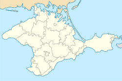 Sanatorne Location of Sanatorne in Crimea | |
| Coordinates: 44°23′54″N 33°48′47″E / 44.39833°N 33.81306°E | |
| Republic | Crimea |
| Municipality | Yalta Municipality |
| Town status | 1971 |
| Elevation | 79 m (259 ft) |
| Population (2014) | |
| • Total | 232 |
| Time zone | UTC+4 (MSK) |
| Postal code | 98692 |
| Area code | +380 654 |
| Climate | Cfb |
| Website | http://rada.gov.ua/ |

Sanatorne (Ukrainian: Санаторне; Russian: Санаторное; Crimean Tatar: Melas, from Greek Μέλας) is an urban-type settlement in the Yalta Municipality of the Autonomous Republic of Crimea, a territory recognized by a majority of countries as part of Ukraine and annexed by Russia as the Republic of Crimea.[2]
Sanatorne is located on Crimea's southern shore at an elevation of 79 metres (259 ft).[1] The settlement is located 3 km (1.9 mi) east from Foros, which it is administratively subordinate to.[2] Its population was 531 in the 2001 Ukrainian census.[2] Current population: 232 (2014 Census).[3]
References
- ^ a b "Sanatorne (Crimea region)". weather.in.ua. Retrieved 30 July 2014.
- ^ a b c "Sanatorne, Autonomous Republic of Crimea, City of Yalta". Regions of Ukraine and their Structure (in Ukrainian). Verkhovna Rada of Ukraine. Archived from the original on 8 August 2014. Retrieved 30 July 2014.
- ^ Russian Federal State Statistics Service (2014). "Таблица 1.3. Численность населения Крымского федерального округа, городских округов, муниципальных районов, городских и сельских поселений" [Table 1.3. Population of Crimean Federal District, Its Urban Okrugs, Municipal Districts, Urban and Rural Settlements]. Федеральное статистическое наблюдение «Перепись населения в Крымском федеральном округе». ("Population Census in Crimean Federal District" Federal Statistical Examination) (in Russian). Federal State Statistics Service. Retrieved January 4, 2016.
| Cities |  | |
|---|---|---|
| Rural settlements | ||
| Villages | ||
This article about a location in Crimea is a stub. You can help Wikipedia by expanding it. |