
| Davenport Murchison Ranges Northern Territory | |||||||||||||||
|---|---|---|---|---|---|---|---|---|---|---|---|---|---|---|---|
 Old Police Station Waterhole in Iytwelepenty / Davenport Range National Park | |||||||||||||||
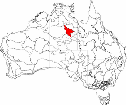 The interim Australian bioregions, with Davenport Murchison Ranges in red | |||||||||||||||
| Area | 58,051.08 km2 (22,413.6 sq mi) | ||||||||||||||
| |||||||||||||||
Davenport Murchison Ranges is an interim Australian bioregion located in the Northern Territory.[1] It has an area of 5,805,108 hectares (14,344,730 acres).[2] The bioregion is part of the larger Great Sandy-Tanami desert ecoregion.
Subregions
Davenport Murchison Ranges is made up of three subregions:[2]
- Ashburton Range (DMR01) – 1,218,621 hectares (3,011,280 acres)
- Davenport (DMR02) – 1,589,590 hectares (3,928,000 acres)
- Barkly (DMR03) – 2,996,897 hectares (7,405,490 acres)
Protected areas
Less than 5% of the bioregion is in protected areas,[3] the largest of which is Iytwelepenty / Davenport Range National Park in the Barkly subregion.
References
- ^ Environment Australia. "Revision of the Interim Biogeographic Regionalisation for Australia (IBRA) and Development of Version 5.1 – Summary Report" (PDF). Department of the Environment and Water Resources, Australian Government. Retrieved 3 May 2022.
{{cite journal}}: Cite journal requires|journal=(help) - ^ a b "Interim Biogeographic Regionalisation for Australia (IBRA7) regions and codes". Department of Sustainability, Environment, Water, Population and Communities. Commonwealth of Australia. 2012. Retrieved 3 May 2022.
- ^ "National Reserve System - IBRA Region Protection Level" (PDF). Department of Agriculture, Water and the Environment, Australian Government. Geospatial & Information Analytics Branch, Australian Government Department of Agriculture, Water and the Environment. Commonwealth of Australia. March 2021. Retrieved 28 May 2022.