
Cák
Caka (in Croatian) Zackenbach (in German) | |
|---|---|
Village | |
 | |
 Flag  Coat of arms | |
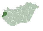
 Cák Location of Cák | |
| Coordinates: 47°21′16″N 16°30′53″E / 47.35456°N 16.51470°E | |
| Country | Hungary |
| Region | Western Transdanubia |
| County | Vas |
| District | Kőszeg |
| Area | |
| • Total | 6.48 km2 (2.50 sq mi) |
| Population (1 January 2023)[1] | |
| • Total | 293 |
| • Density | 45/km2 (120/sq mi) |
| Time zone | UTC+1 (CET) |
| • Summer (DST) | UTC+2 (CEST) |
| Postal code | 9725 |
| Area code | (+36) 94 |
| Website | www |
Cák is a village in Vas County, Hungary, 25 km away from Szombathely and 6 km south from Kőszeg.
YouTube Encyclopedic
-
1/2Views:58 772347 023
-
Cak Nun, Cak Fuad, KiaiKanjeng - Syi'ru Abi Nuwas
-
Lawak Lucu Cak Lontong Lahir di Belanda bagian 1 #YtPop
Transcription
History
In Cák graves have been found from Roman times. The earliest known reference to the village was from 1279 as Villa Chak. Turks destroyed the village in 1532, and Christian soldiers burned it down in 1573 and 1606.[2]
External links
- Street map (in Hungarian)
References
- ^ Error: Unable to display the reference properly. See the documentation for details.
- ^ Cák in the German language Wikipedia

| International | |
|---|---|
| National | |
This Vas location article is a stub. You can help Wikipedia by expanding it. |