
Ólmod
Plajgor (in Croatian) Bleigraben (in German) | |
|---|---|
Village | |
 | |
 Flag  Coat of arms | |
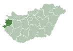
 Ólmod Location of Ólmod | |
| Coordinates: 47°24′54″N 16°35′23″E / 47.415°N 16.589722°E | |
| Country | Hungary |
| Region | Western Transdanubia |
| County | Vas |
| District | Kőszeg |
| Area | |
| • Total | 3.66 km2 (1.41 sq mi) |
| Population (1 January 2023)[1] | |
| • Total | 115 |
| • Density | 31/km2 (81/sq mi) |
| Time zone | UTC+1 (CET) |
| • Summer (DST) | UTC+2 (CEST) |
| Postal code | 9733 |
| Area code | (+36) 94 |
Ólmod is a village in Vas county, Hungary.
YouTube Encyclopedic
-
1/3Views:72 06774 394796
-
Que no se te borre de la mente - Carlos Olmos - 4 Junio 2014
-
¿Qué tengo yo de fariseo? - Carlos Olmos - 14 Octubre 2012
-
Stalker suit in Cordon
Transcription
References
- ^ Error: Unable to display the reference properly. See the documentation for details.

This Vas location article is a stub. You can help Wikipedia by expanding it. |