
| Zwettl | ||
|---|---|---|
| Localidad | ||
 | ||
 Escudo | ||
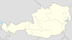 Zwettl Localización de Zwettl en Austria | ||
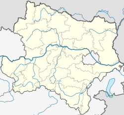 Zwettl Localización de Zwettl en Baja Austria | ||
| Coordenadas | 48°36′12″N 15°10′08″E / 48.603333333333, 15.168888888889 | |
| Idioma oficial | Alemán | |
| Entidad | Localidad | |
| • País |
| |
| • Estado | Baja Austria | |
| • Distrito | Zwettl | |
| Alcalde | Herbert Prinz (ÖVP) | |
| Superficie | ||
| • Total | 256,07 km² | |
| Altitud | ||
| • Media | 520 y 612 m s. n. m. | |
| Población (2022) | ||
| • Total | 10 722 hab. | |
| • Densidad | 41,83 hab./km² | |
| Huso horario | UTC+01:00 y UTC+02:00 | |
| Código postal | 3910[1] | |
| Prefijo telefónico | 02822 | |
| Matrícula | ZT | |
| Sitio web oficial | ||
La ciudad de Zwettl es un municipio austríaco capital del distrito de Zwettl situado en el estado federado de Baja Austria. La ciudad fue fundada en el siglo XII por los caballeros de Kuenring. Se encuentra cerca de la conocida Abadía Cisterciense de Zwettl, fundada en 1137.
YouTube Encyclopedic
-
1/3Views:2 779610419
-
Stadt Zwettl
-
Privatbrauerei Zwettl
-
Vernetzungstreffen Gesunde Schule in der PNMS Zwettl
Transcription
Topónimo
Parece bastante evidente que el moderno topónimo Zwettl deriva de la expresión en lengua eslava svetla que significa "calvero, calva".
Geografía
Zwettl se encuentra localizada en el denominado "Waldviertel", en la confluencia de los ríos Kamp y Zwettl. Su altitud es de 520 metros sobre el nivel del mar.
| Schweiggers, Kirchberg am Walde | Vitis, Echsenbach | Allentsteig |
| Groß Gerungs, Großschönau | 
|
Pölla, Rastenfeld |
| Rapottenstein | Großgöttfritz | Waldhausen |
Demografía
Según el Instituto Austriaco de Estadística (Statistik Austria) en el año 2008 había 11.444 habitantes residiendo en el municipio. La densidad de población era de 44,69/km².[2]
Administración y subdivisiones
Zwettl se divida en 69 subdiviones administrativas (Katastralgemeinden): Annatsberg – Bernhards – Böhmhöf – Bösenneunzehn – Edelhof – Eschabruck – Flachau – Friedersbach – Gerlas – Germanns – Gerotten – Gradnitz – Großglobnitz – Großhaslau – Gschwendt – Guttenbrunn – Hörmanns – Hörweix – Jagenbach – Jahrings – Kleehof – Kleinmeinharts – Kleinotten – Kleinschönau – Koblhof – Koppenzeil – Kühbach – Marbach am Walde – Mayerhöfen – Merzenstein – Mitterreith – Moidrams – Negers – Neusiedl – Niederglobnitz – Niederneustift – Niederstrahlbach – Oberhof – Oberndorf – Oberplöttbach – Oberstrahlbach – Ottenschlag – Pötzles – Purken – Ratschenhof – Rieggers – Ritzmannshof – Rosenau Dorf – Rosenau Schloß – Rottenbach – Rudmanns – Schickenhof – Syrafeld – Unterrabenthan – Unterrosenauerwaldhäuser – Uttissenbach – Waldhams – Wildings – Wolfsberg – Zwettl Stadt – Stift Zwettl
Ciudades hermanadas
Zwettl participa activamente en el hermanamiento de ciudades que promueve el intercambio cultural, amistoso y humano entre varias regiones. La localidad está hermanada con las siguientes ciudades:
Referencias
- ↑ Worldpostalcodes.org, código postal n.º 3910.
- ↑ Statistik Austria. «Poblacion 2008 Zwettl». Consultado el 7 de noviembre de 2008.
Enlaces externos
 Wikimedia Commons alberga una categoría multimedia sobre Zwettl.
- Web oficial del Ayuntamiento de Zwettl