
| St. James | ||
|---|---|---|
| Localidad | ||
 Vista de la localidad
| ||
 St. James Localización de St. James en Trinidad y Tobago | ||
| Coordenadas | 10°40′25″N 61°32′02″O / 10.6736, -61.5338 | |
| Entidad | Localidad | |
| • País |
| |
| • Isla | Trinidad | |
| • Ciudad | Puerto España | |
| Población (2011) | ||
| • Total | 5985 hab. | |
St. James es una localidad de Trinidad y Tobago, que forma parte de la ciudad de Puerto España.[1][2]
Geografía
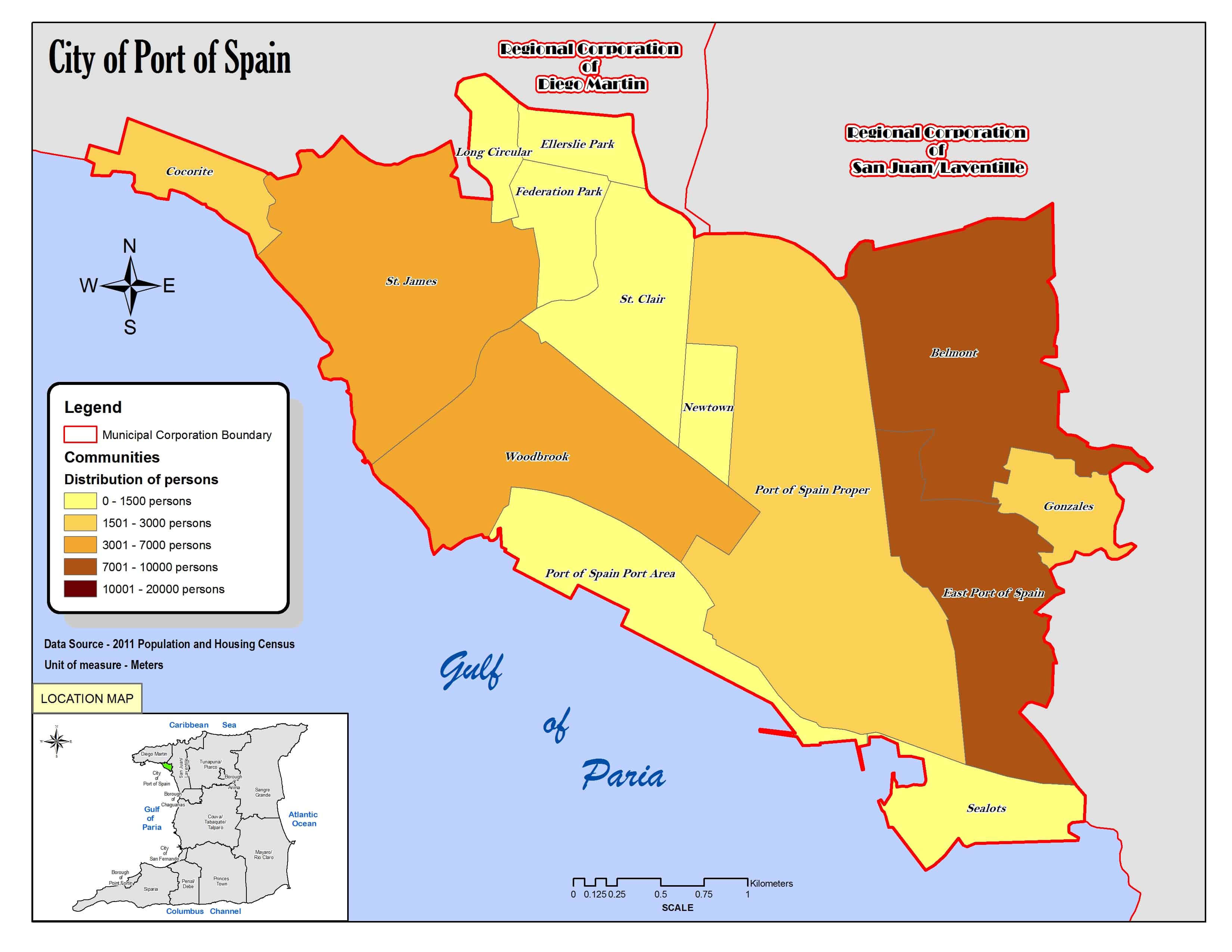
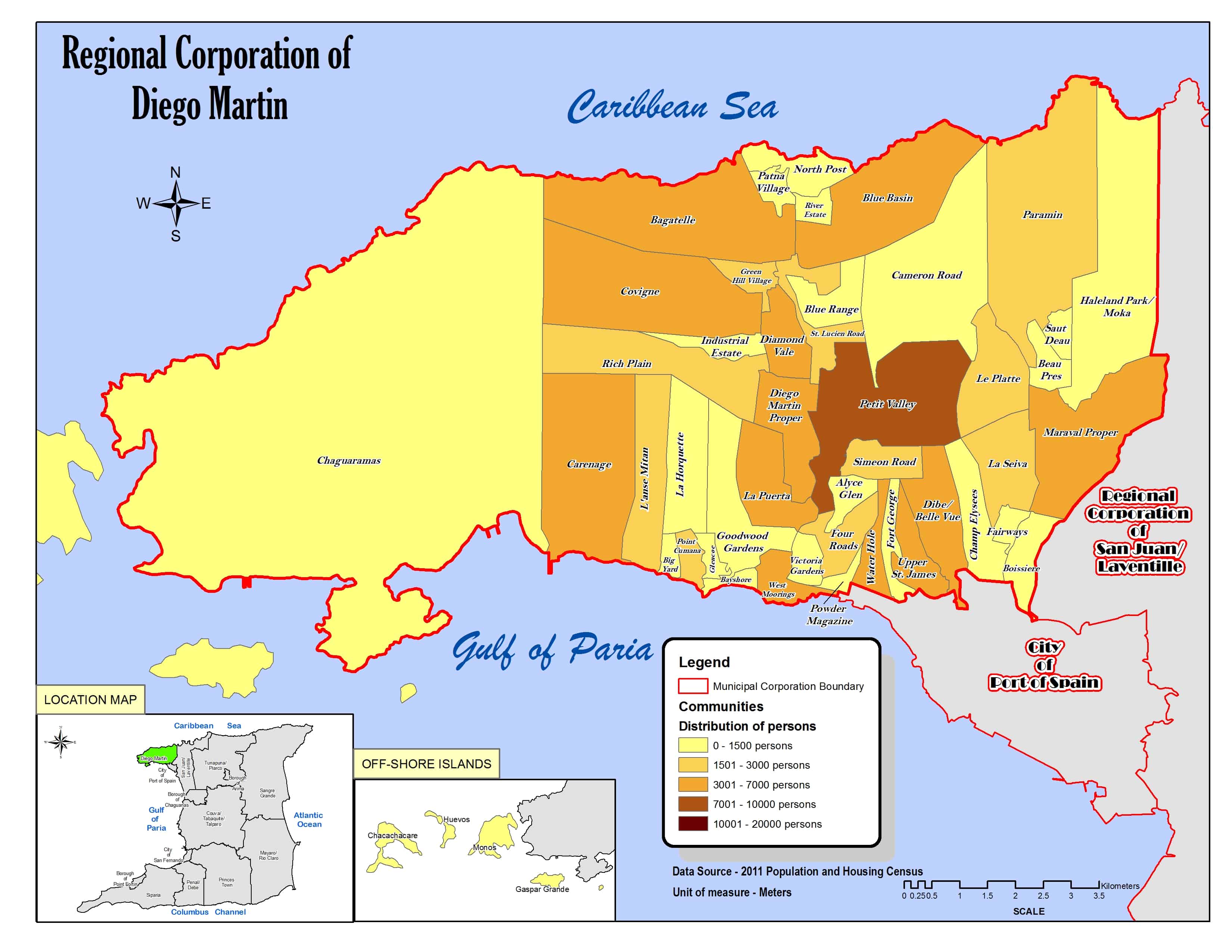
La localidad abarca parte de la isla Trinidad y limita al norte con Fort George, Upper St. James, Dibe-Belle Vue (las tres pertenecientes a la región de Diego Martín), Long Circular y Federation Park, al sur con el golfo de Paria, al este con Federation Park, St. Clair y Woodbrook y al oeste con Cocorite.[3][4]
Demografía
Datos demográficos de la localidad de St. James:[1]
| Gráfica de evolución demográfica de St. James entre 2000 y 2011 |
 |
Referencias
- ↑ a b «TRINIDAD AND TOBAGO. Municipalities and Communities: The population of the cities, boroughs, regions, parishes and communities of Trinidad and Tobago by census years.». Citypopulation.de (en inglés). 18 de mayo de 2020. Consultado el 17 de septiembre de 2023.
- ↑ «Population Statistics: Demographic Profiles of Municipalities and Communities.». CENTRAL STATISTICAL OFFICE. Ministry of Planning and Development (cso.gov.tt) (en inglés). 2023. Consultado el 17 de septiembre de 2023.
- ↑ «City of Port of Spain. Location map.». cso.gov.tt (en inglés). 2011. Consultado el 17 de septiembre de 2023.
- ↑ «Regional Corporation of Diego Martin. Location map.». cso.gov.tt (en inglés). 2011. Consultado el 17 de septiembre de 2023.
Enlaces externos
 Wikimedia Commons alberga una categoría multimedia sobre St. James.
| Control de autoridades |
|
|---|
 Datos: Q7401398
- Multimedia: St. James (Trinidad and Tobago) / Q7401398