
| Sotteville-lès-Rouen | ||
|---|---|---|
| Entidad subnacional | ||
 | ||
 Escudo | ||
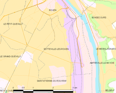
 Sotteville-lès-Rouen Localización de Sotteville-lès-Rouen en Francia | ||
 | ||
| Coordenadas | 49°24′31″N 1°05′21″E / 49.408611111111, 1.0891666666667 | |
| Entidad | Comuna de Francia | |
| • País | Francia | |
| • Región | Alta Normandía | |
| • Departamento | Sena Marítimo | |
| • Distrito | distrito de Rouen | |
| • Cantón | Chef-lieu de dos cantones: cantón de Sotteville-lès-Rouen-Est y cantón de Sotteville-lès-Rouen-Ouest.[1] | |
| • Mancomunidad | Communauté d'agglomération Rouen-Elbeuf-Austreberthe[2] | |
| Alcalde |
Pierre Bourguignon[3] (2008 - 2014) | |
| Superficie | ||
| • Total | 7.44 km² | |
| Altitud | ||
| • Media | 100 m s. n. m. | |
| • Máxima | 48[1] m s. n. m. | |
| • Mínima | 3[1] m s. n. m. | |
| Población (2007[4]) | ||
| • Total | 30 392 hab. | |
| • Densidad | 3893,15 hab./km² | |
| Gentilicio | Sottevillais, Sottevillaises (en francés) | |
| Huso horario | CET (UTC +1) | |
| • en verano | CEST (UTC +2) | |
| Código postal | 76300[6] | |
| Código INSEE | 76681[7] | |
| Sitio web oficial | ||
 | ||
Sotteville-lès-Rouen es una población y comuna francesa, en la región de Normandía, departamento de Sena Marítimo, en el distrito de Ruan. Es el chef-lieu de dos cantones: Sotteville-lès-Rouen-Est y Ouest.
Demografía
Referencias
- ↑ a b c d EHESS (ed.). «Sotteville-lès-Rouen - Notice Communale». Consultado el 5 de marzo de 2011.
- ↑ «Copia archivada». Archivado desde el original el 21 de agosto de 2011. Consultado el 1 de junio de 2011.
- ↑ https://web.archive.org/web/20110512232445/http://www.mairie-sotteville-les-rouen.fr/web/elus/presentation.php
- ↑ a b INSEE (ed.). «Populations légales en vigueur à compter du 1er janvier 2010». Consultado el 5 de marzo de 2011.
- ↑ La Poste SNA (ed.). «La Poste». Consultado el 5 de marzo de 2011.
- ↑ Worldpostalcodes.org, código postal n.º 76300.
- ↑ INSEE, Datos de población para el año 2012 de Sotteville-lès-Rouen (en francés).
 Wikimedia Commons alberga una categoría multimedia sobre Sotteville-lès-Rouen.
Enlaces externos
- INSEE (enlace roto disponible en Internet Archive; véase el historial, la primera versión y la última).
 Datos: Q317082
- Multimedia: Sotteville-lès-Rouen / Q317082