
| Schwäbisch Gmünd | ||||
|---|---|---|---|---|
| Entidad subnacional | ||||
 | ||||
 Schwäbisch Gmünd Localización de Schwäbisch Gmünd en Alemania | ||||
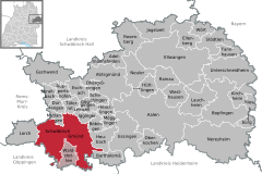 Ubicación de Schwäbisch Gmünd | ||||
| Coordenadas | 48°48′N 9°48′E / 48.8, 9.8 | |||
| Entidad | Municipio urbano de Alemania, Ciudad imperial libre (Sacro Imperio) y Greater district town in Baden-Württemberg | |||
| • País |
| |||
| Superficie | ||||
| • Total | 120,4 km² | |||
| Altitud | ||||
| • Media | 321 m s. n. m. | |||
| Población (31 de diciembre de 2022) | ||||
| • Total | 62 325 hab. | |||
| • Densidad | 547,77 hab/km² | |||
| Huso horario | UTC+01:00 y UTC+02:00 | |||
| Código postal | 73525–73529 | |||
| Prefijo telefónico | 07171, 07173, 07165 y 07332 | |||
| Matrícula | AA y GD | |||
| Número oficial de comunidad | 08136065 | |||
| Sitio web oficial | ||||

Schwäbisch Gmünd es una ciudad del estado federado alemán Baden-Württemberg, situada a unos 50 km de la capital Stuttgart. Es, tras Aalen, la segunda mayor ciudad en cuanto a número de habitantes del distrito de Ostalb. Fue ciudad imperial libre, hasta su anexión al Electorado de Wurtemberg en 1803.
YouTube Encyclopedic
-
1/3Views:16 4439 3218 245
-
Luftportrait Schwäbisch Gmünd
-
SCHWÄBISCH GMÜND STADTMITTE OLD TOWN FEBRUAR 2014-FULL HD
-
Imagefilm Hochschule für Gestaltung Schwäbisch Gmünd
Transcription
Zonas protegidas
En el término municipal de Schwäbisch Gmünd se encuentran cuatro reservas naturales:
- Bargauer Horn (25,2 ha, Ausweisung 1939)
- Kaltes Feld mit Hornberg, Galgenberg und Eierberg (634,4 ha, Ausweisung 1939)
- Lindenfeld (75,0 ha, Ausweisung 1994)
- Scheuelberg (119 ha, Ausweisung 1998)
Ciudades vecinas
Mutlangen, Durlangen, Täferrot, Iggingen, Böbingen an der Rems, Heubach, Bartholomä (alle wie Gmünd im Ostalbkreis), Lauterstein (Landkreis Göppingen), Waldstetten (Ostalbkreis), Donzdorf, Ottenbach, Göppingen, Wäschenbeuren (alle Landkreis Göppingen), Lorch (Ostalbkreis) sowie Alfdorf (Rems-Murr-Kreis).
Ciudades hermanas
- Barnsley (Gran Bretaña, desde 1971)
- Antibes (Francia, desde 1976)
- Bethlehem (Estados Unidos, desde 1991)
- Székesfehérvár (Hungría, desde 1991)
- Faenza (Italia, desde 2001)
Personas notables
Referencias
- Statistisches Bundesamt – Gemeinden in Deutschland mit Bevölkerung am 31.12.2012 (XLS-Datei; 4,0 MB) (Einwohnerzahlen auf Grundlage des Zensus 2011)
- Württembergisches Städtebuch von 1962.
- Klaus Pavel (Hrsg.): „25 Jahre Ostalbkreis 1973–1998. Eine Dokumentation“. In Ostalbkreis. Informationen zur Kreisgeschichte, Band 1, Landratsamt Aalen, Aalen, 1998, S. 76.
- Geologischer Pfad Schwäbisch Gmünd-Hohenrechberg, Einführung in die Landschaftsgeschichte und Landschaftsformen der östlichen Schwäbischen Alb und des Albvorlandes, 3. Auflage, 1988, Hrsg. v. Naturkundeverein Schwäbisch Gmünd e. V.
- Steckbrief des Naturschutzgebietes im Schutzgebietsverzeichnis der LUBW.
- Landschaftsplan Verwaltungsgemeinschaft Schwäbisch Gmünd – Waldstetten vom 8. Februar 2011, S. 26 ff.
Enlaces externos
 Wikimedia Commons alberga una galería multimedia sobre Schwäbisch Gmünd.
 Wikisource contiene obras originales de o sobre Schwäbisch Gmünd.
- Internetpräsenz der Stadt Schwäbisch Gmünd (en alemán)
 Datos: Q4037
- Multimedia: Schwäbisch Gmünd / Q4037