
| Pontypool Pont-y-pŵl | ||
|---|---|---|
| Ciudad | ||
 | ||
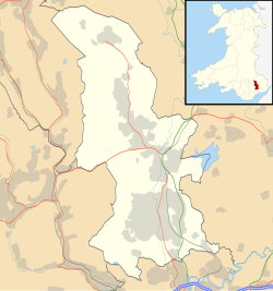 Pontypool Localización de Pontypool en Torfaen | ||
 | ||
| Coordenadas | 51°42′11″N 3°02′28″O / 51.703, -3.041 | |
| Entidad | Ciudad | |
| • País |
| |
| • Nación |
| |
| • Región | Gales del sur | |
| • Condado | Gwent | |
| • Autoridad | Torfaen | |
| Superficie | ||
| • Total | 9 km² | |
| Población (2021) | ||
| • Total | 29 062 hab. | |
| • Densidad | 3229,11 hab./km² | |
| Gentilicio | pontypudliano (–a) | |
| Código postal | NP4 | |
| Prefijo telefónico | 01495 | |
| Sitio web oficial | ||
Pontypool (en galés: Pont-y-pŵl [ˌpɔntəˈpuːl]) es una ciudad de la autoridad unitaria de Torfaen, dentro de las fronteras históricas de Monmouthshire al sur de Gales.[1][2]
YouTube Encyclopedic
-
1/2Views:4 784785
-
The 'Sandy Hook' reference in 'Pontypool' (2008) - Confirmation
-
Blaenserchan Colliery, Abersychan Pontypool South Wales - April 2017
Transcription
Localización
Pontypool está situada sobre el río Afon Lwyd. Al extremo oriental de los yacimientos de carbón de Gales del sur, Pontypool creció alrededor de industrias, incluyendo la producción de hierro y acero, la minería del carbón y el crecimiento de los ferrocarriles. A la industria manufacturera más artística que floreció también aquí al lado la industria pesada fue barnizado con laca japonesa, un tipo de laca.
Pontypool consta de pequeños distritos, entre ellos están Abersychan, Cwmffrwdoer, Pontnewynydd, Trevethin, Penygarn, Wainfelin, Tranch, Brynwern, Pontymoile, Blaendare, Cwmynyscoy, New Inn, Griffithstown and Sebastopol.
Demografía
| Gráfica de evolución de Pontypool entre 2001 y 2021 |
 |
Ciudades hermanadas
 Condeixa-a-Nova – Portugal
 Bretten – Alemania
 Longjumeau – Francia
Referencias
- ↑ «Cwm Lickey, Pontypool:: OS grid ST2698 at Geograph». Geograph.org.uk. Consultado el 15 de julio de 2013.
- ↑ «Cwm Lickey, Pontypool:: OS grid ST2698 at Geograph». Geograph.org.uk. Consultado el 15 de julio de 2013.
Enlaces externos
- Fotografías de Pontypool de Old Francis Frith (enlace roto disponible en Internet Archive; véase el historial, la primera versión y la última).
- www.geograph.co.uk: Fotos de Pontypool y alrededores
- Gwent Army Cadet Force- Pontypool detachment
- Pontypool Past & Present - Community website (enlace roto disponible en Internet Archive; véase el historial, la primera versión y la última).
| Control de autoridades |
|
|---|