
| Piegaro | ||
|---|---|---|
| Entidad subnacional | ||
 | ||
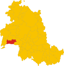
 Piegaro Localización de Piegaro en Italia | ||
 | ||
| Coordenadas | 42°58′00″N 12°05′00″E / 42.966666666667, 12.083333333333 | |
| Capital | Piegaro | |
| Idioma oficial | Italiano | |
| Entidad | Comuna de Italia | |
| • País | Italia | |
| • Región | Umbría | |
| • Provincia | Perugia | |
| Dirigentes | ||
| • Alcalde | Andrea Caporali | |
| Fracciones | Acquaiola Gratiano, Castiglion Fosco, Cibottola, Colle Baldo, Gaiche, Greppolischieto, Ierna Vignaie, Macereto, Oro, Pietrafitta, Pratalenza | |
| Municipios limítrofes | Città della Pieve, Marsciano, Montegabbione, Monteleone d'Orvieto, Paciano, Panicale, Perugia, San Venanzo | |
| Superficie | ||
| • Total | 98.92 km² | |
| Altitud | ||
| • Media | 356 m s. n. m. | |
| Población (2009) | ||
| • Total | 3,795 hab. | |
| • Densidad | 34,23 hab./km² | |
| Gentilicio | piegaresi | |
| Huso horario | CET (UTC +1) | |
| • en verano | CEST (UTC +2) | |
| Código postal | 06066[1] | |
| Prefijo telefónico | 075 | |
| Matrícula | PG | |
| Código ISTAT | 054040 | |
| Código catastral | G601[2] | |
| Fiestas mayores | 31 de diciembre | |
| Patrono(a) | San Silvestre | |
| Sitio web oficial | ||
Piegaro es una localidad italiana de la provincia de Perugia, región de Umbría, con 3.795 habitantes.[3]
YouTube Encyclopedic
-
1/3Views:1 7911 374310
-
Piegaro, A Medieval Village in the Green Heart of Umbria, Italy!
-
Umbria, Life at L'Antica Vetreria in Piegaro
-
Sagra della Castagna in Piegaro, Umbria
Transcription
Evolución demográfica
| Gráfica de evolución demográfica de Piegaro entre 1861 y 2001 |
 |
|
Fuente ISTAT - Elaboración gráfica por parte de Wikipedia |
Ciudades hermanadas
Referencias
- ↑ Worldpostalcodes.org, código postal n.º 06066.
- ↑ «Codici Catastali». Comuni-italiani.it (en italiano). Consultado el 29 de abril de 2017.
- ↑ «Población a 1 de enero de 2009». Archivado desde el original el 30 de abril de 2019. Consultado el 7 de marzo de 2010.