
| Sousa | ||
|---|---|---|
| Microrregión | ||
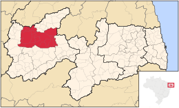 Mapa | ||
| Coordenadas | 6°45′00″S 38°13′00″O / -6.75, -38.216667 | |
| Entidad | Microrregión | |
| • País |
| |
| • Estado | Paraíba | |
| • Mesorregión | Sertão Paraibano | |
| Superficie | ||
| • Total | 4.784,729 km² | |
| Población (est. 2006) | ||
| • Total | 175,204 hab. | |
| • Densidad | 36,6 hab./km² | |
| IBGE/2003 | ||
| • Total | 433.342.880,00 | |
| • PIB per cápita | 2.486,85 | |
La microrregión de Sousa es una de las microrregiones del estado brasileño de la Paraíba perteneciente a la mesorregión Sertón Paraibano. Su población fue estimada en 2006 por el IBGE en 175.204 habitantes y está dividida en diecisiete municipios. Posee un área total de 4.784,729 km².
Municipios
- Aparecida
- Cajazeirinhas
- Condado
- Lastro
- Malta
- Marizópolis
- Nazarezinho
- Paulista
- Pombal
- Santa Cruz
- São Bentinho
- São Domingos de Pombal
- São Francisco
- São José da Lagoa Tapada
- Sousa
- Vieirópolis
- Vista Serrana
| Control de autoridades |
|
|---|
 Datos: Q2143887