To install click the Add extension button. That's it.

The source code for the WIKI 2 extension is being checked by specialists of the Mozilla Foundation, Google, and Apple. You could also do it yourself at any point in time.

4,5
Kelly Slayton
Congratulations on this excellent venture… what a great idea!
Alexander Grigorievskiy
I use WIKI 2 every day and almost forgot how the original Wikipedia looks like.
What we do. Every page goes through several hundred of perfecting techniques; in live mode. Quite the same Wikipedia. Just better.
.
Leo
Newton
Brights
Milds

Distrito de Weimarer Land

De Wikipedia, la enciclopedia libre

Distrito de Weimarer Land
Landkreis Weimarer Land
Distrito


Bandera

Escudo


Ubicación del distrito de Weimarer Land en Turingia

Ubicación del distrito de Weimarer Land en Alemania
Coordenadas 51°00′N 11°25′E / 51, 11.42
Capital Apolda
Entidad Distrito
 • País Alemania
 • Estado Turingia
Subdivisiones 79 Gemeinden
Superficie  
 • Total 804,48 km² Ver y modificar los datos en Wikidata
Altitud  
 • Media 263 m s. n. m.
Población (2015)  
 • Total 82 127 hab.
 • Densidad 102,09 hab./km²
Matrícula AP y APD
Sitio web oficial 

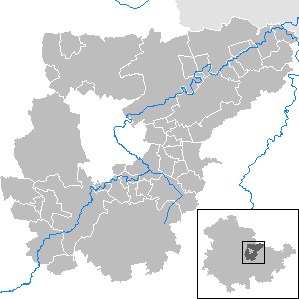
Mapa del distrito (municipios y ciudades)

El Distrito de Weimarer Land (en alemán: Landkreis Weimarer Land) es un Landkreis (distrito rural) ubicado en la parte occidental del estado federal de Turingia (Alemania). Los territorios vecinos al norte son el distrito de Sömmerda así como en el distrito de Burgenland del estado de Sajonia-Anhalt, en la parte occidental el distrito de Saale-Holzland y la ciudad independiente (kreisfreie Stadt) de Jena, al sur el distrito de Saalfeld-Rudolstadt, al sudoeste el distrito de Ilm y al oeste la ciudad independiente de Erfurt. La ciudad independiente de Weimar ocupa un lugar destacado en el distrito dando origen a su nombre. La capital del distrito recae sobre la ciudad de Apolda.

Hier gibt es so viele Hügel! Und hinter jedem Hügel liegt ein Dorf! Und jedes Dorf hat eine eigene Kirche!
¡Aquí hay muchos cerros! y ¡tras cada uno de ellos hay un pueblo! y ¡tras cada pueblo una Iglesia!

Composición del distrito

(Número de Habitantes a 30 de junio de 2005)

Ciudades

¹ Municipios de un Verwaltungsgemeinschaft (Agrupación Administrativa)
² Municipios de relleno (véase los Municipios -Gemeinden-)

  1. Apolda (24.684)
  2. Bad Berka (7.716)
  3. Bad Sulza ² (3.052)
  4. Blankenhain (6.892)
  5. Buttelstedt ¹ (1.405)
  6. Kranichfeld ¹ (3.727)
  7. Magdala ¹ (2.052)
  8. Neumark ¹ (506)

Agrupaciones administrativas

  1. Verwaltungsgemeinschaft Berlstedt
    1. Ballstedt (330)
    2. Berlstedt (1.709)
    3. Ettersburg (575)
    4. Hottelstedt (216)
    5. Krautheim (485)
    6. Neumark, Ciudad (506)
    7. Ramsla (328)
    8. Schwerstedt (371)
    9. Vippachedelhausen (641)
  2. Verwaltungsgemeinschaft Buttelstedt
    1. Buttelstedt, Ciudad (1.405)
    2. Großobringen (833)
    3. Heichelheim (311)
    4. Kleinobringen (290)
    5. Leutenthal (265)
    6. Rohrbach (221)
    7. Sachsenhausen (389)
    8. Wohlsborn (521)
  3. Verwaltungsgemeinschaft Grammetal
    1. Bechstedtstraß (284)
    2. Daasdorf a. Berge (251)
    3. Gutendorf (230)
    4. Hopfgarten (666)
    5. Isseroda (518)
    6. Mönchenholzhausen (1.644)
    7. Niederzimmern (1.053)
    8. Nohra (1.525)
    9. Ottstedt a. Berge (250)
    10. Troistedt (216)
    11. Utzberg (315)
  4. Verwaltungsgemeinschaft Ilmtal-Weinstraße
    1. Kromsdorf (1.573)
    2. Liebstedt (462)
    3. Mattstedt (510)
    4. Niederreißen (238)
    5. Niederroßla (1.233)
    6. Nirmsdorf (91)
    7. Oberreißen (190)
    8. Oßmannstedt (1.334)
    9. Pfiffelbach (644)
    10. Willerstedt (295)
  5. Verwaltungsgemeinschaft Kranichfeld
    1. Hohenfelden (382)
    2. Klettbach (1.337)
    3. Kranichfeld, Stadt (3.727)
    4. Nauendorf (313)
    5. Rittersdorf (272)
    6. Tonndorf (629)
  6. Verwaltungsgemeinschaft Mellingen
    1. Buchfart (181)
    2. Döbritschen (242)
    3. Frankendorf (187)
    4. Großschwabhausen (829)
    5. Hammerstedt (173)
    6. Hetschburg (246)
    7. Hohlstedt (246)
    8. Kapellendorf (461)
    9. Kiliansroda (228)
    10. Kleinschwabhausen (263)
    11. Lehnstedt (327)
    12. Magdala, Ciudad (2.052)
    13. Mechelroda (270)
    14. Mellingen (1.222)
    15. Oettern (151)
    16. Umpferstedt (647)
    17. Vollersroda (217)
    18. Wiegendorf (398)

Municipios

  1. Saaleplatte (3.098)

La ciudad de Bad Sulza se rellena con los siguientes municipios:

  1. Auerstedt (487)
  2. Eberstedt (229)
  3. Flurstedt (280)
  4. Gebstedt (300)
  5. Großheringen (698)
  6. Ködderitzsch (125)
  7. Niedertrebra (899)
  8. Obertrebra (287)
  9. Rannstedt (204)
  10. Reisdorf (339)
  11. Schmiedehausen (445)
  12. Wickerstedt (854)

Véase también

Enlaces externos

Esta página se editó por última vez el 15 jun 2024 a las 20:46.
Basis of this page is in Wikipedia. Text is available under the CC BY-SA 3.0 Unported License. Non-text media are available under their specified licenses. Wikipedia® is a registered trademark of the Wikimedia Foundation, Inc. WIKI 2 is an independent company and has no affiliation with Wikimedia Foundation.