To install click the Add extension button. That's it.

The source code for the WIKI 2 extension is being checked by specialists of the Mozilla Foundation, Google, and Apple. You could also do it yourself at any point in time.

4,5
Kelly Slayton
Congratulations on this excellent venture… what a great idea!
Alexander Grigorievskiy
I use WIKI 2 every day and almost forgot how the original Wikipedia looks like.
What we do. Every page goes through several hundred of perfecting techniques; in live mode. Quite the same Wikipedia. Just better.
.
Leo
Newton
Brights
Milds

Distrito de Greiz

De Wikipedia, la enciclopedia libre

Distrito de Greiz
Landkreis Greiz
Distrito


Bandera

Escudo


Ubicación del distrito de Greiz en Turingia

Ubicación del distrito de Greiz en Alemania
Coordenadas 50°45′N 12°05′E / 50.75, 12.08
Capital Greiz
Entidad Distrito
 • País Alemania
 • Estado Turingia
Superficie  
 • Total 844 km² Ver y modificar los datos en Wikidata
Altitud  
 • Media 366 m s. n. m.
Población (2015)  
 • Total 101 114 hab.
 • Densidad 119,52 hab./km²
Huso horario UTC+01:00 y UTC+02:00
Matrícula GRZ y ZR
Sitio web oficial 

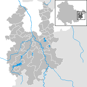
Municipios y ciudades en el distrito de Greiz

El Distrito de Greiz (en alemán: Landkreis Greiz) es un Landkreis (distrito rural) en la parte oriental del estado federal de Turingia (Alemania) con la capital del distrito Greiz.

YouTube Encyclopedic

  • 1/1
    Views:
    464
  • Escuela Naiarah - Competencia Dancing on the World - Baile Pandereta

Transcription

Geografía

Los distritos y territorios que limitan al sur (kreisfreie Stadt) son la ciudad de Gera, al noroeste el Distrito de Altenburger Land, al este el distrito de Sajonia denominado distrito de Zwickauer Land, al sur con Vogtland y al oeste el distrito de Saale-Orla así como el distrito de Saale-Holzland. Al sur el territorio pertenece al Thüringer Schiefergebirge, mientras que al norte conecta con el Leipziger Tieflandsbucht (Saale-Elster-Sandsteinplatte). Los ríos más importantes son el Weiße Elster y su afluenete Weida.

Composición del distrito

(Habitantes a 30 de junio de 2006)

Municipios/Ciudades

*erfüllende Gemeinde für weitere Gemeinden

  1. Bad Köstritz, ciudad * (3.907)
  2. Berga/Elster, ciudad (3.815)
  3. Greiz, ciudad * (23.583)
  4. Harth-Pöllnitz (3.328)
  5. Kraftsdorf (4.284)
  6. Langenwetzendorf (3.720)
  7. Mohlsdorf (2.995)
  8. Ronneburg, ciudad (5.472)
  9. Teichwolframsdorf (2.630)
  10. Vogtländisches Oberland (3.115)
  11. Weida, ciudad * (8.279)
  12. Wünschendorf/Elster (3.234)
  13. Zeulenroda-Triebes, ciudad * (17.360)

Asociaciones administrativas

(Städte in Klammern sind erfüllende Gemeinden):

  1. Caaschwitz Ciudad (717)
  2. Crimla (ciudad Weida) (317)
  3. Hartmannsdorf (411)
  4. Langenwolschendorf (Stadt Zeulenroda-Triebes) (915)
  5. Neumühle/Elster, ciudad (454)
  6. Weißendorf, ciudad (360)

Agrupación administrativas

Greiz.

*Ubicación de la administración

  1. Verwaltungsgemeinschaft Am Brahmetal (5.248)
    1. Bethenhausen (266)
    2. Brahmenau (1.068)
    3. Großenstein * (1.401)
    4. Hirschfeld (141)
    5. Korbußen (499)
    6. Pölzig (1.322)
    7. Reichstädt (393)
    8. Schwaara (158)
  2. Verwaltungsgemeinschaft Auma-Weidatal (4.762)
    1. Auma, ciudad * (3.199)
    2. Braunsdorf (245)
    3. Göhren-Döhlen (131)
    4. Merkendorf (321)
    5. Silberfeld (112)
    6. Staitz (324)
    7. Wiebelsdorf (275)
    8. Zadelsdorf (155)
  3. Verwaltungsgemeinschaft Ländereck (5.129)
    1. Braunichswalde (683)
    2. Endschütz (378)
    3. Gauern (143)
    4. Hilbersdorf (232)
    5. Kauern (449)
    6. Linda b. Weida (479)
    7. Paitzdorf (441)
    8. Rückersdorf (830)
    9. Seelingstädt * (1.494)
  1. Verwaltungsgemeinschaft Leubatal (4.725)
    1. Hain (70)
    2. Hohenleuben, ciudad * (1.795)
    3. Hohenölsen (688)
    4. Kühdorf (75)
    5. Lunzig (176)
    6. Neugernsdorf (162)
    7. Schömberg (116)
    8. Steinsdorf (816)
    9. Teichwitz (118)
    10. Wildetaube (709)
  2. Verwaltungsgemeinschaft Münchenbernsdorf (6.659)
    1. Bocka (545)
    2. Hundhaupten (389)
    3. Lederhose (295)
    4. Lindenkreuz (504)
    5. Münchenbernsdorf, ciudad * (3.304)
    6. Saara (661)
    7. Schwarzbach (250)
    8. Zedlitz (711)

Véase también

Enlaces externos

Esta página se editó por última vez el 15 jun 2024 a las 12:04.
Basis of this page is in Wikipedia. Text is available under the CC BY-SA 3.0 Unported License. Non-text media are available under their specified licenses. Wikipedia® is a registered trademark of the Wikimedia Foundation, Inc. WIKI 2 is an independent company and has no affiliation with Wikimedia Foundation.