
| Ghaziabad | ||
|---|---|---|
| Distrito | ||
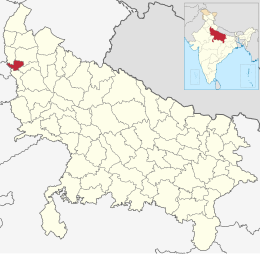 Ubicación del distrito de Ghaziabad en Uttar Pradesh. | ||
| Coordenadas | 28°40′00″N 77°26′00″E / 28.6667, 77.4333 | |
| Capital | Ghaziabad | |
| Entidad | Distrito | |
| • País |
| |
| • Estado | Uttar Pradesh | |
| Superficie | ||
| • Total | 1548 km² | |
| Población (2011[1]) | ||
| • Total | 4 661 452 hab. | |
| • Densidad | 2393,48 hab./km² | |
| Huso horario | UTC+05:30 | |
| ISO 3166-2 | IN.UP.GZ[2] | |
| Sitio web oficial | ||
Ghaziabad (en hindi; ग़ाज़ियाबाद ज़िला, urdu; غازی آباد ضلع,) es un distrito de India en el estado de Uttar Pradesh. Código ISO: IN.UP.GZ.[2]
Comprende una superficie de 1 548 km².
El centro administrativo es la ciudad de Ghaziabad. Dentro del distrito se encuentran las ciudades de Khora, Muradnagar y Niwari.
YouTube Encyclopedic
-
1/1Views:2 386 293
-
Bangkok Red Light Districts (Soi Cowboy, Patpong, Nana Plaza)
Transcription
Demografía
Según censo 2011 contaba con una población total de 4 661 452 habitantes.[1]
Referencias
Enlaces externos
 Datos: Q1773444
 Multimedia: Ghaziabad district / Q1773444