
| Capestrano | ||
|---|---|---|
| Entidad subnacional | ||
 | ||
 Capestrano Localización de Capestrano en Italia | ||
 | ||
| Coordenadas | 42°16′10″N 13°46′00″E / 42.269444444444, 13.766666666667 | |
| Idioma oficial | Italiano | |
| Entidad | Comuna de Italia | |
| • País | Italia | |
| • Región | Abruzos | |
| • Provincia | L'Aquila | |
| Fracciones | Capodacqua, Forca di Penne, San Pelagia, Scarafano. | |
| Municipios limítrofes | Brittoli (PE), Bussi sul Tirino (PE), Carapelle Calvisio, Castelvecchio Calvisio, Collepietro, Corvara (PE), Navelli, Ofena, Pescosansonesco (PE), Villa Santa Lucia degli Abruzzi | |
| Superficie | ||
| • Total | 43,08 km² | |
| Altitud | ||
| • Media | 465 m s. n. m. | |
| Población (01-01-2007 (ISTAT)) | ||
| • Total | 952 hab. | |
| • Densidad | 22,10 hab./km² | |
| Gentilicio | capestranesi | |
| Huso horario | CET (UTC +1) | |
| • en verano | CEST (UTC +2) | |
| Código postal | 67022[1] | |
| Prefijo telefónico | 0862 | |
| Matrícula | AQ | |
| Código ISTAT | 066019 | |
| Código catastral | B651[2] | |
| Fiestas mayores | 23 de octubre | |
| Patrono(a) | Juan Capistrano | |
| Sitio web oficial | ||
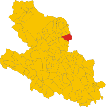
Capestrano es un municipio situado en el territorio de la Provincia de L'Aquila, en Abruzos, (Italia).
YouTube Encyclopedic
-
1/3Views:1 6701 8952 152
-
CAPESTRANO EPICA you tube
-
Capestrano AQ)-Porte Cinta Muraria e Borgo Antico-Parte I/2013
-
capestrano 6 aprile 2009
Transcription
Demografía
| Gráfica de evolución demográfica de Capestrano entre 1861 y 2001 |
 |
|
fuente ISTAT - elaboración gráfica a cargo de Wikipedia |
Véase también
Referencias
- ↑ Worldpostalcodes.org, código postal n.º 67022.
- ↑ «Codici Catastali». Comuni-italiani.it (en italiano). Consultado el 29 de abril de 2017.
Enlaces externos
- Sitio web oficial de Capestrano (en italiano)
 Datos: Q50063
 Multimedia: Capestrano / Q50063