
| Brickfield-Navet | ||
|---|---|---|
| Localidad | ||
 Brickfield-Navet Localización de Brickfield-Navet en Trinidad y Tobago | ||
| Coordenadas | 10°24′39″N 61°15′30″O / 10.4107, -61.2584 | |
| Entidad | Localidad | |
| • País |
| |
| • Isla | Trinidad | |
| • Región | Couva-Tabaquite-Talparo | |
| Población (2011) | ||
| • Total | 586 hab. | |
Brickfield-Navet es una localidad de Trinidad y Tobago, que forma parte de la región de Couva-Tabaquite-Talparo.[1][2]
Geografía
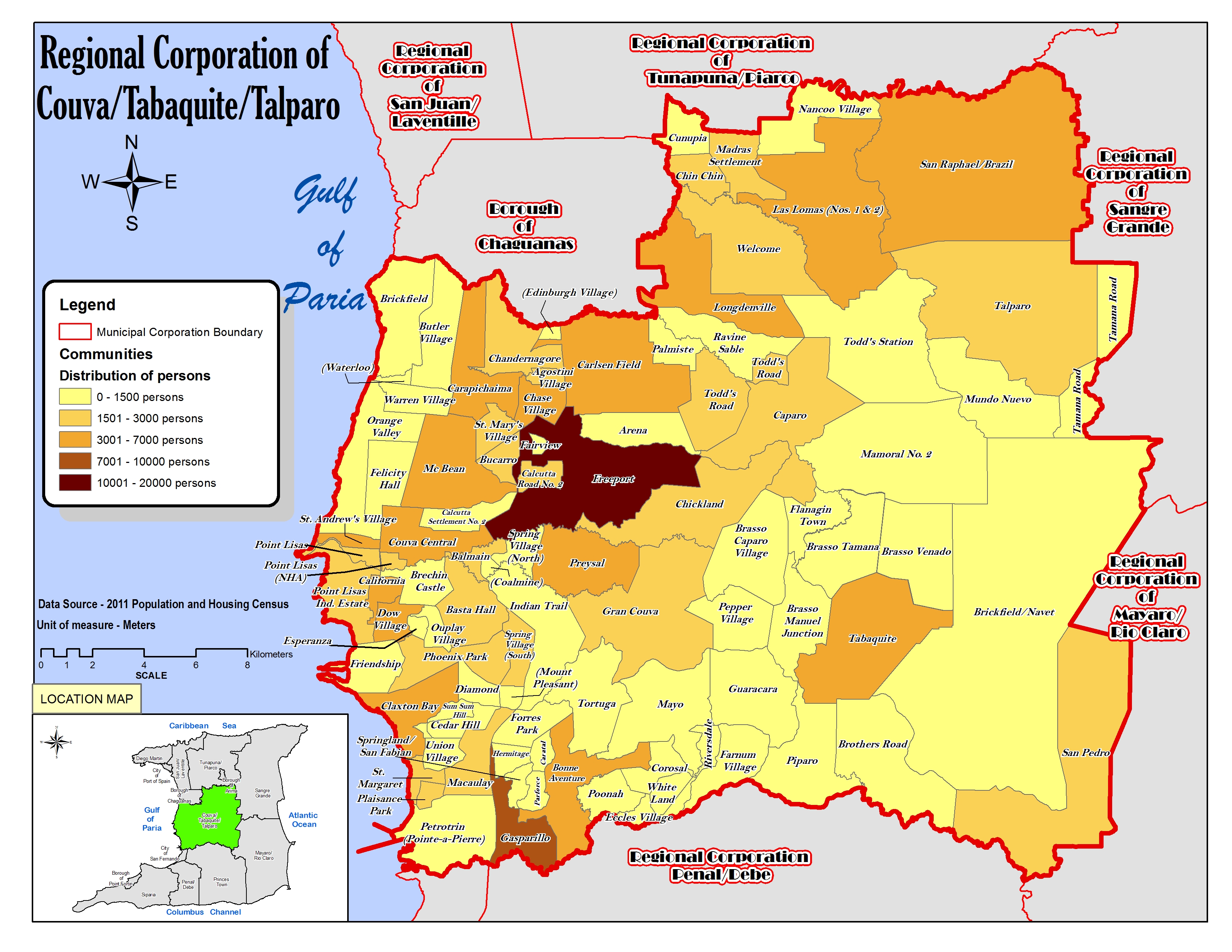
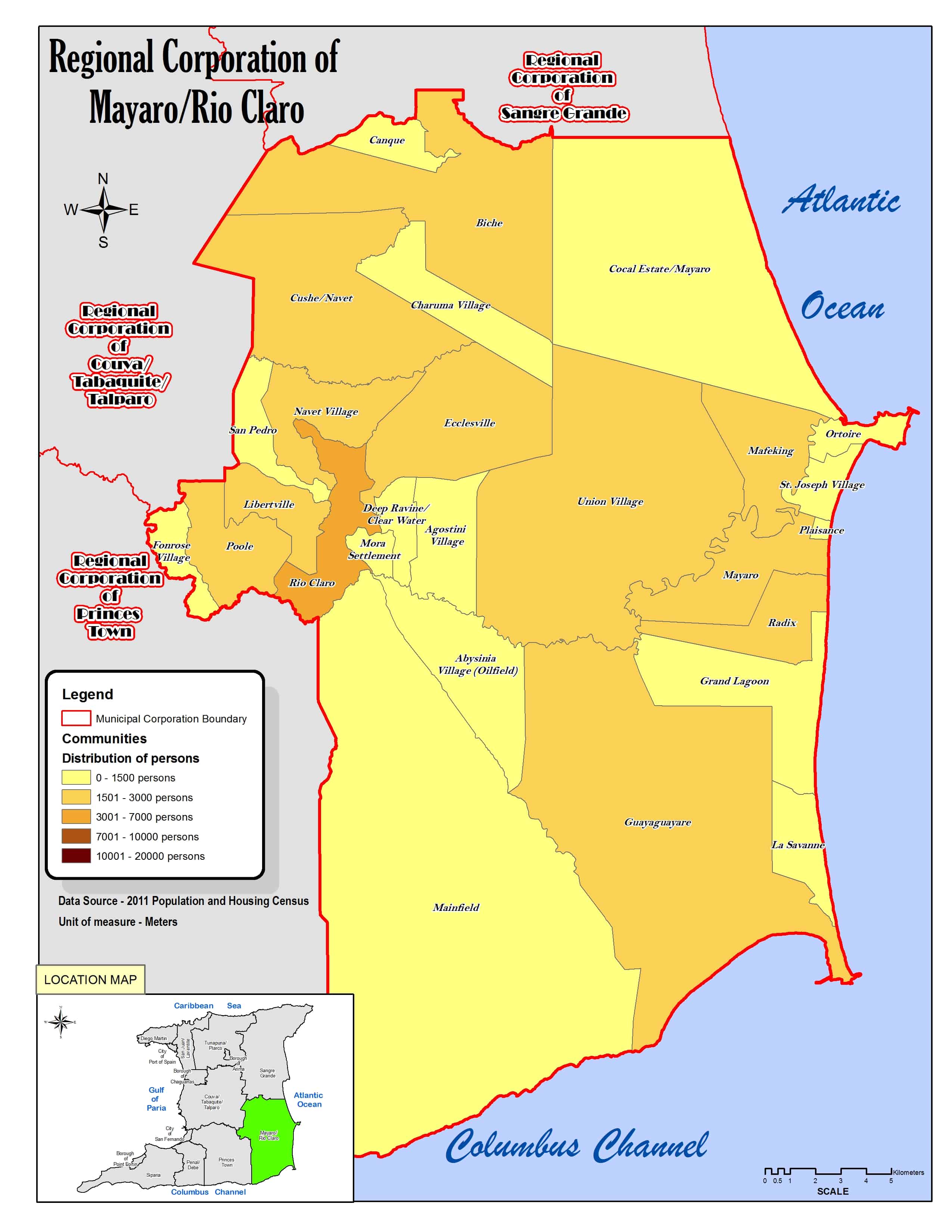
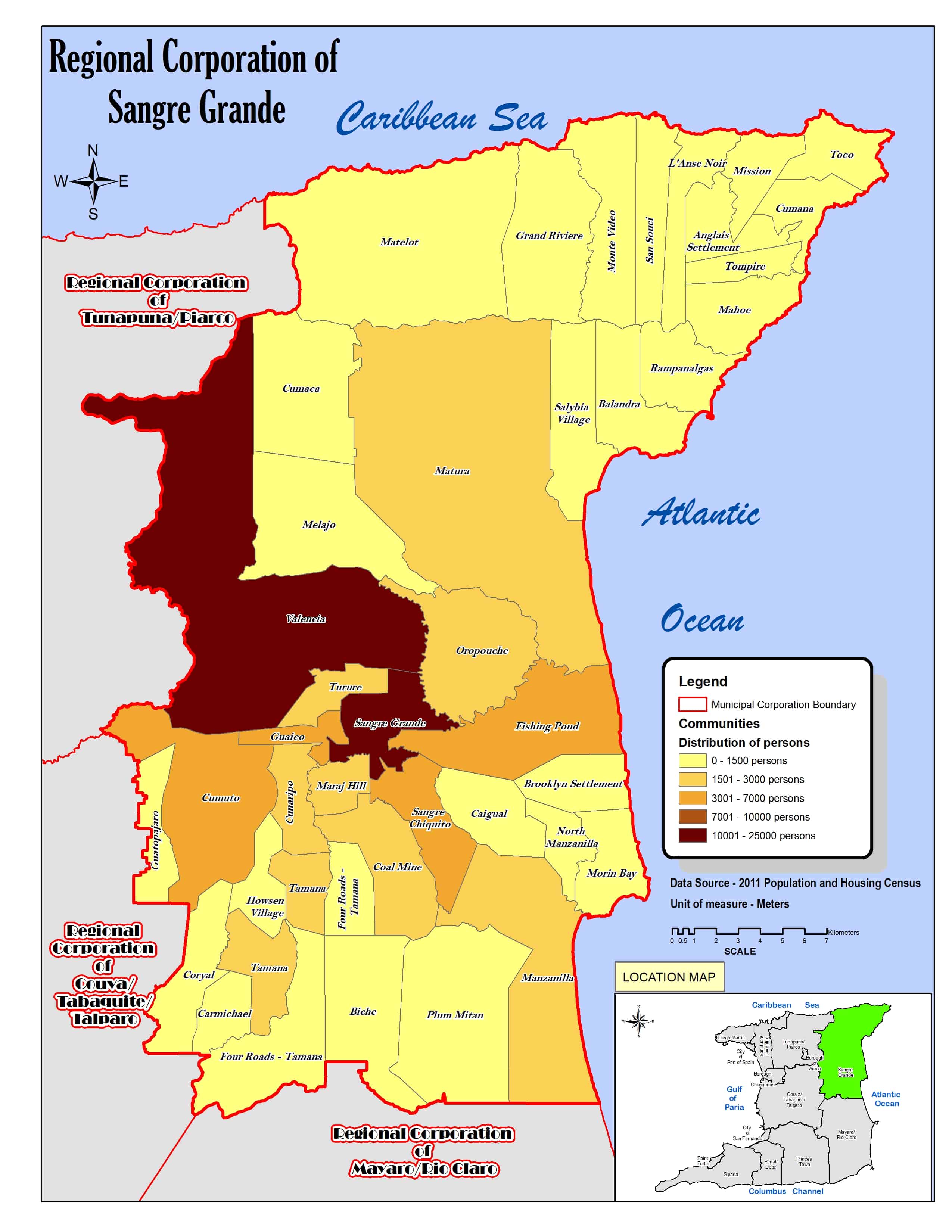
La localidad abarca parte de la isla Trinidad y limita al norte con Mundo Nuevo, Tamana Road, Coryal y Carmichael (estos dos últimos de la región de Sangre Grande), al sur con Brothers Road y San Pedro al este con Four Road-Tamana (de la región de Sangre Grande), Biche, Cushe-Navet (estos dos de la región de Mayaro-Rio Claro) y San Pedro y al oeste con Mamoral No. 2, Brasso Venado, Tabaquite y Brothers Road.[3][4][5]
Demografía
Datos demográficos de la localidad de Brickfield-Navet:[1]
| Gráfica de evolución demográfica de Brickfield-Navet entre 2000 y 2011 |
 |
Referencias
- ↑ a b «TRINIDAD AND TOBAGO. Municipalities and Communities: The population of the cities, boroughs, regions, parishes and communities of Trinidad and Tobago by census years.». Citypopulation.de (en inglés). 18 de mayo de 2020. Consultado el 17 de julio de 2023.
- ↑ «Population Statistics: Demographic Profiles of Municipalities and Communities.». CENTRAL STATISTICAL OFFICE. Ministry of Planning and Development (cso.gov.tt) (en inglés). 2023. Consultado el 17 de julio de 2023.
- ↑ «Regional Corporation of Couva/Tabaquite/Talparo. Location map.». cso.gov.tt (en inglés). 2011. Consultado el 19 de agosto de 2023.
- ↑ «Regional Corporation of Mayaro/Rio Claro. Location map.». cso.gov.tt (en inglés). 2011. Consultado el 20 de agosto de 2023.
- ↑ «Regional Corporation of Sangre Grande. Location map.». cso.gov.tt (en inglés). 2011. Consultado el 20 de agosto de 2023.
| Control de autoridades |
|
|---|
 Datos: Q120805239