
| Bournemouth Bournemouth Borough | ||
|---|---|---|
| Borough y autoridad unitaria | ||
 | ||
 | ||
| Coordenadas | 50°43′00″N 1°53′00″O / 50.71666718, -1.88333333 | |
| Capital | Bournemouth | |
| Entidad | Borough y autoridad unitaria | |
| • País |
| |
| • Nación |
| |
| • Región | South West England | |
| • Condado | Dorset | |
| Subdivisiones | 18 wards | |
| Superficie | ||
| • Total | 46.18 km² | |
| Población (2015) | ||
| • Total | 194 500 hab. | |
| • Densidad | 4211,95 hab./km² | |
| ISO 3166-2 | GB-BMH | |
| Código ONS | 00HN | |
| Sitio web oficial | ||
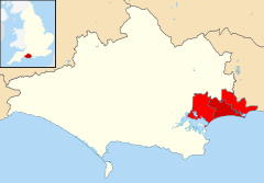
El distrito de Bournemouth es una autoridad unitaria en el sureste de Dorset en Inglaterra[1][2] desde el 1 de abril de 1974, habiendo tomado su nombre de la localidad homónima que se ubica en el mismo distrito. El comienzo de su historia data desde el 27 de agosto de 1890, cuando surgió el <i>borough</i> municipal de Bournemouth. El 1.º de abril de 1900, recibió el estatus de county borough, el cual mantuvo hasta 1974.[3] Bajo la Ley de Gobierno Local de 1972, fue un distrito administrativo del shire county de Dorset desde 1974 hasta 1997.[3]
YouTube Encyclopedic
-
1/3Views:140 2532 3414 347
-
Cool Areas to Visit in London (That You've Never Heard Of) PART 2
-
Workshop Seascape / Street Photography - Boscombe Pier, Bournemouth
-
ASMR El bello macho durmiente. Echando la siesta en Londres antes de ir a comprar al supermercado
Transcription
Gobierno y política
El distrito es administrado por el Bournemouth Borough Council (Consejo del Borough de Bournemouth).
Wards
Su superficie se haya dividida en 18 wards (pequeñas divisiones electorales):
- Boscombe East
- Boscombe West
- Central
- East Cliff & Springbourne
- East Southbourne & Tuckton
- Kinson North
- Kinson South
- Littledown & Iford
- Moordown
- Queen's Park
- Redhill & Northbourne
- Strouden Park
- Talbot & Branksome Woods
- Throop & Muscliff
- Wallisdown & Winton West
- West Southbourne
- Westbourne & Westcliff
- Winton East
Composición del Consejo
En la actualidad (año 2009), el Consejo consta de 54 miembros electos, es decir, tres por cada uno de los wards. Antes del 2003, existían 19 wards; por ende, la cantidad de miembros ascendía a 57. Las elecciones toman lugar cada cuatro años.
Ciudades hermanadas
Las siguientes son ciudades hermanas del borough de Bournemouth:
Referencias
- ↑ Office for National Statistics (2009). «United Kingdom: Counties and Unitary Authorities» (en inglés). Consultado el 24 de febrero de 2013.
- ↑ Office for National Statistics. «Counties, Non-metropolitan Districts and Unitary Authorities» (en inglés). Consultado el 24 de febrero de 2013.
- ↑ a b Bournemouth Borough Council. «History of the Council». Archivado desde el original el 11 de septiembre de 2007. Consultado el 20 de abril de 2007.
Véase también
Enlaces externos
| Control de autoridades |
|
|---|
 Datos: Q20989094
 Multimedia: Borough of Bournemouth / Q20989094