| Bahía Upper New York | ||
|---|---|---|
| Upper New York | ||
 Vista de satélite (destacado en rojo) | ||
| Ubicación geográfica | ||
| Continente | América del Norte | |
| Océano | Océano Atlántico | |
| Isla | Staten Island, Long Island y Manhattan | |
| Coordenadas | 40°40′10″N 74°02′42″O / 40.669444444444, -74.045 | |
| Ubicación administrativa | ||
| País |
| |
| División |
| |
| Cuerpo de agua | ||
| Islas interiores | Governors Island, isla Ellis, Isla de la Libertad y Robbins Reef | |
| Ríos drenados | Río Hudson | |
| Altitud | −2 metro | |
| Mapa de localización | ||
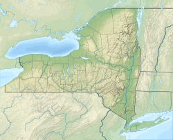
| Geolocalización en el estado de Nueva York | ||
| Estuarios navegables del río Hudson: 1. Río Hudson, 2. Río Este, 3. Long Island Sound, 4. Bahía de Newark, 5. Bahía de Upper New York, 6. Bahía Lower New York, 7. Bahía de Jamaica, 8. Océano Atlántico. | ||
La bahía Upper New York (en inglés: Upper New York Bay, literalmente, «bahía de Nueva York Alto») algunas veces llamada New York Harbor o Upper Bay, es la parte norte del Puerto de Nueva York dentro de los estrechos. Está rodeada por los condados de Nueva York de Manhattan, Brooklyn, Staten Island y el condado de Hudson, y las municipalidades de Nueva Jersey de Jersey City y Bayonne. [1]
La bahía es alimentada por el río Hudson (históricamente llamado «río Norte», ya que pasaba por Manhattan), al igual que por el canal Gowanus. Está conectada con la bahía Lower New York, por The Narrows: con la bahía de Newark, por Kill Van Kull; y con el Long Island Sound por el río Este, que, a pesar de su nombre, es en realidad un estrecho.[2]
Contiene varias islas, como Governors Island, cerca de la desembocadura del río Este, al igual que isla Ellis, Isla de la Libertad y Robbins Reef.[3][4]
YouTube Encyclopedic
-
1/3Views:4 95327 5462 249
-
Bahia Bustamante Lodge - Chubut, Patagonia, Argentina.
-
Visit Bahia - 5 Things You Will Love & Hate about Visiting Salvador, Brazil
-
CAYACOA - GRAND BAHIA PRINCIPE
Transcription
Referencias
- ↑ Hudson County New Jersey Street Map. Hagstrom Map Company, Inc. 2008. ISBN 0-8809-7763-9.
- ↑ [1] Archivado el 15 de septiembre de 2016 en Wayback Machine. Anchorage Channel dredging project]
- ↑ Kurlansky, Mark (2006). The Big Oyster. Nueva York: Random House Trade paerpbacks. ISBN 978-0-345-47639-5.
- ↑ Hudson River Estuary Dept. of Environmental Conservation, NY State.
Enlaces externos
 Wikimedia Commons alberga una categoría multimedia sobre Bahía Upper New York.


