

Tamaño de esta previsualización PNG del archivo SVG: 583 × 599 píxeles. Otras resoluciones: 234 × 240 píxeles · 467 × 480 píxeles · 747 × 768 píxeles · 997 × 1024 píxeles · 1993 × 2048 píxeles · 1347 × 1384 píxeles.
Ver la imagen en su resolución original ((Imagen SVG, nominalmente 1347 × 1384 pixels, tamaño de archivo: 1,38 MB))
| Descripción |
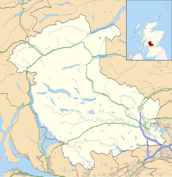
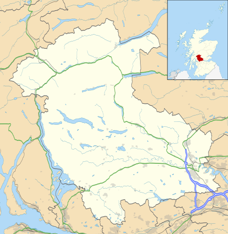
Blank map of Stirling, UK with the following information shown:
Equirectangular map projection on WGS 84 datum, with N/S stretched 175% Geographic limits:
|
| Fecha | |
| Fuente |
|
| Autor | Nilfanion, created using Ordnance Survey data |
| Permiso (Reutilización de este archivo) |
Este archivo se encuentra bajo la licencia Creative Commons Genérica de Atribución/Compartir-Igual 3.0. Atribución: Contains Ordnance Survey data © Crown copyright and database right
|
| Otras versiones | File:Stirling UK blank map.svg - Blank map |
Historial del archivo
Haz clic sobre una fecha y hora para ver el archivo tal como apareció en ese momento.
| Fecha y hora | Miniatura | Dimensiones | Usuario | Comentario | |
|---|---|---|---|---|---|
| actual | 20:26 26 sep 2010 | | 1347 × 1384 (1,38 MB) | Nilfanion | {{Information |Description=Blank map of Stirling, UK with the following information shown: *Administrative borders *Coastline, lakes and rivers *Roads and railways *Urban areas Equirectangular map projection on WGS 84 datum, with N/S stret |
Usos del archivo
Las siguientes páginas usan este archivo:
Uso global del archivo
Las wikis siguientes utilizan este archivo:
- Uso en ar.wikipedia.org
- Uso en bg.wikipedia.org
- Uso en ceb.wikipedia.org
- Uso en de.wikipedia.org
- Uso en en.wikipedia.org
- Aberfoyle, Stirling
- Stirling
- List of monastic houses in Scotland
- Thornhill, Stirling
- Stirling Castle
- Bannockburn
- Bridge of Allan
- Dunblane
- Callander
- Doune
- Stirling (council area)
- Gargunnock
- Trossachs
- Glen Finglas Estate
- Doune Castle
- Drymen
- Crianlarich
- Fintry
- Dunblane Cathedral
- Tyndrum
- Brig o' Turk
- Balquhidder
- Kippen
- Buchanan Smithy
- Cambuskenneth
- Kilmahog
- Killin
- Balfron
- Cornton
- Raploch
- Auchlyne
- Blairlogie
- Buchlyvie
- Lochearnhead
- Killearn
- Stirling services
- Strathblane
- Rowardennan
- Church of the Holy Rude
- Stirling Smith Art Gallery and Museum
- Forthbank Stadium
- Blair Drummond
- Croftamie
Ver más uso global de este archivo.