Ver la imagen en su resolución original (1300 × 1700 píxeles; tamaño de archivo: 480 kB; tipo MIME: image/jpeg)
Historial del archivo
Haz clic sobre una fecha y hora para ver el archivo tal como apareció en ese momento.
| Fecha y hora | Miniatura | Dimensiones | Usuario | Comentario | |
|---|---|---|---|---|---|
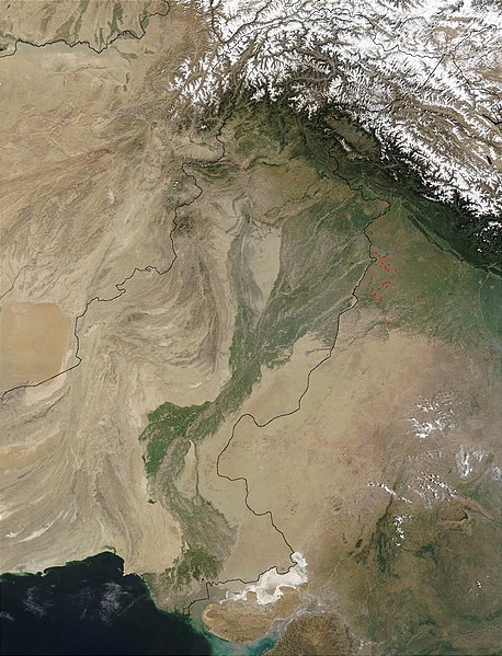
| actual | 13:03 28 mar 2008 |  | 1300 × 1700 (480 kB) | <bdi>File Upload Bot (Magnus Manske)</bdi> | {{BotMoveToCommons|en.wikipedia}} {{Information |Description={{en|en:Satellite image of the en:Indus River basin. Red dots indicate fires. International boundaries are superimposed; the boundary through en:Jammu and Kashmir reflects the [[ |
Usos del archivo
Las siguientes páginas usan este archivo:
Uso global del archivo
Las wikis siguientes utilizan este archivo:
- Uso en af.wikipedia.org
- Uso en ar.wikipedia.org
- Uso en arz.wikipedia.org
- Uso en ast.wikipedia.org
- Uso en as.wikipedia.org
- Uso en azb.wikipedia.org
- Uso en az.wikipedia.org
- Uso en ba.wikipedia.org
- Uso en be-tarask.wikipedia.org
- Uso en bh.wikipedia.org
- Uso en bn.wikipedia.org
- Uso en bo.wikipedia.org
- Uso en br.wikipedia.org
- Uso en bxr.wikipedia.org
- Uso en ca.wikipedia.org
- Uso en ceb.wikipedia.org
- Uso en ce.wikipedia.org
- Uso en ckb.wikipedia.org
- Uso en cy.wikipedia.org
- Uso en da.wikipedia.org
- Uso en en.wikipedia.org
- Uso en eo.wikipedia.org
- Uso en fa.wikipedia.org
- Uso en fiu-vro.wikipedia.org
- Uso en gd.wikipedia.org
- Uso en gl.wikipedia.org
- Uso en hi.wikipedia.org
- Uso en hy.wikipedia.org
- Uso en ia.wikipedia.org
- Uso en id.wikipedia.org
- Uso en ilo.wikipedia.org
- Uso en incubator.wikimedia.org
- Uso en is.wikipedia.org
- Uso en it.wikipedia.org
- Uso en ja.wikipedia.org
- Uso en ka.wikipedia.org
Ver más uso global de este archivo.


