

Tamaño de esta previsualización: 615 × 599 píxeles. Otras resoluciones: 246 × 240 píxeles · 492 × 480 píxeles · 788 × 768 píxeles · 1051 × 1024 píxeles · 1500 × 1462 píxeles.
Ver la imagen en su resolución original (1500 × 1462 píxeles; tamaño de archivo: 521 kB; tipo MIME: image/jpeg)
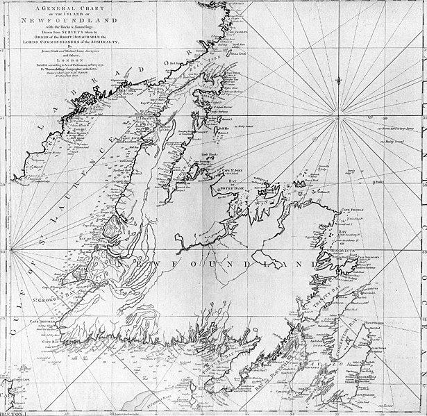
| Descripción | A general chart of the island of Newfoundland. Surveyed by James Cook and Michael Lane, and "publish'd according to Act of Parliament by Thomas Jefferys Geographer to the King, 1775." |
| Fecha | |
| Fuente | originally uploaded to en.wikipedia by Jcmurphy on 23 Apr 2005; copied from "Courtesy of the Centre for Newfoundland Studies, Memorial University of Newfoundland, St. John's, Newfoundland." |
| Autor | Michael Lane and James Cook |
| Permiso (Reutilización de este archivo) |
Public domain because of age |
|
Este material está en dominio público en los demás países donde el derecho de autor se extiende por 100 años (o menos) tras la muerte del autor. | |
| Esta obra ha sido identificada como libre de las restricciones conocidas en virtud del derecho de autor, incluyendo todos los derechos conexos. | |
Historial del archivo
Haz clic sobre una fecha y hora para ver el archivo tal como apareció en ese momento.
| Fecha y hora | Miniatura | Dimensiones | Usuario | Comentario | |
|---|---|---|---|---|---|
| actual | 19:10 6 ene 2006 | | 1500 × 1462 (521 kB) | <bdi>Schaengel89~commonswiki</bdi> | {{Information| |Description =A general chart of the island of Newfoundland. Surveyed by James Cook and Michael Lane, and "publish'd according to Act of Parliament by Thomas Jefferys Geographer to the King, 1775." |Source =originally yuploaded to |
Usos del archivo
La siguiente página usa este archivo:
Uso global del archivo
Las wikis siguientes utilizan este archivo:
- Uso en bs.wikipedia.org
- Uso en ca.wikipedia.org
- Uso en de.wikipedia.org
- Uso en en.wikipedia.org
- Uso en en.wikivoyage.org
- Uso en eo.wikipedia.org
- Uso en fi.wikipedia.org
- Uso en fr.wikipedia.org
- Uso en fur.wikipedia.org
- Uso en ga.wikipedia.org
- Uso en gl.wikipedia.org
- Uso en he.wikipedia.org
- Uso en hy.wikipedia.org
- Uso en ia.wikipedia.org
- Uso en it.wikipedia.org
- Uso en ja.wikipedia.org
- Uso en ka.wikipedia.org
- Uso en ko.wikipedia.org
- Uso en la.wikipedia.org
- Uso en li.wikipedia.org
- Uso en lt.wikipedia.org
- Uso en mk.wikipedia.org
- Uso en ne.wikipedia.org
- Uso en no.wikipedia.org
- Uso en oc.wikipedia.org
- Uso en pl.wikipedia.org
- Uso en pl.wiktionary.org
- Uso en pt.wikipedia.org
Ver más uso global de este archivo.