
Tamaño de esta previsualización: 557 × 599 píxeles. Otras resoluciones: 223 × 240 píxeles · 446 × 480 píxeles · 714 × 768 píxeles · 952 × 1024 píxeles · 1903 × 2048 píxeles · 2877 × 3096 píxeles.
Ver la imagen en su resolución original (2877 × 3096 píxeles; tamaño de archivo: 1,53 MB; tipo MIME: image/jpeg)
Resumen
| Descripción |
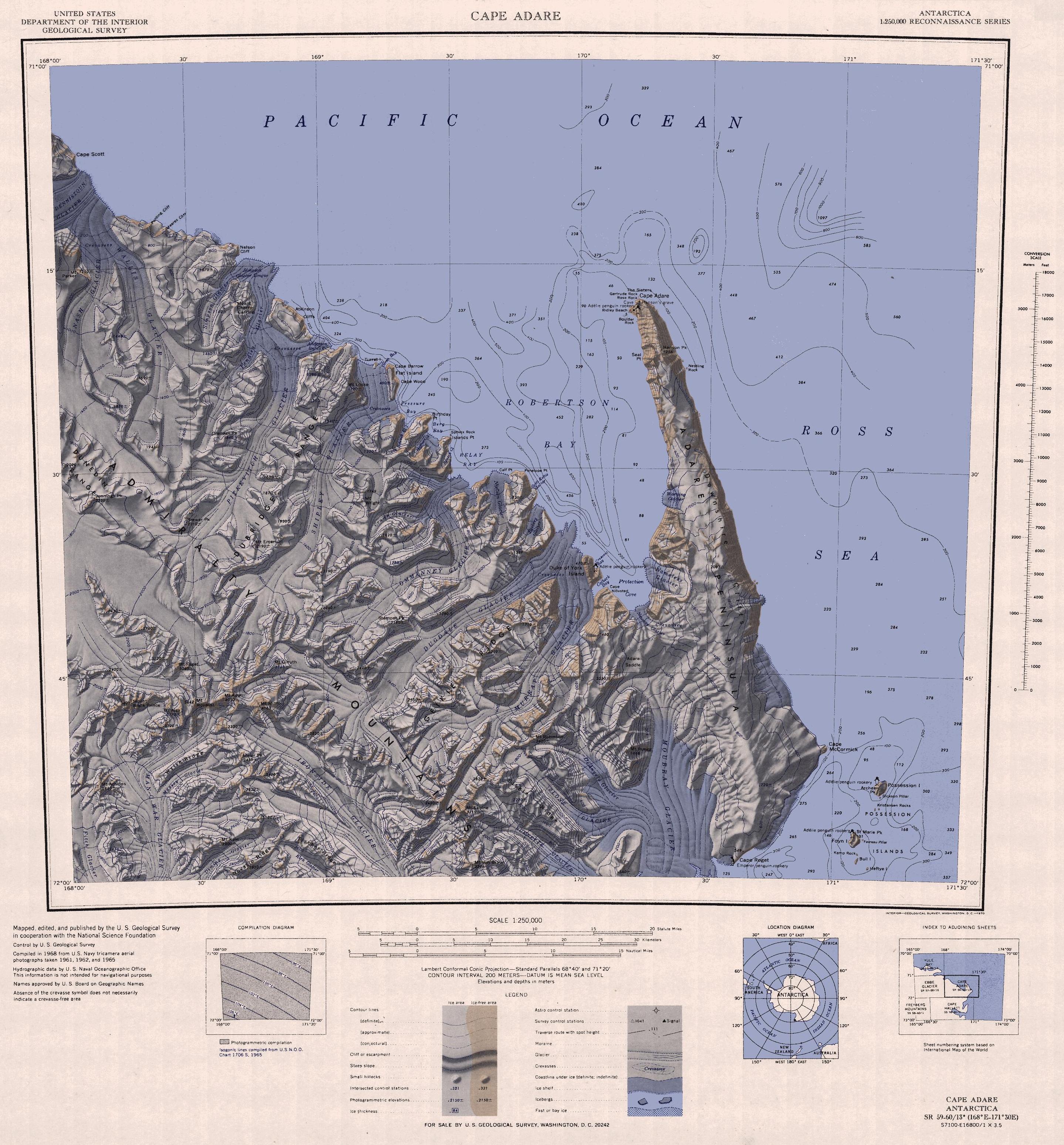
English: 1:250,000-scale topographic reconnaissance map of the Cape Adare region in Antarctica (168°E - 171°30'E, 71°S - 72°S). Mapped, edited and published by the U.S. Geological Survey in cooperation with the National Science Foundation. |
|||
| Fecha | ||||
| Fuente | http://usarc.usgs.gov/drg_dload.shtml | |||
| Autor | United States Geological Survey | |||
| Permiso (Reutilización de este archivo) |
|
|||
| Otras versiones |
Obras derivadas de ésta: |
Historial del archivo
Haz clic sobre una fecha y hora para ver el archivo tal como apareció en ese momento.
| Fecha y hora | Miniatura | Dimensiones | Usuario | Comentario | |
|---|---|---|---|---|---|
| actual | 12:47 26 nov 2015 | | 2877 × 3096 (1,53 MB) | ValeriySh | Обрізка зайвого поля |
| 16:43 3 abr 2005 |  | 3506 × 3260 (1,67 MB) | Achim Raschka | Map of Antarctica by the United States Antarctic Ressource Center of the US Geological Society. {{PD-US}} Copyrights and Trademarks USGS-authored or produced data and information are in the public domain. While the content of most USGS web pages is in th |
Usos del archivo
Las siguientes páginas usan este archivo:
Uso global del archivo
Las wikis siguientes utilizan este archivo:
- Uso en ar.wikipedia.org
- Uso en ast.wikipedia.org
- Uso en az.wikipedia.org
- Uso en be.wikipedia.org
- Uso en bg.wikipedia.org
- Uso en ceb.wikipedia.org
- Uso en de.wikipedia.org
- Uso en el.wikipedia.org
- Uso en en.wikipedia.org
- Uso en eo.wikipedia.org
- Uso en fr.wikipedia.org
- Uso en he.wikipedia.org
- Uso en id.wikipedia.org
- Uso en it.wikipedia.org
Ver más uso global de este archivo.