

Tamaño de esta previsualización PNG del archivo SVG: 800 × 416 píxeles. Otras resoluciones: 320 × 166 píxeles · 640 × 333 píxeles · 1024 × 532 píxeles · 1280 × 666 píxeles · 2560 × 1331 píxeles · 1425 × 741 píxeles.
Ver la imagen en su resolución original ((Imagen SVG, nominalmente 1425 × 741 pixels, tamaño de archivo: 1,51 MB))
| Descripción |
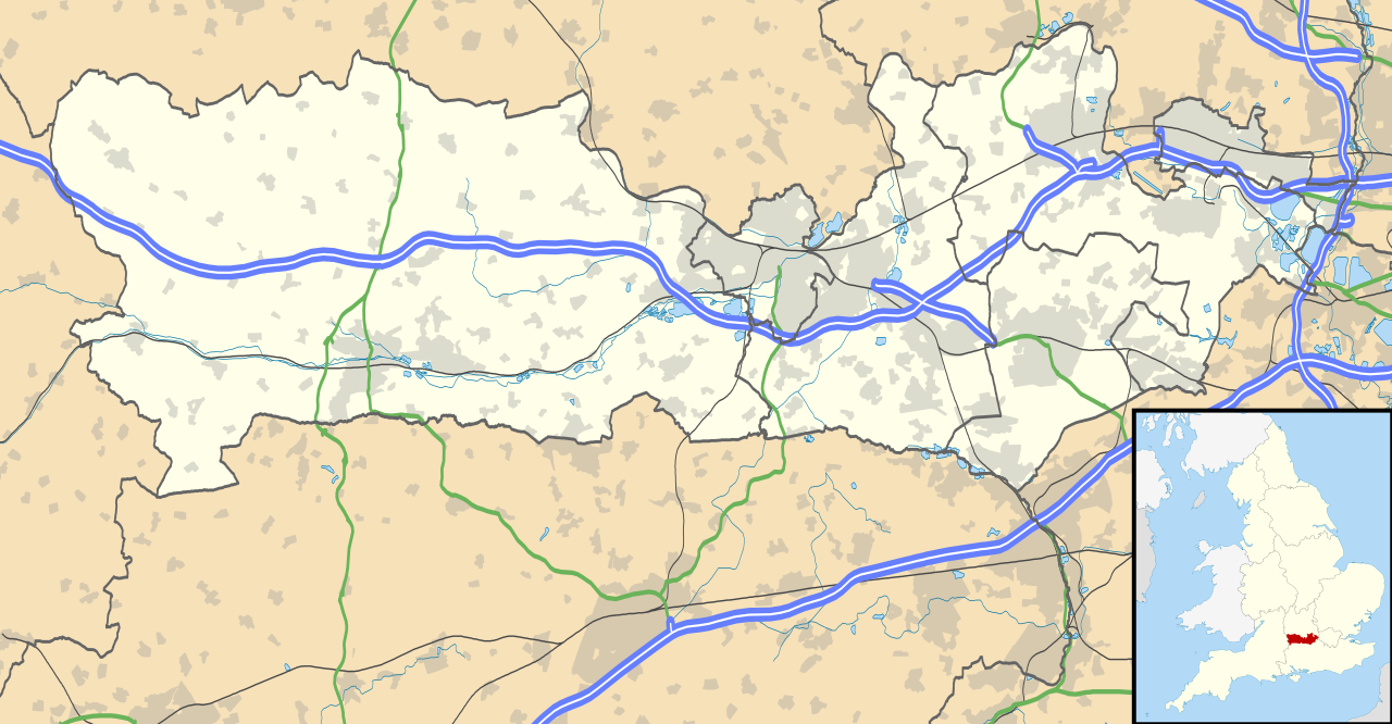
Map of Berkshire, UK with the following information shown:
Equirectangular map projection on WGS 84 datum, with N/S stretched 160% Geographic limits:
|
| Fecha | |
| Fuente |
|
| Autor | Nilfanion, created using Ordnance Survey data |
| Permiso (Reutilización de este archivo) |
Este archivo se encuentra bajo la licencia Creative Commons Genérica de Atribución/Compartir-Igual 3.0. Atribución: Contains Ordnance Survey data © Crown copyright and database right
|
| Otras versiones | File:Berkshire UK district map (blank).svg - Blank map |
.svg)
Historial del archivo
Haz clic sobre una fecha y hora para ver el archivo tal como apareció en ese momento.
| Fecha y hora | Miniatura | Dimensiones | Usuario | Comentario | |
|---|---|---|---|---|---|
| actual | 17:56 26 sep 2010 | | 1425 × 741 (1,51 MB) | Nilfanion | {{Information |Description=Map of Berkshire, UK with the following information shown: *Administrative borders *Coastline, lakes and rivers *Roads and railways *Urban areas Equirectangular map projection on WGS 84 datum, with N/S stretched |
Usos del archivo
Las siguientes páginas usan este archivo:
- Aldermaston Wharf
- Arborfield Cross
- Arborfield Garrison
- Ascot
- Ashmore Green
- Beenham
- Bracknell
- Bradfield
- Broomhall
- Bucklebury
- Burghfield Common
- Capilla memorial de Jorge VI del Reino Unido
- Castillo de Windsor
- Chapel Row
- Charvil
- Cheapside
- Chieveley
- Cold Ash
- Compton (Berkshire)
- Cookham
- Cranbourne (Berkshire)
- Crowthorne
- Datchet
- East Garston
- East Ilsley
- Eton Wick
- Fifield
- Finchampstead
- Great Shefford
- Hampstead Norreys
- Hermitage (Berkshire)
- Horton (Berkshire)
- Hungerford
- Hurley (Berkshire)
- Hurst (Berkshire)
- Kintbury
- Lambourn
- Mortimer
- North Ascot
- Pangbourne
- Reading
- Riseley (Berkshire)
- Sandhurst (Berkshire)
- Southend (Bradfield)
- Spencers Wood
- Streatley (Berkshire)
- Swallowfield
- Thatcham
- Theale
- Twyford (Berkshire)
- Upper Basildon
- Upper Bucklebury
- Wargrave
- Windsor (Berkshire)
- Wokingham
- Woodley (Berkshire)
- Woolhampton
- Wraysbury
Uso global del archivo
Las wikis siguientes utilizan este archivo:
- Uso en ar.wikipedia.org
- Uso en azb.wikipedia.org
- Uso en bg.wikipedia.org
- Uso en bn.wikipedia.org
- Uso en ceb.wikipedia.org
- Uso en en.wikipedia.org
- Slough
- Newbury, Berkshire
- Britwell
- Chalvey
- Colnbrook
- Langley, Berkshire
- Upton, Slough
- Speen, Berkshire
- Maidenhead
- Sandhurst, Berkshire
- Bracknell
- Wraysbury
- Datchet
- Hungerford
- Windsor, Berkshire
- Caversham, Reading
- Frogmore
- Eton, Berkshire
- Ditton, Slough
- Horton, Berkshire
- Sunningdale
- Earley
- Hurley, Berkshire
Ver más uso global de este archivo.