

Tamaño de esta previsualización PNG del archivo SVG: 521 × 599 píxeles. Otras resoluciones: 209 × 240 píxeles · 417 × 480 píxeles · 667 × 768 píxeles · 890 × 1024 píxeles · 1780 × 2048 píxeles · 864 × 994 píxeles.
Ver la imagen en su resolución original ((Imagen SVG, nominalmente 864 × 994 pixels, tamaño de archivo: 135 kB))
| Descripción |
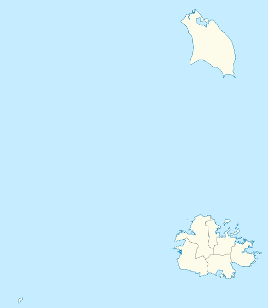
Deutsch: Positionskarte von Antigua und Barbuda. Geographische Begrenzungen der Karte:
English: Location map of Antigua and Barbuda. Geographic limits of the map:
|
| Fecha | |
| Fuente | Trabajo propio utilizando: OpenStreetMap data for the coastlines |
| Autor |
Graphic made by Carport |
| Otras versiones |
_location_map.svg) |
| SVG desarrollo | El código fuente de esta imagen SVG es válido. Este mapa fue creado con Adobe Illustrator |
Licencia
Este archivo se encuentra bajo la licencia Creative Commons Genérica de Atribución/Compartir-Igual 2.0.
- Eres libre:
- de compartir – de copiar, distribuir y transmitir el trabajo
- de remezclar – de adaptar el trabajo
- Bajo las siguientes condiciones:
- atribución – Debes otorgar el crédito correspondiente, proporcionar un enlace a la licencia e indicar si realizaste algún cambio. Puedes hacerlo de cualquier manera razonable pero no de manera que sugiera que el licenciante te respalda a ti o al uso que hagas del trabajo.
- compartir igual – En caso de mezclar, transformar o modificar este trabajo, deberás distribuir el trabajo resultante bajo la misma licencia o una compatible como el original.
Historial del archivo
Haz clic sobre una fecha y hora para ver el archivo tal como apareció en ese momento.
| Fecha y hora | Miniatura | Dimensiones | Usuario | Comentario | |
|---|---|---|---|---|---|
| actual | 17:25 21 oct 2013 | | 864 × 994 (135 kB) | <bdi>TUBS</bdi> | +subdivisions |
| 19:58 23 nov 2009 |  | 1080 × 1243 (182 kB) | <bdi>Carport</bdi> | {{Information |Description={{de|1=Positionskarte von {{w|Antigua und Barbuda|3=de}}. Geographische Begrenzungen der Karte: * N: 17.755° N * S: 16.919° N * W: 62.4° W * E: 61.639° W}} {{en|1=Location map of {{w|Antigua and Barbuda}}. Geographic limits |
Usos del archivo
Las siguientes páginas usan este archivo:
- Aeropuerto de Codrington
- All Saints (Antigua y Barbuda)
- Bahía de Dickenson
- Bahía de Gravenor
- Barbuda
- Bethesda (Antigua y Barbuda)
- Boggy Peak
- Bolands
- Buckleys
- Cedar Grove (Antigua y Barbuda)
- Codrington (Antigua y Barbuda)
- Crosbies
- Ebenezer (Antigua y Barbuda)
- Isla Antigua
- Isla Redonda (Antigua y Barbuda)
- Newfield (Antigua y Barbuda)
- Potters Village
- Saint John (Antigua y Barbuda)
- Seatons
- Swetes
Uso global del archivo
Las wikis siguientes utilizan este archivo:
- Uso en af.wikipedia.org
- Uso en an.wikipedia.org
- Uso en ar.wikipedia.org
- Uso en ast.wikipedia.org
- Uso en ay.wikipedia.org
- Uso en az.wikipedia.org
- Uso en be.wikipedia.org
- Uso en bg.wikipedia.org
- Uso en bn.wikipedia.org
- Uso en bs.wikipedia.org
- Uso en ceb.wikipedia.org
- Plantilya:Location map Antigua and Barbuda
- York Island (pulo sa Antigwa ug Barbuda, Parish of Saint Philip)
- Willoughby Bay (luuk sa Antigwa ug Barbuda)
- William Point (punta sa Antigwa ug Barbuda)
- White Cliff (pangpang sa Antigwa ug Barbuda)
- West Channel (agianan sa Antigwa ug Barbuda)
- Welch Point (punta sa Antigwa ug Barbuda)
- Tucks Point (punta)
- Mount Thomas (bukid sa Antigwa ug Barbuda)
- Table Hill (bungtod sa Antigwa ug Barbuda)
- Sugar Loaf Hill (bungtod sa Antigwa ug Barbuda)
- Spanish Point (punta sa Antigwa ug Barbuda)
- South Point (punta sa Antigwa ug Barbuda)
- South Channel (agianan nga kadagatan sa Antigwa ug Barbuda)
- Soldier Point (punta sa Antigwa ug Barbuda, Parish of Saint John)
- Soldier Point (punta sa Antigwa ug Barbuda, Parish of Saint Philip)
- Soldier Bay (luuk sa Antigwa ug Barbuda)
- Snapper Point (punta sa Antigwa ug Barbuda)
- Smith Island (pulo sa Antigwa ug Barbuda)
- Smith Hill (bungtod sa Antigwa ug Barbuda)
- The Sisters (pulo sa Antigwa ug Barbuda)
- Signal Hill (bukid sa Antigwa ug Barbuda)
- Shoal Point (punta sa Antigwa ug Barbuda)
- Scotts Hill (bungtod sa Antigwa ug Barbuda)
- Sandy Island Channel (agianan sa Antigwa ug Barbuda)
- Sandy Island (pulo sa Antigwa ug Barbuda)
Ver más uso global de este archivo.