

Tamaño de esta previsualización PNG del archivo SVG: 800 × 377 píxeles. Otras resoluciones: 320 × 151 píxeles · 640 × 301 píxeles · 1024 × 482 píxeles · 1280 × 602 píxeles · 2560 × 1205 píxeles · 1481 × 697 píxeles.
Ver la imagen en su resolución original ((Imagen SVG, nominalmente 1481 × 697 pixels, tamaño de archivo: 15 kB))
Resumen
| Descripción |
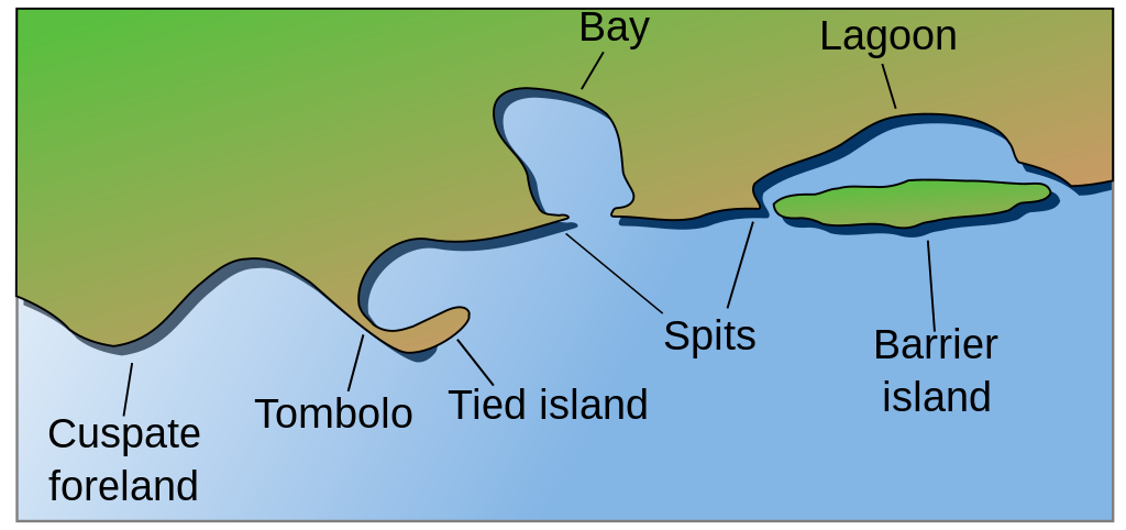
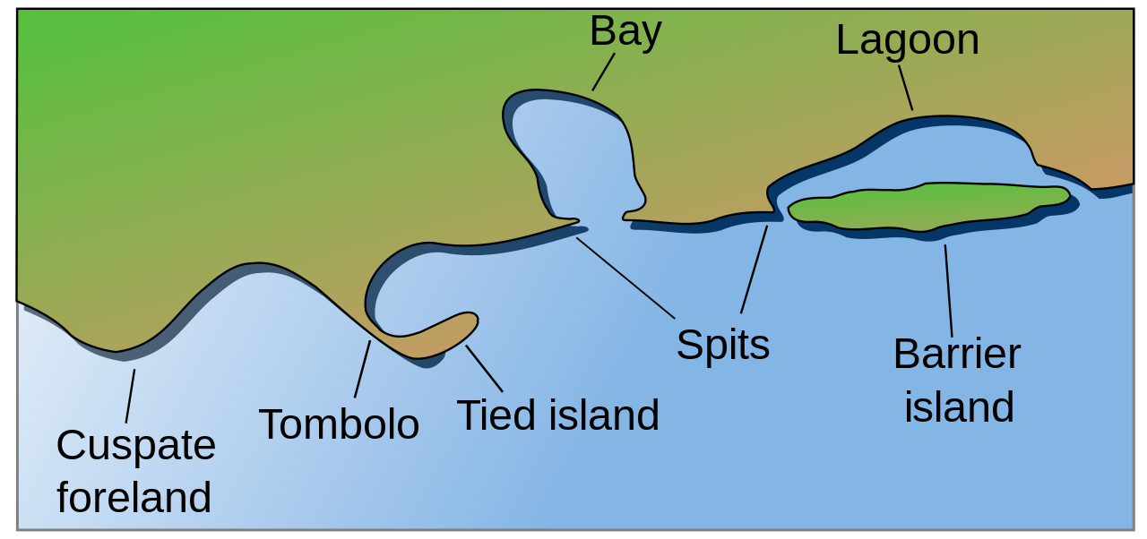
English: Coastal and oceanic landforms. Cuspate foreland, tombolo, spit, bay, lagoon, barrier island. |
| Fecha | |
| Fuente | self-made SVG, based on the public domain PNG Accreting coast Image6.png by Feydey |
| Autor | Surachit |
| Otras versiones |
Obras derivadas de ésta: Accreting coast Image6-ta.svg
|
| SVG desarrollo | El código fuente de esta imagen SVG es válido. Este mapa fue creado con Inkscape, o con otro programa. |


Licencia
| Este trabajo ha sido liberado al dominio público por su autor, Feydey. Esto aplica para todo el mundo. En algunos países esto puede no ser legalmente factible; si ello ocurriese: |
Historial del archivo
Haz clic sobre una fecha y hora para ver el archivo tal como apareció en ese momento.
| Fecha y hora | Miniatura | Dimensiones | Usuario | Comentario | |
|---|---|---|---|---|---|
| actual | 04:17 16 may 2022 | | 1481 × 697 (15 kB) | Bacon Noodles | Fixed background (water) alignment |
| 01:49 12 feb 2018 |  | 1481 × 697 (15 kB) | Howpper | Added tied island. A Tombolo is what connects a Tied island to the mainland, so it would be exclusive to not include both features. | |
| 21:48 16 ago 2007 |  | 1481 × 697 (13 kB) | Surachit | {{Information |Description=Coastal and oceanic landforms. Cuspate foreland, tombolo, spit, bay, lagoon, barrier island. |Source=self-made SVG, based on the public domain PNG [http://en.wikipedia.org/wiki/Image:Accreting_coast_Image6.png] by [http://en.wik |
Usos del archivo
Las siguientes páginas usan este archivo:
Uso global del archivo
Las wikis siguientes utilizan este archivo:
- Uso en ar.wikipedia.org
- Uso en az.wikipedia.org
- Uso en bh.wikipedia.org
- Uso en chr.wikipedia.org
- Uso en cs.wikipedia.org
- Uso en en.wikipedia.org
- Archipelago
- Coast
- Dune
- Island
- List of peninsulas
- Beach
- Fjord
- Atoll
- Strait
- Boulder
- Estuary
- Natural arch
- Lagoon
- Coral reef
- Firth
- Isthmus
- Gulf of California
- Coastal erosion
- Talk:Beach
- River delta
- Cliff
- Reef
- Islet
- Salt marsh
- Tombolo
- Stack (geology)
- Cove
- Shoal
- Spit (landform)
- Longshore drift
- Ria
- Barrier island
- Emergent coastline
- Submergent coastline
- Groyne
- Rip current
- Pebble
- Discordant coastline
- Wave-cut platform
Ver más uso global de este archivo.