
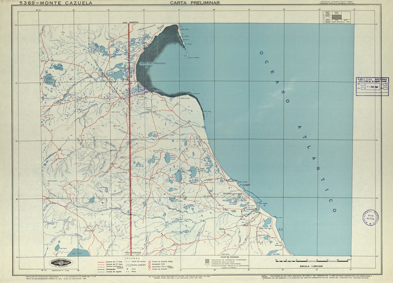
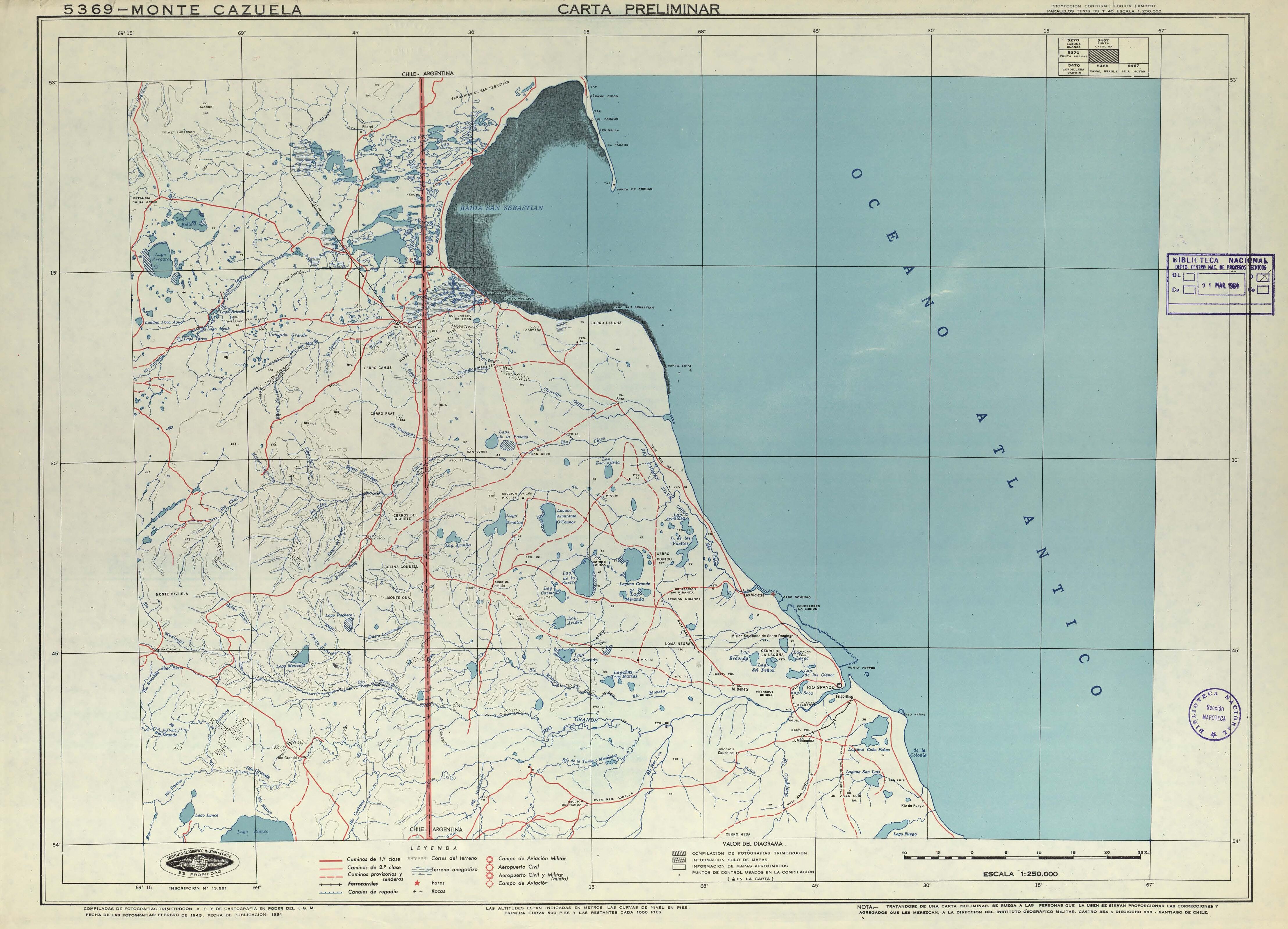
![Monte Cazuela carta preliminar / [material cartográfico] : Instituto Geográfico Militar de Chile. Santiago : Instituto Geográfico Militar de Chile, 1954. 1 mapa : color ; 52 x 71 cm, en hoja 55 x 77 cm. .](http://upload.wikimedia.org/wikipedia/commons/thumb/b/bf/53%C2%B0S-MP0001249.pdf/page1-800px-53%C2%B0S-MP0001249.pdf.jpg)
Tamaño de esta previsualización JPG del archivo PDF: 800 × 577 píxeles. Otras resoluciones: 320 × 231 píxeles · 640 × 461 píxeles · 1024 × 738 píxeles · 1280 × 923 píxeles · 2560 × 1846 píxeles · 4431 × 3195 píxeles.
Ver la imagen en su resolución original (4431 × 3195 píxeles; tamaño de archivo: 1,09 MB; tipo MIME: application/pdf)
Resumen
| Descripción |
Monte Cazuela carta preliminar / [material cartográfico] : Instituto Geográfico Militar de Chile. Santiago : Instituto Geográfico Militar de Chile, 1954. 1 mapa : color ; 52 x 71 cm, en hoja 55 x 77 cm. . |
| Fecha | |
| Fuente | http://www.bibliotecanacionaldigital.gob.cl/bnd/631/w3-article-157080.html |
| Autor | Monte Cazuela carta preliminar / [material cartográfico] : Instituto Geográfico Militar de Chile. Santiago : Instituto Geográfico Militar de Chile, 1954. 1 mapa : color ; 52 x 71 cm, en hoja 55 x 77 cm. . |
Licencia
Este archivo es de dominio público según lo establecido en la Ley de Propiedad Intelectual de Chile (Ley Nº17336 y sus modificaciones). Sin embargo, su autor y origen deben ser acreditados.
Ver aquí tipos de material bajo dominio publico.
|

|
Historial del archivo
Haz clic sobre una fecha y hora para ver el archivo tal como apareció en ese momento.
| Fecha y hora | Miniatura | Dimensiones | Usuario | Comentario | |
|---|---|---|---|---|---|
| actual | 09:45 24 sep 2020 |  | 4431 × 3195 (1,09 MB) | Juan Villalobos | Uploaded a work by Monte Cazuela carta preliminar / [material cartográfico] : Instituto Geográfico Militar de Chile. Santiago : Instituto Geográfico Militar de Chile, 1954. 1 mapa : color ; 52 x 71 cm, en hoja 55 x 77 cm. . from http://www.bibliotecanacionaldigital.gob.cl/bnd/631/w3-article-157080.html with UploadWizard |
Usos del archivo
Las siguientes páginas usan este archivo: