
Zhanaarka
Жаңаарқа | |
|---|---|
 Municipal Library | |
 Zhanaarka Location in Kazakhstan | |
| Coordinates: 48°41′02″N 71°38′15″E / 48.68389°N 71.63750°E | |
| Country | Kazakhstan |
| Region | Ulytau Region |
| District | Zhanaarka District |
| Population (2019) | |
| • Total | 17,559 |
| Time zone | UTC+6 |
| Postcode | 101500 |
Zhanaarka (Kazakh: Жаңаарқа; Russian: Жанаарка) —until 2020 Atasu,[1] is a settlement in Zhanaarka District, Ulytau Region, Kazakhstan. It is the administrative center of the district and the only populated center of the Atasu rural district (KATO code - 354430100).[2] Population: 14,265 (2009 Census results);[3] 14,281 (1999 Census results).[3][4]
Geography
Zhanaarka is located 320 kilometers (200 mi) to the northeast of Zhezkazgan city, by the confluence of the Sarysu and Zhaman Sarysu rivers. Lake Koktinkoli lies 35 kilometers (22 mi) to the southeast of the town.[5][6]
References
- ^ Қарағанды облысы Жаңаарқа ауданындағы Атасу кентін қайта атау туралы (Number of the population of the Republic of Kazakhstan by gender and type of local area —as of January 1, 2023)
- ^ "База КАТО". Агентство Республики Казахстан по статистике. Archived from the original on 2013-09-27.
- ^ a b "Население Республики Казахстан" [Population of the Republic of Kazakhstan] (in Russian). Департамент социальной и демографической статистики. Retrieved 8 December 2013.
- ^ "Итоги Национальной переписи населения Республики Казахстан 2009 года" (PDF). Агентство Республики Казахстан по статистике. Archived from the original (PDF) on 2013-05-13.
- ^ "M-42 Topographic Chart (in Russian)". Retrieved 28 April 2024.
- ^ Google Earth.
External links
 Media related to Zhanaarka at Wikimedia Commons
Capital: Zhezkazgan | ||
| Districts | 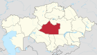 | |
| Cities and administrative centers | ||
This Kazakhstan location article is a stub. You can help Wikipedia by expanding it. |