
Yukhari Askipara
Yuxarı Əskipara | |
|---|---|
 The fortress at Upper Askipara | |
 | |
 Yukhari Askipara | |
| Coordinates: 41°03′58″N 45°01′24″E / 41.06611°N 45.02333°E | |
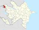
| Country (de jure) | Azerbaijan |
| • District | Qazakh |
| Country (de facto) | Armenia |
| • Province | Tavush |
| • Municipality | Ijevan |
| Time zone | UTC+4 (AZT) |
 | |
Yukhari Askipara (Azerbaijani: Yuxarı Əskipara, lit. 'Upper Askipara'; Armenian: Վերին Ոսկեպար, romanized: Verin Voskepar, lit. 'Upper Voskepar') is a destroyed Azerbaijani village in an exclave of the Qazakh District of Azerbaijan, currently under the control of Armenia and surrounded by the Tavush Province of Armenia. The exclave has been under control by Armenian forces since the First Nagorno-Karabakh War, which also included fighting in Qazakh. Today, the village is destroyed, with only the foundations and some lower portions of the houses remaining.[1]
History
There are three medieval bridges, a fortress and the ruins of a church in the village.[2]
According to the 1915 publication of the Caucasian Calendar, Yukhari Askipara (Аксибара Стар., Aksibara Star.) had a predominantly Tatar (later known as Azerbaijani) population of 278 in 1914.[3]
The village was captured by Armenians in 1990 and its Azerbaijani inhabitants (some 500 people comprising around 100 families) were expelled, becoming internally displaced persons in other villages of Azerbaijan's Qazakh district.[4] The village is now administered as part of the Tavush Province of Armenia.[5]
Notable people
Locally born Firudin Musayev rose from a peasant background to become a brigadier, then state farm director before becoming a deputy of the 8th convocation of the Supreme Soviet of the Soviet Union.[4]
References
- ^ Kiesling, Brady; Raffi Kojian (2001). Rediscovering Armenia: an archaeological/touristic gazetteer and map set for the historical monuments of Armenia. Tigran Mets. p. 69. ISBN 9993052280.
- ^ Karapetyan, Samvel (2004). Northern Artsakh. Yerevan: RAA. ISBN 5-8080-0566-3.
- ^ Кавказский календарь на 1915 год [Caucasian calendar for 1915] (in Russian) (70th ed.). Tiflis: Tipografiya kantselyarii Ye.I.V. na Kavkaze, kazenny dom. 1915. p. 122. Archived from the original on 4 November 2021.
- ^ a b "Əskipara: illərin məsafəsində". MEYDAN.TV (in Azerbaijani). 2014-04-18. Retrieved 2022-01-14.
- ^ АРМЕНИЯ – АЗЕРБАЙДЖАН: ЭТО УЖЕ ПРОСТО ВОЙНА. Vlasts (in Russian). 20 August 1990.
External links
This Qazakh Rayon location article is a stub. You can help Wikipedia by expanding it. |