
Yorktown, New York | |
|---|---|
| Town of Yorktown | |
 | |
 Flag  Seal | |
| Motto: Progress with Preservation | |
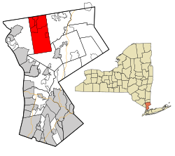 Location of Yorktown, New York | |
| Coordinates: 41°16′56″N 73°48′33″W / 41.28222°N 73.80917°W | |
| Country | United States |
| State | New York |
| County | Westchester |
| Government | |
| • Type | Town Council |
| • Town Supervisor | Tom Diana (C) |
| • Town Council | Ed Lachterman (R) Luciana Haughwout (R) |
| Area | |
| • Total | 39.35 sq mi (101.90 km2) |
| • Land | 36.76 sq mi (95.21 km2) |
| • Water | 2.59 sq mi (6.70 km2) |
| Elevation | 459 ft (140 m) |
| Population | |
| • Total | 36,569 |
| • Estimate (2022)[2] | 35,545 |
| • Density | 994.8/sq mi (384.1/km2) |
| Time zone | UTC-5 (Eastern (EST)) |
| • Summer (DST) | UTC-4 (EDT) |
| ZIP code | 10598 |
| Area code | 914 |
| FIPS code | 36-84077[3] |
| GNIS feature ID | 0979663[4] |
| Website | yorktownny.org |
Yorktown is a town on the northern border of Westchester County, New York, United States. A suburb of the New York City metropolitan area, it is approximately 38 miles (61 km) north of midtown Manhattan. The population was 36,569 at the 2020 U.S. Census.[5]
YouTube Encyclopedic
-
1/4Views:323 0451 351 88712 940114 039
-
History Brief: The Battle of Yorktown
-
Liberty's Kids 136 - Yorktown | History Cartoons For Children
-
Liberty's Kids 136 - Yorktown (with Lafayette and Washington) | American History Videos For Kids
-
History of New York City in 50 seconds
Transcription
History
Yorktown has a rich historical heritage. It was originally inhabited by one or more bands of Wappinger people, including the Kitchawank. Most of Yorktown was part of the Manor of Cortlandt, a Royal Manor granted by King William III for the Van Cortlandt family.[6]
The Croton River, which runs through the southern part of Yorktown, was dammed by the New York City water supply system to provide the city with its first major source of clean and reliable water. The first Croton Dam was located in Yorktown and broke in 1842, causing significant damage to property and major loss of life.[citation needed]

During the American Revolution, Yorktown saw limited action. Late in the war, the Pines Bridge crossing of the Croton River was guarded by the 1st Rhode Island Regiment made up of White, African American, and Native American soldiers. Several of the soldiers were killed, including the regiment's commander, Colonel Christopher Greene, on 14 May 1781 at the Battle of Pine's Bridge in Croton Heights. A memorial was erected at the Presbyterian Church in Crompond, New York.[citation needed] Major John André, a British officer who communicated with Benedict Arnold, ate his final breakfast at the Underhill House at 370 Underhill Avenue on Hanover Street just before his capture and eventual hanging as a spy.[citation needed]
In 1788, the township was officially incorporated as Yorktown, commemorating the Revolutionary War victory of the Franco-American siege of Yorktown, near Yorktown, Virginia, on October 19, 1781. The area had previously been known as Hanover, with a now unwanted association with King George III.
Moving north after the battle of Yorktown, the French army camped at the site of today's French Hill Elementary School, where cannonballs and other relics have been found.[citation needed] Although rumors claim that George Washington passed through Yorktown, no factual records confirm this.[citation needed]
A Bicentennial Committee in 1988 reviewed the town's remaining historic sites and determined which should be preserved.[citation needed]
Geography
The town's northern border is the Town of Putnam Valley in Putnam County. Its eastern border is the Town of Somers. Its southern border is the Town of New Castle. Its western border is the Town of Cortlandt.
According to the United States Census Bureau, the town has a total area of 39.3 square miles (102 km2), of which 36.8 square miles (95 km2) is land and 2.6 square miles (6.7 km2), or 6.57%, is water.[1]
Climate
| Climate data for Yorktown Heights, New York | |||||||||||||
|---|---|---|---|---|---|---|---|---|---|---|---|---|---|
| Month | Jan | Feb | Mar | Apr | May | Jun | Jul | Aug | Sep | Oct | Nov | Dec | Year |
| Record high °F (°C) | 67 (19) |
73 (23) |
85 (29) |
95 (35) |
94 (34) |
94 (34) |
100 (38) |
100 (38) |
95 (35) |
87 (31) |
79 (26) |
73 (23) |
100 (38) |
| Mean daily maximum °F (°C) | 35.5 (1.9) |
38.6 (3.7) |
46.8 (8.2) |
59.7 (15.4) |
69.6 (20.9) |
78.0 (25.6) |
83.0 (28.3) |
81.1 (27.3) |
74.4 (23.6) |
62.5 (16.9) |
51.4 (10.8) |
40.8 (4.9) |
60.1 (15.6) |
| Mean daily minimum °F (°C) | 16.7 (−8.5) |
17.9 (−7.8) |
25.4 (−3.7) |
35.9 (2.2) |
47.8 (8.8) |
55.2 (12.9) |
60.8 (16.0) |
59.3 (15.2) |
51.9 (11.1) |
40.9 (4.9) |
31.5 (−0.3) |
23.3 (−4.8) |
38.9 (3.8) |
| Record low °F (°C) | −15 (−26) |
−10 (−23) |
0 (−18) |
14 (−10) |
30 (−1) |
38 (3) |
46 (8) |
39 (4) |
32 (0) |
20 (−7) |
11 (−12) |
−9 (−23) |
−15 (−26) |
| Average precipitation inches (mm) | 3.72 (94) |
3.06 (78) |
4.10 (104) |
3.89 (99) |
3.91 (99) |
5.00 (127) |
4.32 (110) |
4.28 (109) |
4.80 (122) |
4.61 (117) |
4.24 (108) |
4.37 (111) |
50.30 (1,278) |
| Average snowfall inches (cm) | 8.8 (22) |
12.6 (32) |
8.2 (21) |
1.8 (4.6) |
0 (0) |
0 (0) |
0 (0) |
0 (0) |
0 (0) |
0 (0) |
0.5 (1.3) |
7.6 (19) |
39.50 (100.3) |
| Average precipitation days | 11.1 | 8.6 | 10.5 | 11.1 | 11.6 | 11.3 | 10.3 | 9.9 | 8.9 | 9.4 | 9.1 | 10.5 | 122.3 |
| Average snowy days | 5.2 | 4.1 | 3.3 | 0.4 | 0 | 0 | 0 | 0 | 0 | 0 | 0.5 | 3.4 | 16.9 |
| Source: NOAA[7] | |||||||||||||
Demographics
| Census | Pop. | Note | %± |
|---|---|---|---|
| 1790 | 1,609 | — | |
| 1820 | 1,991 | — | |
| 1830 | 2,141 | 7.5% | |
| 1840 | 2,819 | 31.7% | |
| 1850 | 2,273 | −19.4% | |
| 1860 | 2,231 | −1.8% | |
| 1870 | 2,625 | 17.7% | |
| 1880 | 2,481 | −5.5% | |
| 1890 | 2,378 | −4.2% | |
| 1900 | 2,421 | 1.8% | |
| 1910 | 3,020 | 24.7% | |
| 1920 | 1,441 | −52.3% | |
| 1930 | 2,724 | 89.0% | |
| 1940 | 3,642 | 33.7% | |
| 1950 | 4,731 | 29.9% | |
| 1960 | 16,453 | 247.8% | |
| 1970 | 28,064 | 70.6% | |
| 1980 | 31,988 | 14.0% | |
| 1990 | 33,467 | 4.6% | |
| 2000 | 36,318 | 8.5% | |
| 2010 | 36,081 | −0.7% | |
| 2020 | 36,569 | 1.4% | |
| 2022 (est.) | 35,545 | [2] | −2.8% |
| U.S. Decennial Census[8] | |||
As of the United States Census of 2000, there were 36,318 people, 12,556 households, and 9,831 families residing in the town.[3] The population density was 989.7 inhabitants per square mile (382.1/km2). There were 12,852 housing units at an average density of 350.2 per square mile (135.2/km2). The racial makeup of the town was 90.64% White, 3.04% African American, 0.14% Native American, 3.44% Asian, 0.01% Pacific Islander, 1.30% from other races and 1.43% from two or more races. Hispanic or Latino of any race were 5.82% of the population.
There were 12,556 households, out of which 40.9% had children under the age of 18 living with them, 69.1% were married couples living together, 7.1% had a female householder with no husband present, and 21.7% were non-families. 19.0% of all households were made up of individuals, and 10.0% had someone living alone who was 65 years of age or older. The average household size was 2.83 and the average family size was 3.26.
In the town, the population was spread out, with 27.6% under the age of 18, 5.4% from 18 to 24, 28.5% from 25 to 44, 25.2% from 45 to 64, and 13.3% who were 65 years of age or older. The median age was 39 years. For every 100 females, there were 93.0 males. For every 100 females age 18 and over, there were 88.9 males.
The median income for a household in the town was $133,819, and the median income for a family was $154,984 (these figures had risen to $137,253 and $159,413 respectively as of a 2014 estimate[9]). Males had a median income of $96,071 versus $75,899 for females. The per capita income for the town was $63,570. About 1.1% of families and 1.4% of the population were below the poverty line, including 3.3% of those under age 18 and 4.3% of those age 65 or over.
For the 2010 census, the results showed 87.9% White, 3.3% African-American, 0.1% American Indian, 4.7% Asian, 9.4% Latino.[10]
Some of Yorktown's multiple ethnic groups, nationalities and religious communities are, for example, Italians, Mexicans and American Jews. There is an annual feast of San Gennaro represents the Italian community.[11] Also there are Irish, Japanese and African-Americans, among others.
Government
Yorktown is governed by a five-member town board. It determines policy and is the branch of government that appropriates funds for governmental functions and services. The Board is composed of four Council members, who are elected for a four-year term, and the Supervisor who is elected for a two-year term. Terms are staggered. Two Council positions are elected at each biennial election.
Politics
| Year | Republican | Democratic | Third party | |||
|---|---|---|---|---|---|---|
| No. | % | No. | % | No. | % | |
| 2020 | 10244 | 47.40% | 11099 | 51.35% | 270 | 1.25% |
| 2016 | 9140 | 47.99% | 9073 | 47.63% | 834 | 4.38% |
Communities and locations in Yorktown
The town is made up of five business hamlets: Mohegan Lake, Shrub Oak, Jefferson Valley, Crompond, and Yorktown Heights, and twelve historical residential neighborhoods each with their own unique character and identity.
- Hamlets
- Lake Mohegan
- Shrub Oak
- Jefferson Valley-Yorktown
- Crompond (partially in the town of Cortlandt)
- Yorktown Heights
- Historical Neighborhoods
- Copper Beech/Oakside[citation needed]
- Croton Heights
- Manhattan Park
- Crow Hill[citation needed]
- Huntersville/Hunterbrook
- Kitchawan/Pinesbridge
- Mohansic Park aka Franklin D. Roosevelt State Park
- Quarry/Stony Street[citation needed]
- Sparkle Lake/Cottage Farms[citation needed]
- Teatown (not completely in the town of Yorktown)[citation needed]
- Turkey Hill/Underhill Heights[citation needed]
- Yorkhill/Amawalk Nursery[citation needed]
- Yorktown[citation needed]
Education
The Town of Yorktown is served by four school districts: Yorktown Central School District, Lakeland Central School District, Croton-Harmon Union Free School District, and Ossining Union Free School District.
The Yorktown School District encompasses a large part of the Town of Yorktown and small sections of Cortlandt and New Castle. The district includes two, grade K-3 elementary schools; one, grade 4-5 elementary school; one, grade 6-8 middle school; and one grade 9-12 high school.
Lakeland is a suburban school district located in the Northwest corner of Westchester County and includes parts of six towns: Yorktown, Cortlandt, and Somers in Westchester County; Carmel, Philipstown, and Putnam Valley in Putnam County. Lakeland includes five grade K-5 elementary schools, one grade 6-8 middle school, and two grade 9-12 high schools, as well as the Lakeland Alternative High School.
The Croton-Harmon School District encompasses parts of the towns of Cortlandt, Yorktown, and Ossining and includes the village of Croton-on-Hudson. The district population is approximately 15,000 with some 1,700 students attending Croton schools this year. The district includes one, grade K-4 elementary school; one, grade 5-8 middle school; and one, grade 9-12 high school.
The Ossining Union Free School District encompasses parts of the towns of Yorktown, New Castle, Briarcliff Manor, Ossining, and the Village of Ossining. The district includes the Park Early childhood center, which houses three programs: First Steps for Ossining families with children ages 0 to 4, Pre-Kindergarten for four year-olds and Kindergarten, one grade 1-2 elementary school, one, grade 3-4 elementary school, one grade 5 elementary school, one grade 6-8 middle school, and one grade 9-12 high school.
Business

The headquarters for Contractors Register is located in the Hamlet of Jefferson Valley. Contractors Register publishes The Blue Book of Building and Construction.[13]
The main site of the IBM Thomas J. Watson Research Center is located in the Kitchawan part of Yorktown.
Regional bank PCSB Bank is headquartered in Yorktown Heights.[14]
Commerce
Jefferson Valley Mall, the area's major shopping center, is located in Yorktown, in the hamlet of Jefferson Valley.[15]
Parks
Parks in Yorktown includes several state parks: Donald J. Trump State Park (with north and south sections), sold to the state at a discount by Donald Trump, and Franklin D. Roosevelt State Park.[16] There are also many local parks: Downing Park, Granite Knolls Park, Hilltop Hanover Farm & Environmental Center, Kitchawan Preserve, part of the North County Trailway (now also known as the Empire State Trailway), Patriot Park, Railroad Park, Sylvan Glen Park Preserve, Teatown Lake Reservation (partially in the towns of Cortlandt and New Castle), Turkey Mountain Nature Preserve, and Woodlands Legacy Fields Park.
Rail stops

Yorktown once had five stations along the New York and Putnam Railroad — Kitchawan, Croton Lake, Croton Heights, Yorktown Heights, and Amawalk. The railroad was purchased by the New York Central Railroad, and ran into the early 1960s, when changes in vacation patterns impacting the numerous resort hotels further upline in Lake Mahopac and the dominant car culture killed the rail service. The old right of way is now part of the North County Trailway, which runs north as far as Carmel, New York.[citation needed] There is currently no rail service in Yorktown, but there are multiple Metro-North Railroad stations nearby, in Katonah in the east on the Harlem Line and Peekskill on the Hudson Line.
One of the New York Central stations was restored and today serves as the centerpiece of a small town park.
Events
- Feast of San Gennaro
- Yorktown Grange Fair
- Battle of Yorktown, a litter cleanup initiative held annually in April
- Greasestock, a yearly festival showcasing alternative fuel vehicles.[17]
Notable people
- Roy Colsey, Major League Lacrosse player, grew up in Yorktown
- Nargis Fakhri, Bollywood actress, owns a house in Yorktown[18]
- Susan Faludi, American feminist, journalist, author, and Pulitzer Prize winner grew up in Yorktown
- Charlie Gasparino, American financial journalist
- Robert Hannsen, convicted Russian spy, lived with his family in Yorktown in the mid-1980s
- Margaret Illington, stage actress popular in the first decade of the 20th century, lived on her Dreamlake estate in Yorktown[19]
- Consuelo Kanaga, photographer and writer who became well known for her photographs of African-Americans
- Andrew Kavovit, actor, grew up in Yorktown
- Dave Matthews, singer/songwriter, lived with his family in Yorktown before he moved to Virginia
- William Keepers Maxwell Jr., fiction editor for The New Yorker and novelist[20][21]
- Terrence Murphy, Former New York State Senator
- Alexandria Ocasio-Cortez, Congresswoman, born in NYC, but moved to Yorktown when she was five and later attended Yorktown High School[22]
- Buster Olney, ESPN baseball analyst and former New York Yankees beat writer
- Clifford A. Pickover, writer. In his book, The Mobius Strip, he models the fictional New Devonshire on Yorktown. Pickover also used the Jefferson Valley Mall as the locale for his book The Heaven Virus.
- Al Roker, meteorologist, lived in Yorktown while he was married to the town clerk, Alice Bell
- Anthony "Romeo" Santos, Dominican-American singer, songwriter, actor, record producer, and lead vocalist of the American bachata band Aventura who is the first Latino artist to sell out Yankee and MetLife Stadium
- Matt Slater, American politician currently serving as a member of the New York State Assembly, representing the 94th district. Former Town Supervisor of Yorktown.
- Lawrence Treat, mystery writer and pioneer of the genre of novels police procedurals[23]
- Halsey (H.W.) Wilson, founder of the H. W. Wilson Company, a publisher, lived in the Croton Heights section of Yorktown[24]
References
- ^ a b "2020 U.S. Gazetteer Files". United States Census Bureau. Retrieved March 9, 2024.
- ^ a b c "Population and Housing Unit Estimates". Retrieved March 9, 2024.
- ^ a b "U.S. Census website". United States Census Bureau. Retrieved January 31, 2008.
- ^ "US Board on Geographic Names". United States Geological Survey. October 25, 2007. Retrieved January 31, 2008.
- ^ "U.S. Census Bureau QuickFacts: Yorktown town, Westchester County, New York". www.census.gov. Retrieved September 4, 2022.
- ^ "Historic Yorktown". yorktownhistory.org. Retrieved October 6, 2022.
- ^ "Summary of Monthly Normals 1991-2020". Retrieved May 12, 2022.
- ^ "Census of Population and Housing". Census.gov. Retrieved June 4, 2015.
- ^ "American FactFinder - Results". Archived from the original on February 16, 2020. Retrieved March 31, 2009.
- ^ 2010 Census summary, 'Race and Hispanic or Latino Origin' https://factfinder.census.gov/faces/tableservices/jsf/pages/productview.xhtml?src=CF [1]
- ^ "Yorktown Feast of San Gennaro". Town of Yorktown New York. Retrieved October 28, 2021.
- ^ "DRA 2020". Retrieved September 3, 2022.
- ^ "The Blue Book Building & Construction Network - Home". www.thebluebook.com. Retrieved February 10, 2015.
- ^ Golden, John (December 15, 2016). "PCSB Bank will sell shares, convert to stock savings bank". Westfair Business Publications. Archived from the original on November 18, 2018. Retrieved April 13, 2017.
- ^ "WASHINGTON PRIME GROUP". washingtonprime.com. August 31, 2017. Archived from the original on August 20, 2017. Retrieved August 31, 2017.
- ^ "Franklin D. Roosevelt State Park".
- ^ Norman, Jim. "Where There's Never an Oil Shortage". New York Times. May 13, 2007.
- ^ "Happy Birthday To Yorktown's Nargis Fakhri". Yorktown Daily Voice. The Daily Voice. October 20, 2013. Retrieved March 23, 2019.
- ^ "Dreamlake Is Sold - A. D. Geissler Buys Estate of Margaret Illington" (PDF). timesmachine.nytimes.com. Retrieved June 17, 2011.
- ^ "William Maxwell's Black Characters in Billie Dyer and Other Stories". findinglincolnillinois.com. Retrieved June 17, 2011.
- ^ Burkhardt, Barbara A. (2005). William Maxwell: A Literary Life. ISBN 9780252030185.
- ^ Newman, Andy; Wang, Vivian; Ferré-Sadurní, Luis (June 27, 2018). "Alexandria Ocasio-Cortez Emerges as a Political Star". The New York Times. New York City. Archived from the original on June 28, 2018. Retrieved June 29, 2018.
- ^ "Lawrence Treat, Mystery Writer, 94". articles.sun-sentinel.com. Archived from the original on September 2, 2012. Retrieved June 17, 2011.
- ^ "Halsey W. Wilson". Bulletin of the Medical Library Association. 42 (3): 402–403. 1954. PMC 199761.
External links
- Citizens for an Informed Yorktown
- Town of Yorktown official website
- Yorktown (New York) at Curlie
- Yorktown Heights Fire Department
Municipalities and communities of Westchester County, New York, United States | ||
|---|---|---|
| Cities |  | |
| Towns | ||
| Villages | ||
| CDPs |
| |
| Other hamlets | ||
| Footnotes | ‡This populated place also has portions in an adjacent county or counties | |

| International | |
|---|---|
| National | |
41°17′44″N 73°48′29″W / 41.29556°N 73.80806°W