
Yelatma
Елатьма | |
|---|---|
 Flag  Coat of arms | |
Location of Yelatma  | |
 Yelatma Location of Yelatma 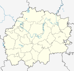 Yelatma Yelatma (Ryazan Oblast) | |
| Coordinates: 54°58′09″N 41°45′12″E / 54.9693°N 41.7532°E | |
| Country | Russia |
| Federal subject | Ryazan Oblast |
| Administrative district | Kasimovsky District |
| Elevation | 135 m (443 ft) |
| Population | |
| • Total | 3,511 |
| • Estimate (2018)[2] | 3,075 (−12.4%) |
| Time zone | UTC+3 (MSK |
| Postal code(s)[4] | 391351 |
| OKTMO ID | 61608156051 |
Yelatma (Russian: Елатьма) is an urban locality (an urban-type settlement) in Kasimovsky District of Ryazan Oblast, Russia. Population: 3,511 (2010 Census);[1] 4,002 (2002 Census);[5] 4,559 (1989 Census).[6]
Climate
Elatma has a humid continental climate (Koppen Dfb).
| Climate data for Elatma, Russia | |||||||||||||
|---|---|---|---|---|---|---|---|---|---|---|---|---|---|
| Month | Jan | Feb | Mar | Apr | May | Jun | Jul | Aug | Sep | Oct | Nov | Dec | Year |
| Record high °C (°F) | 5.8 (42.4) |
7.6 (45.7) |
18.0 (64.4) |
26.6 (79.9) |
34.2 (93.6) |
36.6 (97.9) |
38.3 (100.9) |
39.3 (102.7) |
31.5 (88.7) |
24.2 (75.6) |
18.7 (65.7) |
8.5 (47.3) |
39.3 (102.7) |
| Mean daily maximum °C (°F) | −5.5 (22.1) |
−4.9 (23.2) |
1.5 (34.7) |
11.6 (52.9) |
19.6 (67.3) |
23.2 (73.8) |
25.3 (77.5) |
23.1 (73.6) |
16.6 (61.9) |
8.6 (47.5) |
0.1 (32.2) |
−4.3 (24.3) |
9.6 (49.3) |
| Daily mean °C (°F) | −8.5 (16.7) |
−8.7 (16.3) |
−2.8 (27.0) |
6.3 (43.3) |
13.3 (55.9) |
17.2 (63.0) |
19.3 (66.7) |
17.1 (62.8) |
11.4 (52.5) |
5.0 (41.0) |
−2.3 (27.9) |
−7.0 (19.4) |
5.0 (41.0) |
| Mean daily minimum °C (°F) | −11.5 (11.3) |
−12.2 (10.0) |
−6.5 (20.3) |
1.9 (35.4) |
7.5 (45.5) |
11.9 (53.4) |
14.0 (57.2) |
12.2 (54.0) |
7.3 (45.1) |
2.1 (35.8) |
−4.5 (23.9) |
−9.8 (14.4) |
1.0 (33.9) |
| Record low °C (°F) | −42.9 (−45.2) |
−39.0 (−38.2) |
−31.6 (−24.9) |
−21.0 (−5.8) |
−5.1 (22.8) |
−2.7 (27.1) |
2.1 (35.8) |
0.0 (32.0) |
−7.7 (18.1) |
−20.9 (−5.6) |
−31.0 (−23.8) |
−41.6 (−42.9) |
−42.9 (−45.2) |
| Average precipitation mm (inches) | 46 (1.8) |
39 (1.5) |
32 (1.3) |
36 (1.4) |
39 (1.5) |
73 (2.9) |
70 (2.8) |
71 (2.8) |
57 (2.2) |
62 (2.4) |
52 (2.0) |
53 (2.1) |
630 (24.7) |
| Average snowfall cm (inches) | 23 (9.1) |
33 (13) |
29 (11) |
3 (1.2) |
0 (0) |
0 (0) |
0 (0) |
0 (0) |
0.3 (0.1) |
2 (0.8) |
3 (1.2) |
12 (4.7) |
105.3 (41.1) |
| Average rainy days | 6 | 5 | 8 | 12 | 14 | 17 | 16 | 15 | 17 | 16 | 11 | 7 | 144 |
| Average snowy days | 24 | 21 | 15 | 5 | 1 | 0 | 0 | 0 | 0.3 | 5 | 16 | 23 | 110.3 |
| Average relative humidity (%) | 85 | 81 | 77 | 69 | 64 | 72 | 74 | 76 | 79 | 83 | 87 | 86 | 78 |
| Mean monthly sunshine hours | 44.9 | 78.2 | 141.8 | 202.3 | 278.3 | 290.8 | 294.1 | 241.4 | 159.9 | 86.3 | 39.2 | 26.2 | 1,883.4 |
| Mean daily daylight hours | 8.6 | 10.4 | 12.5 | 14.8 | 17.0 | 18.2 | 17.5 | 15.6 | 13.3 | 11.1 | 9.1 | 8.0 | 13.0 |
| Source 1: Pogoda.ru.net [7] | |||||||||||||
| Source 2: Weatherbase [8] | |||||||||||||
References
- ^ a b Russian Federal State Statistics Service (2011). Всероссийская перепись населения 2010 года. Том 1 [2010 All-Russian Population Census, vol. 1]. Всероссийская перепись населения 2010 года [2010 All-Russia Population Census] (in Russian). Federal State Statistics Service.
- ^ "26. Численность постоянного населения Российской Федерации по муниципальным образованиям на 1 января 2018 года". Federal State Statistics Service. Retrieved January 23, 2019.
- ^ "Об исчислении времени". Официальный интернет-портал правовой информации (in Russian). June 3, 2011. Retrieved January 19, 2019.
- ^ Почта России. Информационно-вычислительный центр ОАСУ РПО. (Russian Post). Поиск объектов почтовой связи (Postal Objects Search) (in Russian)
- ^ Russian Federal State Statistics Service (May 21, 2004). Численность населения России, субъектов Российской Федерации в составе федеральных округов, районов, городских поселений, сельских населённых пунктов – районных центров и сельских населённых пунктов с населением 3 тысячи и более человек [Population of Russia, Its Federal Districts, Federal Subjects, Districts, Urban Localities, Rural Localities—Administrative Centers, and Rural Localities with Population of Over 3,000] (XLS). Всероссийская перепись населения 2002 года [All-Russia Population Census of 2002] (in Russian).
- ^ Всесоюзная перепись населения 1989 г. Численность наличного населения союзных и автономных республик, автономных областей и округов, краёв, областей, районов, городских поселений и сёл-райцентров [All Union Population Census of 1989: Present Population of Union and Autonomous Republics, Autonomous Oblasts and Okrugs, Krais, Oblasts, Districts, Urban Settlements, and Villages Serving as District Administrative Centers]. Всесоюзная перепись населения 1989 года [All-Union Population Census of 1989] (in Russian). Институт демографии Национального исследовательского университета: Высшая школа экономики [Institute of Demography at the National Research University: Higher School of Economics]. 1989 – via Demoscope Weekly.
- ^ "Pogoda.ru.net". Retrieved September 3, 2020.
- ^ "Weatherbase". Retrieved September 3, 2020.
This Ryazan Oblast location article is a stub. You can help Wikipedia by expanding it. |