
Yazıhan | |
|---|---|
District and municipality | |
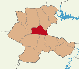 Map showing Yazıhan District in Malatya Province | |
 Yazıhan Location in Turkey | |
| Coordinates: 38°35′49″N 38°11′16″E / 38.59694°N 38.18778°E | |
| Country | Turkey |
| Province | Malatya |
| Government | |
| • Mayor | Nevzat Öztürk (AKP) |
| Area | 653 km2 (252 sq mi) |
| Population (2022)[1] | 11,984 |
| • Density | 18/km2 (48/sq mi) |
| Time zone | TRT (UTC+3) |
| Postal code | 44350 |
| Area code | 0422 |
| Website | www |
Yazıhan (Kurdish: Patrîkxan[2]) is a municipality and district of Malatya Province, Turkey.[3] Its area is 653 km2,[4] and its population is 11,984 (2022).[1] The mayor is Nevzat Öztürk (AKP).
Main economical activities are agriculture and trade.
YouTube Encyclopedic
-
1/3Views:4 2731 38030 582
-
Malatya Yazıhan Belgeseli
-
Malatya Boztepe Barajı - Yazıhan, Akyazı, Sarsap Köyü
-
dırejan aşireti tura oyunu
Transcription
Composition
There are 33 neighbourhoods in Yazıhan District:[5]
- Akyazı
- Alican
- Ambarcık
- Bahçelievler
- Balaban
- Bereketli
- Böğürtlen
- Boyaca
- Boztepe
- Buzluk
- Çavuş
- Çivril
- Dedekargın
- Doğuş
- Durucasu
- Eğribük
- Epreme
- Erecek
- Fethiye
- Gayret
- Gövük
- Hamidiye
- İriağaç
- Karaca
- Kömüşhan
- Koşar
- Mısırdere
- Sadıklı
- Sinanlı
- Sürür
- Tahtalı
- Tecirli
- Yeni
Notable people
- Sebahat Tuncel, Kurdish politician in Turkey
References
- ^ a b "Address-based population registration system (ADNKS) results dated 31 December 2022, Favorite Reports" (XLS). TÜİK. Retrieved 19 September 2023.
- ^ Avcýkýran, Dr. Adem (ed.). "Kürtçe Anamnez, Anamneza bi Kurmancî" (PDF). Tirsik. p. 55. Retrieved 17 December 2019.
- ^ Büyükşehir İlçe Belediyesi, Turkey Civil Administration Departments Inventory. Retrieved 19 September 2023.
- ^ "İl ve İlçe Yüz ölçümleri". General Directorate of Mapping. Retrieved 19 September 2023.
- ^ Mahalle, Turkey Civil Administration Departments Inventory. Retrieved 19 September 2023.
Yazıhan in Malatya Province of Turkey | |||||||||||||||||||||||||||
|---|---|---|---|---|---|---|---|---|---|---|---|---|---|---|---|---|---|---|---|---|---|---|---|---|---|---|---|
| Districts |   | ||||||||||||||||||||||||||
|
Metropolitan municipalities are bolded. | |||||||||||||||||||||||||||
This article about an Eastern Anatolia Region of Turkey location is a stub. You can help Wikipedia by expanding it. |