
Yawata
八幡市 | |
|---|---|
 Yawata City HAll | |
 Flag  Emblem | |
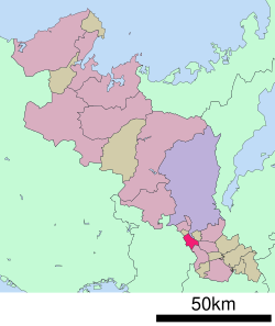
 Location of Yawata in Kyoto Prefecture | |
 | |
 Yawata Location in Japan | |
| Coordinates: 34°52′32″N 135°42′27″E / 34.87556°N 135.70750°E | |
| Country | Japan |
| Region | Kansai |
| Prefecture | Kyoto |
| Government | |
| • Mayor | Shōko Kawada (since November 2023) |
| Area | |
| • Total | 24.35 km2 (9.40 sq mi) |
| Population (July 31, 2023) | |
| • Total | 69,306 |
| • Density | 2,800/km2 (7,400/sq mi) |
| Time zone | UTC+09:00 (JST) |
| City hall address | Yawata-Sonouchi 75, Yawata-shi, Kyoto-fu 614-8501 |
| Website | Official website |
| Symbols | |
| Bird | Parus minor |
| Flower | Rhododendron |
| Tree | Cinnamomum camphora |

Yawata (八幡市, Yawata-shi) is a city located in Kyoto Prefecture, Japan. As of 31 July 2023[update], the city has an estimated population of 69,306 in 33972 households and a population density of 2800 persons per km2.[1] The total area of the city is 24.35 square kilometres (9.40 sq mi). The Iwashimizu Hachiman-gū is located in Yawata.
Geography
Yawata is located in southern Kyoto Prefecture near the confluence of three rivers: the Kizugawa, Ujigawa, and Katsura. Because of the widespread low-lying wetlands prone to such flooding, the old city was located on a natural embankment that was slightly higher than the surrounding area, called Minamiyama. Yawata has several enclaves, located on the border between Fushimi-ku, Kyoto and Kumiyama, and on the border between Kyōtanabe and Hirakata, Osaka.
Neighboring municipalities
Climate
Yawata has a humid subtropical climate (Köppen Cfa) characterized by warm summers and cool winters with light to no snowfall. The average annual temperature in Yawata is 14.5 °C. The average annual rainfall is 1356 mm with September as the wettest month. The temperatures are highest on average in August, at around 26.5 °C, and lowest in January, at around 3.1 °C.[2]
Demographics
Per Japanese census data,[3] the population Yawata has since peaked in the 1990s and has declined slightly. Currently, many people commute to work or study outside the city, such as Hirakata, Kyoto, and Osaka, and the city is included in the Kyoto metropolitan area as an urban employment area.
| Year | Pop. | ±% |
|---|---|---|
| 1940 | 13,576 | — |
| 1950 | 16,063 | +18.3% |
| 1960 | 16,322 | +1.6% |
| 1970 | 22,974 | +40.8% |
| 1980 | 64,882 | +182.4% |
| 1990 | 75,758 | +16.8% |
| 2000 | 73,682 | −2.7% |
| 2010 | 74,246 | +0.8% |
| 2020 | 70,433 | −5.1% |
History
The area of Yawata was part of ancient Yamashiro Province and developed as a town in front of the gates of Iwashimizu Hachiman-gu, a Shinto shrine, which attracted a wide range of worship from the imperial family and samurai to the common people.The town of Yawata in Tsuzuki District, Kyoto were established on April 1, 1889 with the creation of the modern municipalities system. It was elevated to city status on November 1, 1977.
Government
Yawata has a mayor-council form of government with a directly elected mayor and a unicameral city council of 21 members. Yawata contributes two members to the Kyoto Prefectural Assembly. In terms of national politics, the city is part of the Kyoto 6th district of the lower house of the Diet of Japan.
Economy
Yawata has a mixed economy based on commerce, agriculture and light manufacturing. Industries are mainly located along Japan National Route 1 and are concentrated on metal processing. Due to transportation connections, Yawata is also a warehouse and distribution base. Due to its proximity to Osaka and Kyoto, the city is gradually becoming a commuter town.
Education
Yawata has eight public elementary schools and four public junior high schools operated by city government and one public high school operated by the Kyoto Prefectural Board of Education. The prefecture also operates one special education school for the handicapped.
Transportation
Railways
![]() - Keihan Electric Railway - Keihan Main Line / Ōtō Line
- Keihan Electric Railway - Keihan Main Line / Ōtō Line
![]() - Keihan Electric Railway - Keihan Cable Line
- Keihan Electric Railway - Keihan Cable Line
Highways
Sister city relations
 - Milan, Ohio, United States, sister city since August 12, 1986
 - Baoji, Shaanxi, China, partner city since November 2, 1992
Local attractions
- Iwashimizu Hachiman-gū
- Edison Memorial, as Thomas Alva Edison used bamboo filaments from Yawata for his early light bulb tests
Notable people
- Hisashi Nogami - video game designer, director, and producer
References
External links
- Yawata City official website (in Japanese)
- Edison Ceremonial
| International | |
|---|---|
| National | |
| Geographic | |
This Kyoto Prefecture location article is a stub. You can help Wikipedia by expanding it. |