
Yangju
양주시 | |
|---|---|
| Korean transcription(s) | |
| • Hangul | 양주시 |
| • Hanja | 楊州市 |
| • Revised Romanization | Yangju-si |
| • McCune-Reischauer | Yangju-si |
 | |
 Flag Emblem of Yangju | |
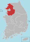
 Location in South Korea | |
| Country | |
| Region | Gyeonggi Province (Sudogwon) |
| Administrative divisions | 1 eup, 4 myeon, 6 dong |
| Area | |
| • Total | 310.1 km2 (119.7 sq mi) |
| Population (2009 Dec) | |
| • Total | 189,492 |
| • Density | 611.1/km2 (1,583/sq mi) |
| • Dialect | Seoul |
Yangju (Korean pronunciation: [jaŋ.dzu]) is a city in Gyeonggi Province, South Korea. Yangju is located south of Dongducheon and north of Uijeongbu, not far from Seoul.
YouTube Encyclopedic
-
1/3Views:2 1517587 178
-
Bus Ride Home - Yangju-si, Gyeonggi-do, South Korea
-
양주나리공원 (yangju nari park in yangju, South Korea) - 여행이의 스토리
-
서울지하철 1호선 양주-인천 주행영상(Seoul line 1 Yangju-Incheon)
Transcription
History
- 1395 - Renamed to Yangju.
- January 1, 1963 - Uijeongbu is separated and becomes a city.
- April 1, 1980 - Namyangju is separated and becomes a city.
- July 1, 1981 - Dongducheon is separated and becomes a city.
Attractions
Yangju is home to the Jangheun Art Gallery, which features six exhibition halls and includes subsidiary facilities such as outdoor performances and outdoor sculptures. Yangju also has an astronomical observatory and planetarium that is open to the public.[1] The city also used to have a walking Dae Jang Geum Theme Park featuring the film locations and constructed sets for the MBC Korean drama Daejanggeum, but this was closed permanently in late 2011 due to persistent vandalism.[2]
Yangju also hosts the yearly Yangju Snow Festival.[3] The city has a few mountains, including Gamaksan and Bulgoksan, which can be hiked. Part of Bukhansan is located within Yangju.
Town
It is divided into Okjeong New City and Hoecheon New City.
Okjeong City consists of Okjeong Village, Yuljeong Village, Hoeam Village, Wow Village, Cheonbosan Village, and Dokbawigol.
Okjeong new city
In the beginning, the correct name was Okjeong-gu, Yangjin City, but the LH removed the name Yangjin-city to reflect the opinions of residents, and Okjeong-gu was called Okjeong-si, and Hoecheon-si was called Hoecheon New Town. It is being sold under the name of the city of Okshin City. It claims to be a pleasant new town with a green area ratio of 26.88% where a high-tech city and clean nature harmonize. Okjeong and Hoecheon With a population of 160,000, the target population of 41,481 households is 106,000. As of March 2021, 17 complexes have been completed / moved in, and the resident population has exceeded 50,000 (as of February 10, 2021).
Currently 8 complexes remain.
Okjeong Lake Park
Okjeong Lake Park is a lake park that has been completed since the development of Yangshuo City in 2007 . There are facilities such as a fountain facility, an outdoor stage, and a lake observatory.
Climate
Yangju has a monsoon-influenced humid continental climate (Köppen: Dwa) with cold, dry winters and hot, rainy summers.
| Climate data for Yangju (1996–2020 normals) | |||||||||||||
|---|---|---|---|---|---|---|---|---|---|---|---|---|---|
| Month | Jan | Feb | Mar | Apr | May | Jun | Jul | Aug | Sep | Oct | Nov | Dec | Year |
| Mean daily maximum °C (°F) | 1.7 (35.1) |
5.0 (41.0) |
11.2 (52.2) |
18.3 (64.9) |
24.2 (75.6) |
28.2 (82.8) |
29.5 (85.1) |
30.5 (86.9) |
26.5 (79.7) |
20.3 (68.5) |
11.6 (52.9) |
3.5 (38.3) |
17.5 (63.5) |
| Daily mean °C (°F) | −4.8 (23.4) |
−1.5 (29.3) |
4.5 (40.1) |
11.2 (52.2) |
17.3 (63.1) |
22.1 (71.8) |
24.8 (76.6) |
25.3 (77.5) |
20.1 (68.2) |
12.7 (54.9) |
5.0 (41.0) |
−2.5 (27.5) |
11.2 (52.2) |
| Mean daily minimum °C (°F) | −10.7 (12.7) |
−7.5 (18.5) |
−1.9 (28.6) |
4.3 (39.7) |
10.8 (51.4) |
16.6 (61.9) |
21.1 (70.0) |
21.2 (70.2) |
14.7 (58.5) |
6.3 (43.3) |
−0.7 (30.7) |
−8.0 (17.6) |
5.5 (41.9) |
| Average precipitation mm (inches) | 14.3 (0.56) |
23.2 (0.91) |
30.6 (1.20) |
63.7 (2.51) |
95.6 (3.76) |
114.6 (4.51) |
381.0 (15.00) |
340.4 (13.40) |
141.7 (5.58) |
47.4 (1.87) |
46.2 (1.82) |
18.2 (0.72) |
1,316.9 (51.85) |
| Average precipitation days (≥ 0.1 mm) | 3.1 | 3.9 | 5.6 | 7.4 | 7.9 | 7.9 | 13.8 | 12.2 | 7.4 | 5.2 | 7.0 | 5.2 | 86.6 |
| Source: Korea Meteorological Administration[4] | |||||||||||||
Transportation
There are three subway stations covered by the Seoul Metropolitan Subway, and it takes about 70 minutes from the center of Seoul to the first station located in Yangju. Also, there are numerous public bus services running between Seoul, Uijeongbu, and up to Yeoncheon, where the border with North Korea is crossed by the Demilitarized Military Zone.
Railroad
Bus
- City Bus: Yangju City Bus, Yangju Village Bus
- Intercity Bus: Yangju Intercity Bus Station
Road
Highway
- Seoul Ring Expressway: Songchu IC, Sapsan Tunnel
- Sejong–Pocheon Expressway: Okjeong IC, Yangju IC
- Highway Route No. 400
Route
Local Roads
- Local Route 39, Local Route 56, Local Route 78, Local Route 98
- Local Route 360, Local Route 364, Local Route 367, Local Route 371, Local Route 379
Sister Cities
 South Korea - Eunpyeong District, Seoul
 United States - Henrico County, Virginia
 China - Dongying, Shandong
 Japan - Fujieda, Shizuoka
Notable people from Yangju
- Lee Seung-hyung (Hangul: 이승형), South Korean actor.
Statistics

See also
References
- ^ "- Gyeonngi Tourism Organization". en.ggtour.or.kr.
- ^ "- Official Korea Tourism Organization". english.visitkorea.or.kr.
- ^ "- Official Korea Tourism Organization". english.visitkorea.or.kr.
- ^ "Climatological Normals of Korea (1991 ~ 2020)" (PDF) (in Korean). Korea Meteorological Administration. Archived from the original (PDF) on 29 January 2022. Retrieved 7 June 2023.
External links
Suwon (capital) | ||||||||||||||||||||
 | Specific cities |
| ||||||||||||||||||
| Cities | ||||||||||||||||||||
| Counties | ||||||||||||||||||||
| 2,000,000 and more | |
|---|---|
| 1,000,000–1,999,999 | |
| 500,000–999,999 | |
| 200,000–499,999 | |
37°47′06″N 127°02′45″E / 37.785131°N 127.04572°E