
40°16′N 68°49′E / 40.267°N 68.817°E
Yangiyer
Uzbek: Yangiyer | |
|---|---|
City | |
 | |
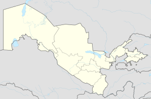 Yangiyer Location in Uzbekistan | |
| Coordinates: 40°16′N 68°49′E / 40.267°N 68.817°E | |
| Country | |
| Region | Sirdaryo Region |
| Area | |
| • Metro | 30.0 km2 (11.6 sq mi) |
| Population (2021)[1] | |
| • City | 44,200 |
| 121000 | 121001 |
Yangiyer (Uzbek: Yangiyer — new land) — is a city in Sirdaryo Region, Eastern Uzbekistan. It is a district-level city.[2] Its population is 44,200 (2021).[1]
YouTube Encyclopedic
-
1/3Views:7 2691 5824 398
-
Янгиер-Набережная улица
-
ЯНГИЕР Канал
-
Гулистан-Янгиер (въезд в Янгиер со стороны Гулистан,автовидеорегистратор)
Transcription
Etymology
The name of the city is translated from Uzbek as "new land".
History
It was established in 1957 as part of the grand Soviet project to cultivate the naturally saline virgin lands of Mirzachoʻl, a vast area of about 10,000 square kilometres in Eastern Uzbekistan. The shortage of irrigation water was the main problem hindering the development of agriculture in the area.
Economy
The city has several plants including a plant of building materials, pipe plant, asphalt plant.
Yangier also has a branch of Tashkent Institute of Agriculture and Irrigation Engineering, a college of civil engineering and a museum dedicated to cultivation of virgin lands of Mirzachoʻl
Climate
| Climate data for Yangiyer (1991–2020) | |||||||||||||
|---|---|---|---|---|---|---|---|---|---|---|---|---|---|
| Month | Jan | Feb | Mar | Apr | May | Jun | Jul | Aug | Sep | Oct | Nov | Dec | Year |
| Mean daily maximum °C (°F) | 6.1 (43.0) |
8.8 (47.8) |
16.0 (60.8) |
23.0 (73.4) |
29.3 (84.7) |
35.0 (95.0) |
36.4 (97.5) |
34.7 (94.5) |
29.6 (85.3) |
22.4 (72.3) |
13.8 (56.8) |
7.5 (45.5) |
21.9 (71.4) |
| Daily mean °C (°F) | 2.3 (36.1) |
4.2 (39.6) |
10.4 (50.7) |
16.5 (61.7) |
22.2 (72.0) |
27.3 (81.1) |
28.8 (83.8) |
26.8 (80.2) |
21.3 (70.3) |
14.8 (58.6) |
8.2 (46.8) |
3.6 (38.5) |
15.5 (59.9) |
| Mean daily minimum °C (°F) | −0.5 (31.1) |
0.8 (33.4) |
6.2 (43.2) |
11.3 (52.3) |
15.7 (60.3) |
19.9 (67.8) |
21.5 (70.7) |
19.3 (66.7) |
14.1 (57.4) |
8.8 (47.8) |
3.8 (38.8) |
0.6 (33.1) |
10.1 (50.2) |
| Average precipitation mm (inches) | 34.2 (1.35) |
46.2 (1.82) |
59.2 (2.33) |
60.4 (2.38) |
36.8 (1.45) |
10.2 (0.40) |
3.7 (0.15) |
2.1 (0.08) |
4.4 (0.17) |
18.1 (0.71) |
38.8 (1.53) |
37.1 (1.46) |
351.2 (13.83) |
| Average precipitation days (≥ 1.0 mm) | 9 | 10 | 11 | 10 | 8 | 4 | 2 | 1 | 2 | 5 | 8 | 10 | 80 |
| Source: NOAA[3] | |||||||||||||
References
- ^ a b "Urban and rural population by district" (PDF) (in Uzbek). Sirdaryo regional department of statistics.
- ^ "Classification system of territorial units of the Republic of Uzbekistan" (in Uzbek and Russian). The State Committee of the Republic of Uzbekistan on statistics. July 2020.
- ^ "World Meteorological Organization Climate Normals for 1991-2020 — Yangiyer". National Oceanic and Atmospheric Administration. Retrieved January 20, 2024.
Capital: Guliston | ||
| Districts |  | |
| Cities | ||
| Towns | ||
| Villages | ||
This Uzbekistan location article is a stub. You can help Wikipedia by expanding it. |