
Yakushima
屋久島町 | |
|---|---|
Town | |
 View of Miyanoura and Yaku wetland area | |
 Flag  Emblem | |
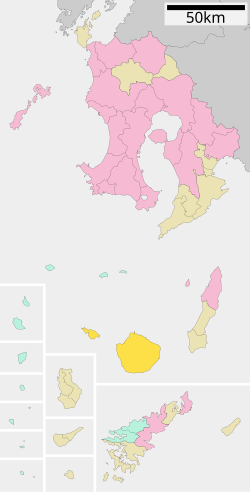 Location of Yakushima in Kagoshima Prefecture | |
 Yakushima Location in Japan | |
| Coordinates: 30°23′24″N 130°39′4″E / 30.39000°N 130.65111°E | |
| Country | Japan |
| Region | Kyushu (Ōsumi) |
| Prefecture | Kagoshima Prefecture |
| District | Kumage |
| First official recorded | 607 AD |
| Kami-yaku town settled | April 1, 1958 |
| Yaku town settled | April 1, 1959 |
| Merged with two towns and current town name changed | October 1, 2007 |
| Government | |
| • Mayor | Tonao Hidaka |
| Area | |
| • Total | 540.98 km2 (208.87 sq mi) |
| Population (January 2008) | |
| • Total | 13,486 |
| • Density | 24.9/km2 (64/sq mi) |
| Time zone | UTC+09:00 (JST) |
| City hall address | 469-45 Koseda, Yakushima-chō, Kumage-gun, Kagoshima-ken 891-4207 |
| Website | www |
| Symbols | |
| Bird | Yaku komadori (Erithacus akahige tanensis Kuroda) |
| Flower | Yakushima shakunage (Rhododendron metternichii Sieb. et Zucc. var. yakushimanum (Nakai) Ohwi) |
| Tree | Yakusugi |
Yakushima (屋久島町, Yakushima-chō) is a town located in Kumage District, Kagoshima, Japan. The town is on the island of Yakushima and Kuchinoerabujima.
YouTube Encyclopedic
-
1/5Views:7908 7154643 106672
-
Guide to Japan's Kagoshima and Yakushima Islands
-
Exploring Hidden Yakushima Island | Japans Secret Paradise
-
[4K] Yakushima, Kagoshima Japan🇯🇵 Walking Tour - sankara hotel &spa Yakushima - (サンカラホテル&スパ/屋久島/鹿児島)
-
Cycle Touring Japan: Yakushima Kagoshima and Sakurajima
-
【4K ULTRA HD】Japan's World Natural Heritage Site: Yakushima Ancient Forest Scenic Relaxation Film
Transcription
History
On October 1, 2007, the town was formed by the merger of the towns of Kamiyaku and Yaku, both from Kumage District.
Geography
Major settlements of the island are the port towns of Anbō and Miyanoura. Other settlements are the coastal villages of Hiranai, Kuriobashi, Nagata, Okonotaki and the abandoned forest village of Kosugidani. Among the localities, there are the gorges of Shiratani Unsui, Arakawa, Yakushima Airport, Kigensugi and Yakusugi.
Demographics
As of 2008, the town has an estimated population of 13,486 and the density of 24.9 persons per km2. The total area is 540.98 km2.
Transport
Yakushima Airport serves Yakushima. There are also hydrofoils and ferries serving the island. Kuchinoerabujima is accessible by a municipal ferry. Inside the island there is a forest railway, the Anbō Forest Railway.
Education
- High schools
- Kagoshima Prefectural Yakushima High School
- Yakushima Ōzora High School (correspondence course high school)
- Junior high schools
- Anbō Junior High School
- Gakunan Junior High School
- Issō Junior High School
- Kanadake Junior High School
- Koseda Junior High School
- Miyaura Junior High School
- Nagata Junior High School
- Elementary schools
- Anbō Elementary School
- Hachiman Elementary School
- Issō Elementary School
- Kamiyama Elementary School
- Kanadake Elementary School
- Koseda Elementary School
- Kurio Elementary School
- Miyaura Elementary School
- Nagata Elementary School
Climate
| Climate data for Yakushima (1991−2020 normals, extremes 1937−present) | |||||||||||||
|---|---|---|---|---|---|---|---|---|---|---|---|---|---|
| Month | Jan | Feb | Mar | Apr | May | Jun | Jul | Aug | Sep | Oct | Nov | Dec | Year |
| Record high °C (°F) | 25.3 (77.5) |
26.1 (79.0) |
29.6 (85.3) |
29.8 (85.6) |
31.9 (89.4) |
34.8 (94.6) |
35.2 (95.4) |
35.4 (95.7) |
34.7 (94.5) |
31.3 (88.3) |
30.7 (87.3) |
26.6 (79.9) |
35.4 (95.7) |
| Average high °C (°F) | 14.7 (58.5) |
15.5 (59.9) |
18.0 (64.4) |
21.4 (70.5) |
24.5 (76.1) |
26.9 (80.4) |
30.5 (86.9) |
30.9 (87.6) |
28.9 (84.0) |
25.2 (77.4) |
21.2 (70.2) |
16.8 (62.2) |
22.9 (73.2) |
| Daily mean °C (°F) | 11.8 (53.2) |
12.3 (54.1) |
14.6 (58.3) |
17.8 (64.0) |
21.0 (69.8) |
23.7 (74.7) |
27.0 (80.6) |
27.5 (81.5) |
25.7 (78.3) |
22.2 (72.0) |
18.2 (64.8) |
13.9 (57.0) |
19.6 (67.3) |
| Average low °C (°F) | 8.9 (48.0) |
9.2 (48.6) |
11.3 (52.3) |
14.2 (57.6) |
17.5 (63.5) |
21.0 (69.8) |
23.9 (75.0) |
24.6 (76.3) |
22.8 (73.0) |
19.4 (66.9) |
15.2 (59.4) |
11.0 (51.8) |
16.6 (61.9) |
| Record low °C (°F) | 1.0 (33.8) |
0.7 (33.3) |
1.5 (34.7) |
4.5 (40.1) |
10.1 (50.2) |
13.7 (56.7) |
18.3 (64.9) |
19.6 (67.3) |
15.2 (59.4) |
9.1 (48.4) |
5.6 (42.1) |
2.2 (36.0) |
0.7 (33.3) |
| Average precipitation mm (inches) | 294.6 (11.60) |
289.2 (11.39) |
387.0 (15.24) |
405.5 (15.96) |
444.1 (17.48) |
860.3 (33.87) |
362.4 (14.27) |
256.5 (10.10) |
450.7 (17.74) |
309.9 (12.20) |
309.6 (12.19) |
281.8 (11.09) |
4,651.7 (183.14) |
| Average snowfall cm (inches) | 0 (0) |
0 (0) |
0 (0) |
0 (0) |
0 (0) |
0 (0) |
0 (0) |
0 (0) |
0 (0) |
0 (0) |
0 (0) |
0 (0) |
0 (0) |
| Average precipitation days (≥ 0.5 mm) | 17.2 | 15.2 | 16.2 | 13.5 | 13.7 | 19.6 | 12.5 | 14.6 | 15.5 | 12.8 | 12.8 | 15.8 | 179.3 |
| Average relative humidity (%) | 68 | 68 | 69 | 71 | 76 | 85 | 83 | 82 | 81 | 74 | 71 | 69 | 75 |
| Mean monthly sunshine hours | 74.9 | 83.2 | 117.9 | 146.2 | 152.7 | 100.0 | 209.9 | 201.3 | 139.8 | 115.9 | 97.3 | 78.8 | 1,515.8 |
| Source: Japan Meteorological Agency[1] | |||||||||||||
Image
-

Forest of Yakushima
-

Hydrofoil serving the island
References
- ^ 気象庁 / 平年値(年・月ごとの値). Japan Meteorological Agency. Retrieved May 19, 2021.
External links
 Media related to Yakushima, Kagoshima at Wikimedia Commons
- Yakushima official website (in Japanese)
| Authority control databases: Geographic |
|---|
This Kagoshima Prefecture location article is a stub. You can help Wikipedia by expanding it. |