
Xunyang
旬阳市 Sunyang; Sünyang | |
|---|---|
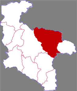 Xunyang in Ankang | |
 Ankang in Shaanxi | |
| Coordinates: 32°50′03″N 109°21′55″E / 32.8341°N 109.3653°E | |
| Country | People's Republic of China |
| Province | Shaanxi |
| Prefecture-level city | Ankang |
| Area | |
| • Total | 3,540.8 km2 (1,367.1 sq mi) |
| Population (2019) | |
| • Total | 450,122 |
| • Density | 130/km2 (330/sq mi) |
| Time zone | UTC+8 (China standard time) |
| Postal code | 725700 |
| Licence plates | 陕G |
| Website | www |
Xunyang (simplified Chinese: 旬阳市; traditional Chinese: 旬陽市; pinyin: Xúnyáng Shì; formerly written as (Chinese: 洵陽) until 1964)[1] is a county-level city in the south of Shaanxi province, China, bordering Hubei province to the northeast and southeast. It is under the administration of the prefecture-level city of Ankang. Its administrative seat is in the town of Chengguan.[2] The county covers an area of 3,540.8 square kilometres (1,367.1 sq mi),[2] and has a population of 450,122 as of 2019.[3]
History
During the Spring and Autumn period, the area of present-day Xunyang County belonged to the State of Chu.[4]
In the Warring States period, the area was incorporated as Xunyang County.[4]
In 312 BCE, Xunyang County was taken by the State of Qin following the Battle of Danyang and Lantian.[4]
Later, the area became part of the Han Dynasty, where it was placed under the Hanzhong Commandery.[4]
During the Qing Dynasty, the area belonged to the Xing'an Fu.[4]
From 1914 to 1928, the area belonged to Hanzhong Circuit.[4] From 1928 to 1949, the area was directly administered by Shaanxi Province.[4]
Since the establishment of the People's Republic of China in 1949, the county has belonged to Ankang.[4] In 1964, its name was changed from Xunyang County (Chinese: 洵阳县; pinyin: Xúnyáng Xiàn) to Xunyang County (Chinese: 旬阳县; pinyin: Xúnyáng Xiàn), due to the uncommon nature of the previous first character.[4]
Geography
Xunyang is located in the Shaanan region, approximately 220 kilometres (140 mi) from Xi'an.[2] To the county's north lies the Qinling Mountains.[2] The Han River flows through the county, as well as a number of its tributaries, such as the Xun River, the Xian River, the Shen River, the Lengshui River, the Zhutong River, the Xicha River, and the Shu River.[2]
Climate
Xunyang County has an average annual precipitation of 777 millimetres (30.6 in).[2]
| Climate data for Xunyang (2000–2020 normals, extremes 1981–2010) | |||||||||||||
|---|---|---|---|---|---|---|---|---|---|---|---|---|---|
| Month | Jan | Feb | Mar | Apr | May | Jun | Jul | Aug | Sep | Oct | Nov | Dec | Year |
| Record high °C (°F) | 20.2 (68.4) |
25.1 (77.2) |
34.9 (94.8) |
36.9 (98.4) |
39.8 (103.6) |
41.2 (106.2) |
43.1 (109.6) |
41.2 (106.2) |
39.9 (103.8) |
31.6 (88.9) |
25.4 (77.7) |
19.6 (67.3) |
43.1 (109.6) |
| Mean daily maximum °C (°F) | 9.7 (49.5) |
13.0 (55.4) |
19.5 (67.1) |
25.0 (77.0) |
28.3 (82.9) |
31.8 (89.2) |
33.9 (93.0) |
32.9 (91.2) |
27.5 (81.5) |
21.9 (71.4) |
15.9 (60.6) |
10.8 (51.4) |
22.5 (72.5) |
| Daily mean °C (°F) | 4.5 (40.1) |
7.3 (45.1) |
12.7 (54.9) |
17.6 (63.7) |
21.6 (70.9) |
25.4 (77.7) |
27.8 (82.0) |
27.0 (80.6) |
22.2 (72.0) |
16.9 (62.4) |
10.9 (51.6) |
5.7 (42.3) |
16.6 (61.9) |
| Mean daily minimum °C (°F) | 0.8 (33.4) |
3.3 (37.9) |
7.8 (46.0) |
12.3 (54.1) |
16.8 (62.2) |
20.9 (69.6) |
23.7 (74.7) |
23.1 (73.6) |
18.9 (66.0) |
13.9 (57.0) |
7.8 (46.0) |
2.3 (36.1) |
12.6 (54.7) |
| Record low °C (°F) | −5.7 (21.7) |
−4.6 (23.7) |
−2.5 (27.5) |
0.8 (33.4) |
9.5 (49.1) |
15.7 (60.3) |
19.1 (66.4) |
14.4 (57.9) |
12.2 (54.0) |
5.3 (41.5) |
−1.8 (28.8) |
−6.3 (20.7) |
−6.3 (20.7) |
| Average precipitation mm (inches) | 4.8 (0.19) |
8.9 (0.35) |
22.0 (0.87) |
49.9 (1.96) |
83.4 (3.28) |
111.6 (4.39) |
134.6 (5.30) |
109.7 (4.32) |
115.9 (4.56) |
66.1 (2.60) |
22.4 (0.88) |
4.1 (0.16) |
733.4 (28.86) |
| Average precipitation days (≥ 0.1 mm) | 3.7 | 4.8 | 7.4 | 9.0 | 11.4 | 10.7 | 11.5 | 10.7 | 12.2 | 11.8 | 7.8 | 3.8 | 104.8 |
| Average snowy days | 2.5 | 1.8 | 0.6 | 0.1 | 0 | 0 | 0 | 0 | 0 | 0 | 0.4 | 1.0 | 6.4 |
| Average relative humidity (%) | 64 | 62 | 59 | 64 | 70 | 72 | 74 | 74 | 77 | 79 | 77 | 69 | 70 |
| Mean monthly sunshine hours | 109.9 | 111.2 | 161.6 | 180.5 | 179.1 | 186.2 | 210.3 | 193.0 | 119.4 | 102.8 | 97.2 | 103.9 | 1,755.1 |
| Percent possible sunshine | 35 | 35 | 43 | 46 | 42 | 44 | 49 | 47 | 33 | 30 | 31 | 34 | 39 |
| Source: China Meteorological Administration[5][6] | |||||||||||||
Government
In 2019, the county government earned ¥1.877 billion in fiscal revenue, and spent ¥3.994 billion in fiscal expenditures.[7]
Administrative divisions
As of 2020, Xunyang County is divided into 21 towns.[8]
|
|
|
Demographics
As of 2019, Xunyang County has a population of 450,122 people, who reside in 149,961 households.[3] The county's dominant ethnicity is Han, but populations of Hui, Manchu, Korean, Tujia, Nakhi, Mongol, Miao, Kam, and Yi people reside within the county.[3]
Economy
In 2019, Xunyang County reported a gross domestic product (GDP) of ¥18.705 billion, an 8.4% annual increase.[7] The county's per capita GDP rose 8.0% to ¥42,982.[7] 10.6% of the county's GDP came from its primary sector, 52.5% came from its secondary sector, and 36.9% came from its tertiary sector.[7] The county's public sector accounted for 41.9% of its GDP.[7]
Agriculture
The county's main agricultural products include various grains, oils, tobacco, and vegetables.[7] In 2019, the county had about 1 million heads of poultry, 205 thousand heads of swine, 134 thousand heads of goats, and 67 thousand heads of cattle.[7] The county also has sizable aquaculture and forestry industries.[7]
Industry
Major industries in Xinyang County include the production of medicine, cement and building materials, hydropower, equipment manufacturing, tobacco, food products, and mining.[7] Xunyang County is home to deposits of mercury, antimony, aluminum, zinc, gold, barite, and slate.[2]
Retail
In 2019, the county experienced a total of ¥5.757 billion in consumer retail sales.[7]
Transport
Road
National Highway 316 passes through the county.[2] The Xikang Expressway, part of the G65 Baotou–Maoming Expressway, passes through the county.[citation needed] Shaanxi Provincial Highway 102 also passes through Xunyang County.[citation needed]
Rail
14 train stations serve the county, which is home to 128 kilometers of railroad.[citation needed] The Xiangyang–Chongqing railway passes through Xunyang County,[2] as does the Xi'an–Ankang railway.[citation needed]
Notes
- ^ "1956年以来更改生僻县名用字研究 - 百度文库". wenku.baidu.com. Archived from the original on 2021-08-24. Retrieved 2021-08-24.
- ^ a b c d e f g h i 旬阳县概况地图. xzqh.org (in Chinese). 2015-07-01. Archived from the original on 2021-01-02. Retrieved 2021-01-02.
- ^ a b c 人口民族. xyx.gov.cn (in Chinese). Xunyang County People's Government. 2020-07-23. Archived from the original on 2021-01-03. Retrieved 2021-01-02.
- ^ a b c d e f g h i 旬阳县历史沿革. xzqh.org (in Chinese). 2015-07-01. Archived from the original on 2021-01-03. Retrieved 2021-01-02.
- ^ 中国气象数据网 – WeatherBk Data (in Simplified Chinese). China Meteorological Administration. Retrieved 26 August 2023.
- ^ 中国气象数据网 (in Simplified Chinese). China Meteorological Administration. Retrieved 26 August 2023.
- ^ a b c d e f g h i j 经济发展. xyx.gov.cn (in Chinese). Xunyang County People's Government. 2020-07-23. Archived from the original on 2021-01-03. Retrieved 2021-01-02.
- ^ 2020年统计用区划代码(旬阳县) (in Chinese). National Bureau of Statistics of China. 2020. Archived from the original on 2021-01-02. Retrieved 2021-01-02.
External links
- "旬阳县概况地图沿革 (Overview, History and Map of Xunyang)" (in Chinese). Archived from the original on 13 November 2012.
- "走进旬阳 (About Xunyang)" (in Chinese). Archived from the original on 6 December 2011.
- Xunyang County Government Website (2020)