
 open-air museum at the Wolińska Kępa island. | |
 Wolińska Kępa 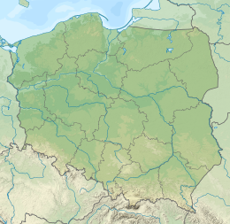 Wolińska Kępa 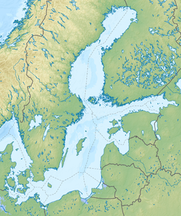 Wolińska Kępa | |
| Geography | |
|---|---|
| Location | Dziwna channel |
| Coordinates | 53°50′31″N 14°37′17″E / 53.84194°N 14.62139°E |
| Length | 0.7 km (0.43 mi) |
| Width | 0.25 km (0.155 mi) |
| Administration | |
| Voivodeship | West Pomeranian Voivodeship |
| County | Kamień |
| Demographics | |
| Ethnic groups | Poles |
| Additional information | |
| Time zone | |
| • Summer (DST) | |
 | |
Wolińska Kępa,[1] commonly known as Ostrów,[2][3] (German: Plage Wiese)[4] is an island on the Dziwna channel in the Kamień County, West Pomeranian Voivodeship, Poland. It lies within the town limits of Wolin, between island of Wolin and mainland with the village of Recław on the coast.[1][5] Length of the island is 0.7 km (0.41 mi) and width, 0.25 km (0.155 mi).
YouTube Encyclopedic
-
1/3Views:1 3719 8581 016
-
Wolin - Skansen Słowian i Wikingów
-
Wieslawa Dudkowiak & VIKINGS - JOMSBORG VINETA WOLIN
-
Osada Wikingow (SUBS EN) - Travels of Monte Kristo
Transcription
Buildings and infrastructure
On the islands is located open-air museum operated by Slavs and Vikings Centre. It has a buildings referring to the architecture of early Medieval Vikings and Slavs. It is surrounded by the defensive walls and fragments of the palisade with the gate and tower.[5][6] Through the island goes Zamkowa Street. It is connected with island of Wolin by one bridge, while with mainland by two. Northern part of the island, from the Zamkowa Street, is an area of bird protected area registered as Szczecin Lagoon as a pert of Natura 2000 initiative.
Culture
Every year, in the first week of August, on the island is organised the Slavs and Vikings Festival in the open-air museum.
References
- ^ a b Zarządzenie Ministra Administracji Publicznej z dnia 15 grudnia 1949 r. o przywróceniu i ustaleniu nazw miejscowości (M.P. z 1950 r. nr 8, poz. 76, s. 76)
- ^ "Kontakt" (in Polish). Stowarzyszenie Centrum Słowian i Wikingów Wolin - Jomsborg - Vineta. Retrieved 2014-02-13.
- ^ "XIX Festiwal Słowian i Wikingów" (in Polish). Wolin Town Hall. 2013-07-29. Retrieved 2014-02-13.
- ^ Arkusz 2153 Wollin. W: Topografische Karten (Meßtischblätter) 1:25 000. Reichsamt für Landesaufnahme, 1941.
- ^ a b "6 NIEOCZYWISTYCH MIEJSC NA WYSPIE WOLIN, KTÓRE TRZEBA ZOBACZYĆ". crazynauka.pl (in Polish).
- ^ "Centrum Słowian i Wikingów w Wolinie". kierunkowo.pl (in Polish).