
Wolf Trap, Virginia | |
|---|---|
 Houses near the Barns at Wolf Trap | |
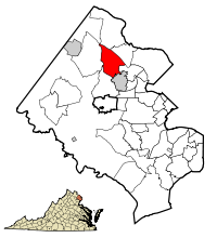 Location of Wolf Trap in Fairfax County, Virginia | |
 Wolf Trap, Virginia  Wolf Trap, Virginia  Wolf Trap, Virginia | |
| Coordinates: 38°56′1″N 77°16′35″W / 38.93361°N 77.27639°W | |
| Country | United States |
| State | Virginia |
| County | Fairfax |
| Area | |
| • Total | 9.8 sq mi (25.5 km2) |
| • Land | 9.8 sq mi (25.4 km2) |
| • Water | 0.04 sq mi (0.1 km2) |
| Elevation | 285 ft (87 m) |
| Population (2020) | |
| • Total | 16,496 |
| • Density | 1,646/sq mi (635.6/km2) |
| Time zone | UTC−5 (Eastern (EST)) |
| • Summer (DST) | UTC−4 (EDT) |
| FIPS code | 51-87240[1] |
| GNIS feature ID | 1867602[2] |
Wolf Trap is a census-designated place (CDP) in Fairfax County, Virginia, United States. The population was 16,131 at the 2010 census.[3] Wolf Trap National Park for the Performing Arts is located in the CDP.
Geography
Wolf Trap is located in northern Fairfax County at 38°56′1″N 77°16′35″W / 38.93361°N 77.27639°W (38.933477, −77.276510).[4] It is bordered by McLean to the northeast, Tysons Corner to the southeast, Vienna to the south, Oakton to the southwest, Reston to the west, and the community of Great Falls to the north. The Dulles Toll Road crosses the center of the CDP, with access from Exits 15 (Wolftrap Park) and 16 (Virginia State Route 7). The Toll Road leads west 11 miles (18 km) to Washington Dulles International Airport; downtown Washington, D.C. is 16 miles (26 km) to the east via the Toll Road and Interstate 66. Virginia Route 7 (Leesburg Pike) forms the northern border of the CDP; the highway leads northwest 20 miles (32 km) to Leesburg.
According to the United States Census Bureau, the Wolf Trap CDP has a total area of 9.8 square miles (25.5 km2), of which 9.8 square miles (25.4 km2) is land and 0.04 square miles (0.1 km2), or 0.54%, is water.[3]
Demographics
| Census | Pop. | Note | %± |
|---|---|---|---|
| 1980 | 9,875 | — | |
| 1990 | 13,133 | 33.0% | |
| 2000 | 14,001 | 6.6% | |
| 2010 | 16,131 | 15.2% | |
| 2020 | 16,496 | 2.3% | |
| source:[5] | |||
As of 2019, Census reports that the population density was 1,512.3 inhabitants per square mile (583.9/km2). There were 4,606 housing units at an average density of 497.5 per square mile (192.1/km2). The racial makeup of the CDP was 79% White, 2% African American, 0% Native American, 14% Asian, 0.64% from other races, and 2.64% from two or more races. Hispanic or Latino of any race were 2.63% of the population.
There were 5,462 households, out of which 45.4% had children under the age of 18 living with them, 86.1% were married couples living together, 3.9% had a female householder with no husband present, and 8.6% were non-families. 6.3% of all households were made up of individuals, and 2.5% had someone living alone who was 65 years of age or older. The average household size was 3.07 and the average family size was 3.19.
Census also reports that the 2019 median income for a household in the Wolf Trap CDP was $222,908 (based on 2014-2018 data).
In popular culture
Wolf Trap is named as the location for the home of FBI Special Investigator Will Graham (Hugh Dancy) in NBC's 2013 TV series Hannibal, but the actual filmed location of the house is in the hamlet of Whitevale, Ontario.
References
- ^ "U.S. Census website". United States Census Bureau. Retrieved January 31, 2008.
- ^ "US Board on Geographic Names". United States Geological Survey. October 25, 2007. Retrieved January 31, 2008.
- ^ a b "Geographic Identifiers: 2010 Demographic Profile Data (G001): Wolf Trap CDP, Virginia". U.S. Census Bureau, American Factfinder. Retrieved October 17, 2016.[dead link]
- ^ "US Gazetteer files: 2010, 2000, and 1990". United States Census Bureau. February 12, 2011. Retrieved April 23, 2011.
- ^ "CENSUS OF POPULATION AND HOUSING (1790–2000)". U.S. Census Bureau. Retrieved July 17, 2010.
