
Winterbach | |
|---|---|
 Coat of arms | |
Location of Winterbach within Bad Kreuznach district 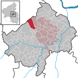 | |
 Winterbach  Winterbach | |
| Coordinates: 49°52′31.69″N 7°38′10.55″E / 49.8754694°N 7.6362639°E | |
| Country | Germany |
| State | Rhineland-Palatinate |
| District | Bad Kreuznach |
| Municipal assoc. | Rüdesheim |
| Government | |
| • Mayor (2019–24) | Werner Rebenich[1] |
| Area | |
| • Total | 14.49 km2 (5.59 sq mi) |
| Elevation | 355 m (1,165 ft) |
| Population (2021-12-31)[2] | |
| • Total | 503 |
| • Density | 35/km2 (90/sq mi) |
| Time zone | UTC+01:00 (CET) |
| • Summer (DST) | UTC+02:00 (CEST) |
| Postal codes | 55595 |
| Dialling codes | 06756 |
| Vehicle registration | KH |
| Website | winterbachsoonwald.de |
Winterbach is a municipality in the district of Bad Kreuznach in Rhineland-Palatinate, in western Germany. It belongs to the Rüdesheim association. Winterbach is also a state-approved resort.[3]
YouTube Encyclopedic
-
1/1Views:3 737
-
Lkw unter Brücke festgefahren
Transcription
Geography
Winterbach is located in the southern Hunsrück, on the edge of the Soonwald at the 657 meter high Ellerspring. With 77.1 percent of the land area being wooded. The Ellerbach also flows through the village. Winterbach also includes the residences of Forsthaus Winterbach, Kreershäuschen and Kuhpferch.[4]
References
- ^ Direktwahlen 2019, Landkreis Bad Kreuznach, Landeswahlleiter Rheinland-Pfalz, accessed 2 August 2021.
- ^ "Bevölkerungsstand 2021, Kreise, Gemeinden, Verbandsgemeinden" (in German). Statistisches Landesamt Rheinland-Pfalz. 2022.
- ^ Rheinland-Pfalz, Staatskanzlei. "Mein Dorf, meine Stadt (Template)". Statistisches Landesamt Rheinland-Pfalz. Retrieved 2017-10-26.
- ^ "Statistisches Landesamt Rheinland-Pfalz - Official Directory of Municipalities and Municipalities 2010 , page 16 (PDF, 2,3 MB)" (PDF). Archived from the original (PDF) on 2015-11-25.
| Authority control databases: National |
|---|
This Bad Kreuznach district location article is a stub. You can help Wikipedia by expanding it. |