
Winchester, Idaho | |
|---|---|
 Business Highway 95 into downtown Winchester | |
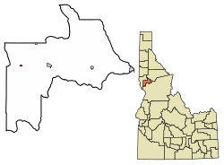 Location of Winchester in Lewis County, Idaho. | |
| Coordinates: 46°14′27″N 116°37′24″W / 46.24083°N 116.62333°W | |
| Country | United States |
| State | Idaho |
| County | Lewis |
| Government | |
| • Mayor | Randolph D. Stewart[1] |
| Area | |
| • Total | 0.18 sq mi (0.46 km2) |
| • Land | 0.18 sq mi (0.46 km2) |
| • Water | 0.00 sq mi (0.00 km2) |
| Elevation | 3,980 ft (1,210 m) |
| Population (2020) | |
| • Total | 356 |
| • Estimate (2019)[3] | 443 |
| • Density | 2,517.05/sq mi (970.19/km2) |
| Time zone | UTC-8 (Pacific (PST)) |
| • Summer (DST) | UTC-7 (PDT) |
| ZIP code | 83555 |
| Area code | 208 |
| FIPS code | 16-87850 |
| GNIS feature ID | 0375955 |
Winchester is a city in western Lewis County, Idaho, United States, located on the Camas Prairie in the north central part of the state. The population was 356 at the 2020 census, up from 340 in 2010.[4]
YouTube Encyclopedic
-
1/2Views:3851 652
-
Winchester Grade Idaho
-
Waha Lake in the Craig Mountains, IDAHO
Transcription
History

Winchester is within the Nez Perce Indian Reservation,[5] and similar to the opening of lands in Oklahoma, the U.S. government opened the reservation for white settlement in November 1895. The proclamation had been signed less than two weeks earlier by President Cleveland.[6][7][8][9]
The city was named in 1900 during a meeting to establish a school district. While considering the possibilities, an individual looked at the stack of Winchester rifles at the door and suggested the name, which was approved.[10][11] The sawmill closed in May 1965 after the mature timber in the area had been cut.[12][13] The mill was operated by Boise Cascade for its final five years; its closure followed a fire which destroyed much of downtown Winchester in November 1964.[14][15][16][17]
A half mile (1 km) outside of town is Winchester Lake State Park, planned in 1966[18] and established in 1969.[19] Originally it was a mill pond, created in 1910 by damming Lapwai Creek.[20] Water quality issues at the lake[21][22] were addressed with the installation of aeration units in 2002.[23][24]
Geography
Winchester is located at 46°14′27″N 116°37′24″W / 46.24083°N 116.62333°W ,[25] at an elevation of 3,980 feet (1,210 m) above sea level.[26]
According to the United States Census Bureau, the city has a total area of 0.18 square miles (0.47 km2), all of it land.[27]
Winchester is located on the northern shore of Lapwai Lake at the location where Lapwai Creek emerges from the lake. U.S. Route 95 passes about a mile to the northeast of Winchester, but the town is connected to the highway by a business route of U.S. 95.[28] It is located in the broader Camas Prairie region.[29]
Climate
| Climate data for Winchester, Idaho (3972 feet) | |||||||||||||
|---|---|---|---|---|---|---|---|---|---|---|---|---|---|
| Month | Jan | Feb | Mar | Apr | May | Jun | Jul | Aug | Sep | Oct | Nov | Dec | Year |
| Average high °F (°C) | 36.6 (2.6) |
39.7 (4.3) |
45.3 (7.4) |
52.3 (11.3) |
59.6 (15.3) |
66.7 (19.3) |
76.7 (24.8) |
78.0 (25.6) |
68.9 (20.5) |
56.2 (13.4) |
42.1 (5.6) |
34.7 (1.5) |
54.7 (12.6) |
| Daily mean °F (°C) | 29.5 (−1.4) |
31.4 (−0.3) |
36.3 (2.4) |
42.0 (5.6) |
48.6 (9.2) |
54.8 (12.7) |
62.1 (16.7) |
62.6 (17.0) |
54.8 (12.7) |
44.9 (7.2) |
34.8 (1.6) |
27.7 (−2.4) |
44.1 (6.7) |
| Average low °F (°C) | 22.3 (−5.4) |
23.0 (−5.0) |
27.4 (−2.6) |
31.8 (−0.1) |
37.5 (3.1) |
43.0 (6.1) |
47.5 (8.6) |
47.2 (8.4) |
40.7 (4.8) |
33.7 (0.9) |
27.5 (−2.5) |
20.6 (−6.3) |
33.5 (0.8) |
| Average precipitation inches (mm) | 1.73 (44) |
1.44 (37) |
2.36 (60) |
2.44 (62) |
3.00 (76) |
2.23 (57) |
1.20 (30) |
1.04 (26) |
1.28 (33) |
1.76 (45) |
2.46 (62) |
1.58 (40) |
22.52 (572) |
| Average snowfall inches (cm) | 17.0 (43) |
11.0 (28) |
13.9 (35) |
8.1 (21) |
1.8 (4.6) |
0.2 (0.51) |
0 (0) |
0 (0) |
0.1 (0.25) |
1.4 (3.6) |
13.8 (35) |
14.8 (38) |
82.1 (208.96) |
| Source: NOAA (normals 1981−2010)[30] | |||||||||||||
Demographics
| Census | Pop. | Note | %± |
|---|---|---|---|
| 1920 | 745 | — | |
| 1930 | 665 | −10.7% | |
| 1940 | 634 | −4.7% | |
| 1950 | 488 | −23.0% | |
| 1960 | 427 | −12.5% | |
| 1970 | 274 | −35.8% | |
| 1980 | 343 | 25.2% | |
| 1990 | 262 | −23.6% | |
| 2000 | 308 | 17.6% | |
| 2010 | 340 | 10.4% | |
| 2019 (est.) | 443 | [3] | 30.3% |
| U.S. Decennial Census[31] | |||
2010 census
As of the census[32] of 2010, there were 340 people, 134 households, and 84 families residing in the city. The population density was 1,888.9 inhabitants per square mile (729.3/km2). There were 167 housing units at an average density of 927.8 per square mile (358.2/km2). The racial makeup of the city was 92.1% White, 1.2% African American, 3.2% Native American, 0.3% Asian, 0.9% from other races, and 2.4% from two or more races. Hispanic or Latino of any race were 2.1% of the population.
There were 134 households, of which 20.1% had children under the age of 18 living with them, 52.2% were married couples living together, 6.0% had a female householder with no husband present, 4.5% had a male householder with no wife present, and 37.3% were non-families. 34.3% of all households were made up of individuals, and 14.2% had someone living alone who was 65 years of age or older. The average household size was 2.19 and the average family size was 2.75.
The median age in the city was 50.4 years. 17.4% of residents were under the age of 18; 4.3% were between the ages of 18 and 24; 17.6% were from 25 to 44; 39.4% were from 45 to 64; and 21.2% were 65 years of age or older. The gender makeup of the city was 52.1% male and 47.9% female.
2000 census
As of the census[33] of 2000, there were 308 people, 135 households, and 88 families residing in the city. The population density was 1,699.7 inhabitants per square mile (656.3/km2). There were 158 housing units at an average density of 871.9 per square mile (336.6/km2). The racial makeup of the city was 94.81% White, 1.30% Native American, 1.30% from other races, and 2.60% from two or more races. Hispanic or Latino of any race were 0.32% of the population.
There were 135 households, out of which 20.0% had children under the age of 18 living with them, 56.3% were married couples living together, 5.9% had a female householder with no husband present, and 34.8% were non-families. 28.9% of all households were made up of individuals, and 14.1% had someone living alone who was 65 years of age or older. The average household size was 2.22 and the average family size was 2.74.
In the city, the population was spread out, with 17.5% under the age of 18, 4.9% from 18 to 24, 23.4% from 25 to 44, 37.0% from 45 to 64, and 17.2% who were 65 years of age or older. The median age was 47 years. For every 100 females, there were 105.3 males. For every 100 females age 18 and over, there were 106.5 males.
The median income for a household in the city was $36,250, and the median income for a family was $40,179. Males had a median income of $35,625 versus $23,125 for females. The per capita income for the city was $16,588. About 8.1% of families and 7.4% of the population were below the poverty line, including 4.8% of those under the age of eighteen and 3.8% of those 65 or over.
Transportation
Highway
 - US 95 - to Lewiston (north) and Grangeville (south)
The city is two miles (3 km) west of U.S. Route 95, which connects it to Craigmont to the east and Lewiston to the northwest, via the Lapwai Canyon.
Until 1960, US 95 was routed through Winchester on this spur and descended Culdesac Hill (46°19′55″N 116°37′59″W / 46.332°N 116.633°W), considered the worst of the three major grades (White Bird, Lewiston), all of which were extremely twisty.[34] The new route through Lapwai Canyon was built in three years and reduced the distance by over 4 miles (6.4 km) and saved 25 minutes of driving time.[35][36] The earlier road was completed in 1923.[37] The first organized road race on the old road took place in 1964; among the participants in the hill climb was Bob Knievel of Butte, Montana, later known as Evel Knievel.[38]
The timber trestles of the former Camas Prairie Railroad are visible throughout the area.
Education
The public schools are in Craigmont, operated by the Highland Joint School District #305, led by Highland High School. The consolidated district was formed in 1962; prior to that Winchester had its own schools and the high school's mascot was a logger.[39]
In popular culture
In the television series Death Valley Days, the episode “The Thirty-Caliber Town” dramatized how Winchester rifles gave the town its name. An epilogue featuring host Robert Taylor and Lester Shadduck, the mayor of Winchester, was shot on location in 1967.[40]
In the television series Numb3rs, FBI agent Colby Granger was from Winchester.
See also
References
- ^ lewiscountyid.us - sample ballot - Nov 2011
- ^ "2019 U.S. Gazetteer Files". United States Census Bureau. Retrieved July 9, 2020.
- ^ a b "Population and Housing Unit Estimates". United States Census Bureau. May 24, 2020. Retrieved May 27, 2020.
- ^ "Explore Census Data". data.census.gov. Retrieved December 8, 2021.
- ^ "The Nez Perce Reservation and its location". Nez Perce Tribe. Retrieved November 27, 2012.
- ^ Hamilton, Ladd (June 25, 1961). "Heads were popping up all over the place". Lewiston Morning Tribune. p. 14.
- ^ Brammer, Rhonda (July 24, 1977). "Unruly mobs dashed to grab land when reservation opened". Lewiston Morning Tribune. p. 6E.
- ^ "3,000 took part in "sneak" when Nez Perce Reservation was opened". Lewiston Morning Tribune. November 19, 1931. p. 3.
- ^ "Nez Perce Reservation". Spokesman-Review. December 11, 1921. p. 5.
- ^ "Town of Winchester named through a stack of rifles". Lewiston Morning Tribune. October 6, 1955. p. 11.
- ^ "There is usually a logical reason for the name a town ends up with". Lewiston Morning Tribune. February 25, 1990. p. 11-Centennial.
- ^ "Boise Cascade will close Winchester mill in spring". Lewiston Morning Tribune. December 8, 1964. p. 14.
- ^ Conley, Cort. Idaho for the Curious. Cambridge: Backeddy, 1982, 623. ISBN 0-9603566-3-0.
- ^ "Idaho sawmill to close soon". Spokane Daily Chronicle. March 17, 1965. p. 7.
- ^ "Devastating fire hits Winchester". Spokane Daily Chronicle. November 25, 1964. p. 6.
- ^ "Devastating fire hits Idaho town". Spokesman-Review. Associated Press. November 26, 1964. p. 6.
- ^ "Mill will quit fire-hit town". Spokane Daily Chronicle. Associated Press. December 8, 1964. p. 6.
- ^ "Recreation area planned around Winchester lake". Lewiston Morning Tribune. June 5, 1966. p. 11.
- ^ "Winchest offers alternative to roaring rivers". Lewiston Morning Tribune. June 14, 1996. p. 5A.
- ^ Starmont, Leon (January 28, 1951). "Winchester, Idaho, named for a rifle". Spokesman-Review. p. 12-Inland Empire.
- ^ Walker, Jodi (December 5, 1998). "Man-made Winchester Lake has special kind of problems". Lewiston Morning Tribune. p. 5A.
- ^ "Too much of a good thing". Lewiston Morning Tribune. June 17, 1999. p. 1C.
- ^ "Lake getting oxygen boost from Idaho department". Moscow-Pullman Daily News. Associated Press. May 10, 2002. p. 3A.
- ^ Demick, Mike (November 18, 2002). "Winchester Lake water project nears completion". Moscow-Pullman Daily News. p. 1C.
- ^ "US Gazetteer files: 2010, 2000, and 1990". United States Census Bureau. February 12, 2011. Retrieved April 23, 2011.
- ^ U.S. Geological Survey Geographic Names Information System: Winchester, Idaho
- ^ "US Gazetteer files 2010". United States Census Bureau. Archived from the original on July 2, 2012. Retrieved December 18, 2012.
- ^ "Winchester East Quadrangle". usgs.gov. U.S. Geological Survey. Retrieved May 5, 2022.
- ^ "Camas Prairie". visitnorthcentralidaho.org. Retrieved May 5, 2022.
- ^ "Normals Monthly Station Details". National Oceanic and Atmospheric Administration. Retrieved June 26, 2015.
- ^ "Census of Population and Housing". Census.gov. Retrieved June 4, 2015.
- ^ "U.S. Census website". United States Census Bureau. Retrieved December 18, 2012.
- ^ "U.S. Census website". United States Census Bureau. Retrieved January 31, 2008.
- ^ Carter, Jack (July 4, 1960). "Winding Winchester grade won't bother much longer". Lewiston Morning Tribune. p. 10.
- ^ "Culdesac cutoff finished in 1960". Lewiston Morning Tribune. January 2, 1961. p. 5.
- ^ Hughes, John B. (June 29, 1958). "New Culdesac cutoff to be scenic wonder". Lewiston Morning Tribune. p. 1-sec.2.
- ^ "Winchester celebrating new Culdesac hill highway". Lewiston Morning Tribune. August 3, 1923. p. 6.
- ^ "Drivers test Winchester grade in prelude to hill climb today". May 31, 1964. p. 10.
- ^ "Highland picked as name for new consolidated high school". Lewiston Morning Tribune. October 16, 1962. p. 9.
- ^ "The Thirty-Caliber Town". Internet Movie Data Base. April 12, 1968. Retrieved July 6, 2017.
External links
- Chamber of Commerce - Greater Craigmont Area - Winchester
- Association of Idaho Cities - Community Spotlight: Winchester - p. 17-19 - 2011-03-23
- Winchester Lake State Park
- Visit Idaho.org - Winchester Lake State Park
- Highland Joint School District #305
- Photo of Winchester's new school - November 1911
Municipalities and communities of Lewis County, Idaho, United States | ||
|---|---|---|
| Cities |  | |
| Unincorporated community | ||
| Indian reservation | ||
| Footnotes | ‡This populated place also has portions in an adjacent county or counties | |
| International | |
|---|---|
| National | |