
Whittingham, New Jersey | |
|---|---|
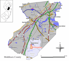 Map of Whittingham highlighted within Middlesex County. Inset: Location of Middlesex County in New Jersey. | |
 Whittingham Location in Middlesex County  Whittingham Location in New Jersey  Whittingham Location in the United States | |
| Coordinates: 40°19′50″N 74°26′44″W / 40.330542°N 74.445603°W | |
| Country | |
| State | |
| County | Middlesex |
| Township | Monroe |
| Area | |
| • Total | 0.69 sq mi (1.78 km2) |
| • Land | 0.69 sq mi (1.78 km2) |
| • Water | 0.00 sq mi (0.01 km2) 0.60% |
| Elevation | 161 ft (49 m) |
| Population | |
| • Total | 2,348 |
| • Density | 3,422.74/sq mi (1,321.78/km2) |
| Time zone | UTC−05:00 (Eastern (EST)) |
| • Summer (DST) | UTC−04:00 (Eastern (EDT)) |
| Area code | 609 |
| FIPS code | 34-81042[4][5][6] |
| GNIS feature ID | 02390511[4][7] |
Whittingham, also known as Greenbriar at Whittingham, is an unincorporated community and census-designated place (CDP) located within Monroe Township, in Middlesex County, in the U.S. state of New Jersey.[8][9] As of the 2010 United States Census, the CDP's population was 2,476.[10] The area is focused around the age-restricted gated community of Whittingham.
YouTube Encyclopedic
-
1/1Views:148 028
-
Abandoned Lakeland Mental Asylum and Indian Cabin Rd Abandoned Homes
Transcription
Geography
According to the United States Census Bureau, the CDP had a total area of 1.003 square miles (2.598 km2), including 0.997 square miles (2.582 km2) of land and 0.006 square miles (0.016 km2) of water (0.60%).[4][11]
Demographics
| Census | Pop. | Note | %± |
|---|---|---|---|
| 2000 | 2,483 | — | |
| 2010 | 2,476 | −0.3% | |
| 2020 | 2,348 | −5.2% | |
| Population sources: 2000[12] 2010[10][3] | |||
2010 census
The 2010 United States census counted 2,476 people, 1,416 households, and 862 families in the CDP. The population density was 2,483.2 per square mile (958.8/km2). There were 1,564 housing units at an average density of 1,568.6 per square mile (605.6/km2). The racial makeup was 95.48% (2,364) White, 2.22% (55) Black or African American, 0.00% (0) Native American, 2.02% (50) Asian, 0.00% (0) Pacific Islander, 0.16% (4) from other races, and 0.12% (3) from two or more races. Hispanic or Latino of any race were 1.62% (40) of the population.[10]
Of the 1,416 households, 3.0% had children under the age of 18; 58.9% were married couples living together; 1.7% had a female householder with no husband present and 39.1% were non-families. Of all households, 35.7% were made up of individuals and 33.1% had someone living alone who was 65 years of age or older. The average household size was 1.75 and the average family size was 2.16.[10]
3.3% of the population were under the age of 18, 1.3% from 18 to 24, 3.0% from 25 to 44, 11.3% from 45 to 64, and 81.1% who were 65 years of age or older. The median age was 75.3 years. For every 100 females, the population had 76.1 males. For every 100 females ages 18 and older there were 75.1 males.[10]
2000 census
As of the 2000 United States Census[5] there were 2,483 people, 1,339 households, and 1,033 families living in the CDP. The population density was 949.2/km2 (2,462.4/mi2). There were 1,414 housing units at an average density of 540.5/km2 (1,402.3/mi2). The racial makeup of the CDP was 98.59% White, 0.56% African American, 0.04% Native American, 0.48% Asian, 0.24% from other races, and 0.08% from two or more races. Hispanic or Latino of any race were 0.64% of the population.[12]
There were 1,339 households, out of which 0.7% had children under the age of 18 living with them, 75.7% were married couples living together, 1.2% had a female householder with no husband present, and 22.8% were non-families. 20.5% of all households were made up of individuals, and 16.9% had someone living alone who was 65 years of age or older. The average household size was 1.85 and the average family size was 2.07.[12]
In the CDP the population was spread out, with 0.8% under the age of 18, 0.3% from 18 to 24, 1.9% from 25 to 44, 25.7% from 45 to 64, and 71.3% who were 65 years of age or older. The median age was 69 years. For every 100 females, there were 84.7 males. For every 100 females age 18 and over, there were 84.0 males.[12]
The median income for a household in the CDP was $57,273, and the median income for a family was $66,346. Males had a median income of $70,556 versus $35,833 for females. The per capita income for the CDP was $40,447. About 1.3% of families and 2.3% of the population were below the poverty line, including none of those under age 18 and 1.6% of those age 65 or over.[12]
References
- ^ "ArcGIS REST Services Directory". United States Census Bureau. Retrieved October 11, 2022.
- ^ U.S. Geological Survey Geographic Names Information System: Whittingham Park Census Designated Place, Geographic Names Information System. Accessed November 28, 2012.
- ^ a b "Census Population API". United States Census Bureau. Retrieved October 11, 2022.
- ^ a b c Gazetteer of New Jersey Places, United States Census Bureau. Accessed July 21, 2016.
- ^ a b U.S. Census website, United States Census Bureau. Accessed September 4, 2014.
- ^ Geographic Codes Lookup for New Jersey, Missouri Census Data Center. Accessed June 9, 2023.
- ^ US Board on Geographic Names, United States Geological Survey. Accessed September 4, 2014.
- ^ New Jersey: 2010 - Population and Housing Unit Counts - 2010 Census of Population and Housing (CPH-2-32), United States Census Bureau, August 2012. Accessed November 28, 2012.
- ^ GCT-PH1 - Population, Housing Units, Area, and Density: 2010 - County -- County Subdivision and Place from the 2010 Census Summary File 1 for Middlesex County, New Jersey Archived 2020-02-12 at archive.today, United States Census Bureau. Accessed November 28, 2012.
- ^ a b c d e DP-1 - Profile of General Population and Housing Characteristics: 2010 Demographic Profile Data for Whittingham CDP, New Jersey, United States Census Bureau. Accessed November 28, 2012.
- ^ US Gazetteer files: 2010, 2000, and 1990, United States Census Bureau. Accessed September 4, 2014.
- ^ a b c d e DP-1 - Profile of General Demographic Characteristics: 2000 from the Census 2000 Summary File 1 (SF 1) 100-Percent Data for Whittingham CDP, New Jersey Archived 2020-02-12 at archive.today, United States Census Bureau. Accessed November 28, 2012.
