
Whitman | |
|---|---|
 Whitman Elementary | |
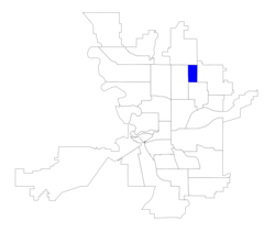 Location within the city of Spokane | |
| Coordinates: 47°42′02.5″N 117°25′33.3″W / 47.700694°N 117.425917°W | |
| Country | United States |
| State | Washington |
| County | Spokane |
| City | Spokane |
| Population (2017 [1]) | |
| • Total | 3,741 |
| Demographics 2017 | |
| • White | 80.9% |
| • Latinx | 7.1% |
| • Asian/Native Hawaiian/Pacific Islander | 4.4% |
| • American Indian/Alaska Native | 3.3% |
| • Black/African American | 2.9% |
| Time zone | UTC-8 (PST) |
| • Summer (DST) | UTC-7 (PDT) |
| ZIP Codes | 99207, 99208 |
| Area code | 509 |
Whitman is a neighborhood located on the northeast side of Spokane, Washington. It is named for pioneer missionaries Marcus and Narcissa Whitman.[2]
History
The Spokane people have lived in what is now Whitman for hundreds of years.[3] The area was annexed into the city of Spokane in 1907.[4]
Geography
Whitman is a rectangular neighborhood bordered by Francis Avenue on the north, Crestline Street on the east, Wellesley Avenue on the south and Perry Street on the west. It borders the Hillyard neighborhood to the east, the Bemiss neighborhood to the south, Nevada Heights in the west and Shiloh Hills in the north. It is six city blocks across east–west but shown as four blocks in the north and six in the south. There is little separating Whitman from Nevada Heights and Hillyard. Major arterials in Francis and Wellesley Avenues separate the neighborhood from Shiloh Hills to the north and Bemiss to the south, but lesser streets form the eastern and western boundaries. Whitman's boundaries outside of those two streets are not obvious on the ground.[2] Whitman's connection to surrounding neighborhoods is strengthened by its presence in the Greater Hillyard-Northeast Planning Alliance, together with the Bemiss and Hillyard neighborhoods.[5]
Demographics
As of 2017, there were 3,741 residents in the neighborhood across 1,397 households, of which 33.3% had children. 38.7% of households were rented, compared to 45.3% citywide. 28.9% of the residents were aged 19 or younger, compared to 21.9% citywide. Those over 65 made up 11.1% of the population, compared to 14.5% citywide. The median household income was $41,156, compared to $44,768 citywide. 9.9% of the population has a bachelor's degree or higher while 40.6% have at most a high school diploma. The unemployment rate was 8.8% compared to 6.5% citywide. 79.6% of students qualify for free or reduced lunch, compared to 54.5% citywide. 93.7% of residents were born in the United States or one of its territories. Of those born elsewhere, 30.2% were from Vietnam, 24.7% from Ukraine, 19.4% from the Philippines and 9.6% from the Uzbekistan.[1]
Education
Whitman Elementary is located in the neighborhood and also serves the Whitman Neighborhood. After Whitman Elementary, students attend Garry Middle School in the adjacent Nevada Heights neighborhood.[6] John R. Rogers High School, located across the street to the south of the Whitman neighborhood, serves the area's high school students.[7]
Transportation
Surface Streets
Whitman's roads aligned with the city's street grid and are connected to the rest of the city street system by a pair of primary artierals. Wellesley Avenue on the south and Francis Avenue on the north are both classified as primary arterials by the city, with Rowan Avenue and Crestline Street classified as minor arterials. The rest of Whitman's roads are considered to be local access.[8]
For cyclists, there is a dedicated bike lanes on Crestline Street, while Central Avenue is a designated bike route without a dedicated lane.[9]
Public Transit
The Spokane Transit Authority, the region's public transportation provider, serves Whitman with two fixed schedule bus lines.[10]
| Route | Termini | Service operation and notes | Streets traveled | ||
|---|---|---|---|---|---|
33
Wellesley |
Spokane Community College SCC Transit Center |
↔ | Spokane Falls Community College Spokane Falls Station |
High-frequency route | Wellesley |
27
Hillyard |
Downtown Spokane STA Plaza |
↔ | Balboa/South Indian Trail Five Mile Park & Ride |
Basic Frequency Route | Crestline, Francis |
References
- ^ a b "Whitman Neighborhood Snapshot" (PDF). spokanecity.org. City of Spokane. Retrieved 19 June 2022.
- ^ a b "Whitman Neighborhood Profile" (PDF). spokanecity.org. City of Spokane. Retrieved 19 June 2022.
- ^ "History - Spokane Tribe of Indians". spokanetribe.com. Spokane Tribe of Indians. Archived from the original on 1 June 2022. Retrieved 12 June 2022.
- ^ "Annexation History" (PDF). static.spokanecity.org. Retrieved 19 June 2022.
- ^ Hallenberg, Pia (13 September 2012). "Northeast collaboration looks at shared issues". The Spokesman-Review. Retrieved 19 June 2022.
- ^ "Elementary School Boundary Map" (PDF). spokaneschools.org. Spokane Public Schools. Retrieved 18 June 2022.
- ^ "High School Boundary Map" (PDF). spokaneschools.org. Spokane Public Schools. Retrieved 18 June 2022.
- ^ "Official Arterial Street Map" (PDF). spokanecity.org. City of Spokane. Retrieved 19 June 2022.
- ^ "Spokane Regional Bike Map". srtc.maps.arcgis.org. Spokane Regional Transportation Council. Retrieved 7 May 2022.
- ^ "STA System Map" (PDF). spokanetransit.com. Spokane Transit Authority. Retrieved 18 June 2022.
Places adjacent to Whitman, Spokane | |
|---|---|