
White Salmon | |
|---|---|
| White Salmon, Washington | |
 White Salmon City Hall. | |
| Nickname: The Land Where The Sun Meets The Rain | |
 | |
| Coordinates: 45°43′44″N 121°29′1″W / 45.72889°N 121.48361°W | |
| Country | United States |
| State | Washington |
| County | Klickitat |
| Area | |
| • Total | 1.54 sq mi (3.98 km2) |
| • Land | 1.54 sq mi (3.98 km2) |
| • Water | 0.00 sq mi (0.00 km2) |
| Elevation | 623 ft (190 m) |
| Population | |
| • Total | 2,485 |
| • Estimate (2023)[3] | 2,594 |
| • Density | 1,684.42/sq mi (650.36/km2) |
| Time zone | UTC-8 (Pacific (PST)) |
| • Summer (DST) | UTC-7 (PDT) |
| ZIP code | 98672 |
| Area code | 509 |
| FIPS code | 53-78330[4] |
| GNIS feature ID | 1512803[5] |
| Website | City of White Salmon |
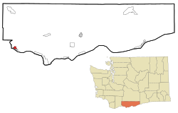
White Salmon is a city in Klickitat County, Washington, United States. It is located in the Columbia River Gorge. The population was 2,193 at the 2000 census, increased 1.4% to 2,224 at the 2010 census, and increased 11.7% to 2,485 at the 2020 census.
YouTube Encyclopedic
-
1/5Views:176 9746441 0161 099476
-
Condit Dam & the White Salmon
-
White Salmon Narrows
-
Syncline | White Salmon, WA | 04.22.2018
-
Low Water Little White Salmon, WA "2015 Lost Files"
-
Rafting Husum Waterfalls and cliff jumping into cold White Salmon River Water
Transcription
History
White Salmon was first settled in 1852 by Erastus Joslyn and his wife.[6] White Salmon was officially incorporated on June 3, 1907.
White Salmon was part of the home of the Klickitat Tribe, now a part of the Yakama Confederated Nations. The Klickitat Tribe sold some land to the Joslyns. They were generally Native advocates for the time. The area was thrown open on October 31, 1858 for white settlement after the Klickitat and Yakama lost the fight for their homelands in the Yakama War. Within the same year, the region was very rapidly and heavily settled by white immigrants making land claims. The Klickitat were forced to relocate to the Yakama Reservation.[7]
White Salmon was named after the White Salmon, a now-extinct species of salmon that lived in the Columbia River and surrounding area.[8]
Government
White Salmon's current city government includes Mayor Marla Keethler, first elected in 2019 and re-elected to a four-year term in November 2023.
Current city council members, elected to four-year terms, include Patty Fink (Position 1), David Lindley (Position 2), Jason Hartmann (Position 3), Jim Ransier (Position 4) and Ben Giant (Position 5).[9]
Geography
White Salmon is located at 45°43′44″N 121°29′1″W / 45.72889°N 121.48361°W (45.728792, -121.483557).[10]
According to the United States Census Bureau, the city has a total area of 1.22 square miles (3.16 km2), all of it land.[11]
The city is located opposite Hood River, Oregon on the Columbia River.
Climate
| Climate data for White Salmon, Washington | |||||||||||||
|---|---|---|---|---|---|---|---|---|---|---|---|---|---|
| Month | Jan | Feb | Mar | Apr | May | Jun | Jul | Aug | Sep | Oct | Nov | Dec | Year |
| Record high °F (°C) | 63 (17) |
68 (20) |
81 (27) |
90 (32) |
102 (39) |
105 (41) |
115 (46) |
108 (42) |
100 (38) |
89 (32) |
69 (21) |
66 (19) |
115 (46) |
| Mean daily maximum °F (°C) | 42 (6) |
47 (8) |
55 (13) |
61 (16) |
69 (21) |
74 (23) |
82 (28) |
82 (28) |
76 (24) |
64 (18) |
50 (10) |
40 (4) |
62 (17) |
| Mean daily minimum °F (°C) | 31 (−1) |
31 (−1) |
35 (2) |
39 (4) |
45 (7) |
51 (11) |
55 (13) |
54 (12) |
46 (8) |
38 (3) |
34 (1) |
30 (−1) |
41 (5) |
| Record low °F (°C) | −20 (−29) |
−21 (−29) |
9 (−13) |
23 (−5) |
26 (−3) |
32 (0) |
37 (3) |
36 (2) |
26 (−3) |
15 (−9) |
−5 (−21) |
−10 (−23) |
−21 (−29) |
| Average precipitation inches (mm) | 5.32 (135) |
4.06 (103) |
3.01 (76) |
1.76 (45) |
1.30 (33) |
0.87 (22) |
0.28 (7.1) |
0.31 (7.9) |
0.92 (23) |
2.29 (58) |
5.39 (137) |
5.91 (150) |
31.42 (797) |
| Source: [12] | |||||||||||||
Demographics
| Census | Pop. | Note | %± |
|---|---|---|---|
| 1910 | 682 | — | |
| 1920 | 619 | −9.2% | |
| 1930 | 798 | 28.9% | |
| 1940 | 985 | 23.4% | |
| 1950 | 1,353 | 37.4% | |
| 1960 | 1,590 | 17.5% | |
| 1970 | 1,585 | −0.3% | |
| 1980 | 1,853 | 16.9% | |
| 1990 | 1,861 | 0.4% | |
| 2000 | 2,193 | 17.8% | |
| 2010 | 2,224 | 1.4% | |
| 2019 (est.) | 2,691 | [13] | 21.0% |
| U.S. Decennial Census[14] | |||
2010 census
At the 2010 census there were 2,224 people in 921 households, including 559 families, in the city. The population density was 1,823.0 inhabitants per square mile (703.9/km2). There were 1,039 housing units at an average density of 851.6 per square mile (328.8/km2). The racial makeup of the city was 78.8% White, 0.3% African American, 1.4% Native American, 0.9% Asian, 14.7% from other races, and 3.9% from two or more races. Hispanic or Latino of any race were 24.4%.[2]
Of the 921 households 31.5% had children under the age of 18 living with them, 45.7% were married couples living together, 10.7% had a female householder with no husband present, 4.2% had a male householder with no wife present, and 39.3% were non-families. 33.1% of households were one person and 14.3% were one person aged 65 or older. The average household size was 2.41 and the average family size was 3.09.
The median age was 38.1 years. 25.6% of residents were under the age of 18; 6.5% were between the ages of 18 and 24; 26.8% were from 25 to 44; 25.2% were from 45 to 64; and 15.8% were 65 or older. The gender makeup of the city was 48.6% male and 51.4% female.
2000 census
At the 2000 census there were 2,193 people in 887 households, including 590 families, in the city. The population density was 1,759.2 people per square mile (677.4/km2). There were 948 housing units at an average density of 760.5 per square mile (292.8/km2). The racial makeup of the city was 83.08% White, 0.23% African American, 1.14% Native American, 0.73% Asian, 0.09% Pacific Islander, 12.04% from other races, and 2.69% from two or more races. Hispanic or Latino of any race were 16.83%.[4]
Of the 887 households 34.4% had children under the age of 18 living with them, 50.1% were married couples living together, 12.3% had a female householder with no husband present, and 33.4% were non-families. 29.7% of households were one person and 14.2% were one person aged 65 or older. The average household size was 2.46 and the average family size was 3.03.
The age distribution was 28.7% under the age of 18, 7.0% from 18 to 24, 28.2% from 25 to 44, 20.4% from 45 to 64, and 15.7% 65 or older. The median age was 37 years. For every 100 females, there were 93.0 males. For every 100 females age 18 and over, there were 84.7 males.
The median household income was $34,787 and the median family income was $39,653. Males had a median income of $33,021 versus $20,417 for females. The per capita income for the city was $17,995. About 13.0% of families and 16.7% of the population were below the poverty line, including 23.6% of those under age 18 and 12.8% of those age 65 or over.
References
- ^ "2019 U.S. Gazetteer Files". United States Census Bureau. Retrieved August 7, 2020.
- ^ a b "U.S. Census website". United States Census Bureau. Retrieved December 19, 2012.
- ^ Cite error: The named reference
USCensusEstimate2023was invoked but never defined (see the help page). - ^ a b "U.S. Census website". United States Census Bureau. Retrieved January 31, 2008.
- ^ "White Salmon". Geographic Names Information System. United States Geological Survey, United States Department of the Interior.
- ^ Majors, Harry M. (1975). Exploring Washington. Van Winkle Publishing Co. p. 150. ISBN 978-0-918664-00-6.
- ^ "KLICKITAT COUNTY: INDIANS OF AND SETTLEMENT BY WHITES". Retrieved October 27, 2023.
- ^ Johnson, Thom H.; Lincoln, Rich; Graves, Gary R. & Gibbons, Robert G. (1997). "Status of Wild Salmon and Steelhead Stocks in Washington State". In Stouder, Deanna J.; Bisson, Peter A. & Naiman, Robert J. (eds.). Pacific Salmon and Their Ecosystems: Status and Future Options. Springer. pp. 127–144. doi:10.1007/978-1-4615-6375-4_11. ISBN 978-1-4615-6375-4.
- ^ "City Council | White Salmon Washington".
- ^ "US Gazetteer files: 2010, 2000, and 1990". United States Census Bureau. February 12, 2011. Retrieved April 23, 2011.
- ^ "US Gazetteer files 2010". United States Census Bureau. Retrieved December 19, 2012.
- ^ "weather.com".
- ^ "Annual Estimates of the Resident Population for Incorporated Places in Washington: April 1, 2010 to July 1, 2019". United States Census Bureau. May 2020. Retrieved May 27, 2020.
- ^ United States Census Bureau. "Census of Population and Housing". Retrieved August 31, 2014.
External links
- City website
- The Enterprise, local newspaper
Municipalities and communities of Klickitat County, Washington, United States | ||
|---|---|---|
| Cities |  | |
| CDPs | ||
| Unincorporated communities | ||
| Ghost towns | ||
| Indian reservation | ||
| Footnotes | ‡This populated place also has portions in an adjacent county or counties | |
| International | |
|---|---|
| National | |