
White Post Township | |
|---|---|
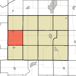 Location in Pulaski County | |
| Coordinates: 41°02′21″N 86°52′23″W / 41.03917°N 86.87306°W | |
| Country | |
| State | |
| County | Pulaski |
| Government | |
| • Type | Indiana township |
| Area | |
| • Total | 36.46 sq mi (94.4 km2) |
| • Land | 36.46 sq mi (94.4 km2) |
| • Water | 0 sq mi (0 km2) 0% |
| Elevation | 676 ft (206 m) |
| Population (2020) | |
| • Total | 1,072 |
| • Density | 29/sq mi (11/km2) |
| ZIP codes | 47946, 47957 |
| GNIS feature ID | 454052 |
White Post Township is one of twelve townships in Pulaski County, Indiana, United States. As of the 2020 census, its population was 1,072 and it contained 450 housing units.[1]
The township is an almost precise 6 mile by 6 mile square; 36.46 square miles and runs from the intersection of County Road 200N and County Road CR1700W (Jasper County line) southwards along CR1700W to CR400S thence east to CR 1100W thence north to CR200N and finally back west to the origin.
White Post Township took its name from a stagecoach stop named White Post, and it is supposed the stop was named for a nearby large white stump.[2]
| Census | Pop. | Note | %± |
|---|---|---|---|
| 1890 | 922 | — | |
| 1900 | 1,384 | 50.1% | |
| 1910 | 1,401 | 1.2% | |
| 1920 | 1,281 | −8.6% | |
| 1930 | 1,116 | −12.9% | |
| 1940 | 1,307 | 17.1% | |
| 1950 | 1,372 | 5.0% | |
| 1960 | 1,284 | −6.4% | |
| 1970 | 1,218 | −5.1% | |
| 1980 | 1,252 | 2.8% | |
| 1990 | 1,242 | −0.8% | |
| 2000 | 1,069 | −13.9% | |
| 2010 | 1,075 | 0.6% | |
| 2020 | 1,072 | −0.3% | |
| Source: US Decennial Census[3] | |||
YouTube Encyclopedic
-
1/2Views:66 2531 671
-
How much should Basement Waterproofing Cost
-
Turkey Run Civilian Conservation Corps Reunion | Indiana DNR
Transcription
Geography
According to the 2010 census, the township has a total area of 36.46 square miles (94.4 km2), all land.[4]
Cities, towns, villages
Adjacent townships
- Cass Township (north)
- Rich Grove Township (northeast)
- Jefferson Township (east)
- Beaver Township (southeast)
- Salem Township (south)
- Gillam Township, Jasper County (west)
Cemeteries
The township contains five cemeteries: White Post, Medaryville (or Rose Hill), Bowman, Saint Henry's and Saint Mark's.
Major highways
Education
- West Central School Corporation
White Post Township residents may obtain a free library card from the Pulaski County Public Library in Winamac.[5]
Political districts
- Indiana's 2nd congressional district
- State House District 20
- State Senate District 18
References
- United States Census Bureau 2008 TIGER/Line Shapefiles
- United States Board on Geographic Names (GNIS)
- IndianaMap
- ^ "Explore Census Data". data.census.gov. Retrieved April 14, 2024.
- ^ Counties of White and Pulaski, Indiana: Historical and Biographical. F.A. Battey & Company. 1883. p. 572.
- ^ "Township Census Counts: STATS Indiana".
- ^ "Population, Housing Units, Area, and Density: 2010 - County -- County Subdivision and Place -- 2010 Census Summary File 1". United States Census. Archived from the original on February 12, 2020. Retrieved May 10, 2013.
- ^ "The Library District". Pulaski County Public Library. Retrieved March 14, 2018.
External links
Places adjacent to White Post Township, Pulaski County, Indiana | |
|---|---|
Municipalities and communities of Pulaski County, Indiana, United States | ||
|---|---|---|
| Towns |  | |
| Townships | ||
| CDPs | ||
| Other communities | ||
| Footnotes | ‡This populated place also has portions in an adjacent county or counties | |