
White Oak, Mississippi | |
|---|---|
 | |
 White Oak, Mississippi | |
| Coordinates: 34°38′45″N 90°21′15″W / 34.64583°N 90.35417°W | |
| Country | United States |
| State | Mississippi |
| County | Tunica |
| Area | |
| • Total | 0.46 sq mi (1.20 km2) |
| • Land | 0.46 sq mi (1.20 km2) |
| • Water | 0.00 sq mi (0.00 km2) |
| Elevation | 180 ft (50 m) |
| Population (2020) | |
| • Total | 595 |
| • Density | 1,287.88/sq mi (497.21/km2) |
| Time zone | UTC-6 (Central (CST)) |
| • Summer (DST) | UTC-5 (CDT) |
| ZIP code | 38676 |
| Area code | 662 |
| GNIS feature ID | 684877[2] |
White Oak is a census-designated place located on Mississippi Highway 4 in Tunica County, Mississippi. White Oak is approximately 2 miles (3.2 km) east of Evansville and approximately 8 miles (13 km) west of Savage. The population at the 2020 census was 692.[3]
YouTube Encyclopedic
-
1/5Views:140 3753214 4111 0911 033
-
Bore sawing a 52" diameter white oak in Mississippi with a Husky 394
-
200 year old Live Oak Tree near Magnolia, Mississippi Pike County
-
Oakleaf Hydrangea - Southern Gardening TV, June 6, 2012
-
Microcosm (Illinois) - #50StatesAlbum - #Paperslide Music Video
-
Microcosm (Illinois) - Dr. Lodge McCammon's #50StatesAlbum
Transcription
Demographics
| Census | Pop. | Note | %± |
|---|---|---|---|
| 2010 | 692 | — | |
| 2020 | 595 | −14.0% | |
| U.S. Decennial Census[4] 2010[5] 2020[6] | |||
2020 census
| Race / Ethnicity | Pop 2010[5] | Pop 2020[6] | % 2010 | % 2020 |
|---|---|---|---|---|
| White alone (NH) | 10 | 1 | 1.45% | 0.17% |
| Black or African American alone (NH) | 672 | 585 | 97.11% | 98.32% |
| Native American or Alaska Native alone (NH) | 2 | 0 | 0.29% | 0.00% |
| Asian alone (NH) | 0 | 0 | 0.00% | 0.00% |
| Pacific Islander alone (NH) | 0 | 0 | 0.00% | 0.00% |
| Some Other Race alone (NH) | 0 | 0 | 0.00% | 0.00% |
| Mixed Race/Multi-Racial (NH) | 5 | 8 | 0.72% | 1.34% |
| Hispanic or Latino (any race) | 3 | 1 | 0.43% | 0.17% |
| Total | 692 | 595 | 100.00% | 100.00% |
Education
Residents are in the Tunica County School District.[7] Rosa Fort High School is the district's comprehensive high school.
Gallery
-
 White Oak Community Center
References
- ^ "2020 U.S. Gazetteer Files". United States Census Bureau. Retrieved July 24, 2022.
- ^ U.S. Geological Survey Geographic Names Information System: White Oak, Mississippi
- ^ "White Oak CDP, Mississippi". United States Census Bureau. Retrieved March 13, 2022.
- ^ "Decennial Census of Population and Housing by Decades". US Census Bureau.
- ^ a b "P2 HISPANIC OR LATINO, AND NOT HISPANIC OR LATINO BY RACE – 2010: DEC Redistricting Data (PL 94-171) – White Oak CDP, Mississippi". United States Census Bureau.
- ^ a b "P2 HISPANIC OR LATINO, AND NOT HISPANIC OR LATINO BY RACE – 2020: DEC Redistricting Data (PL 94-171) – White Oak CDP, Mississippi". United States Census Bureau.
- ^ "2020 CENSUS - SCHOOL DISTRICT REFERENCE MAP: Tunica County, MS" (PDF). U.S. Census Bureau. Retrieved July 31, 2022. - Text list
Municipalities and communities of Tunica County, Mississippi, United States | ||
|---|---|---|
| Town | 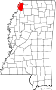 | |
| CDPs | ||
| Other communities | ||
| Ghost towns | ||


State of Mississippi | |
|---|---|
Jackson (capital) | |
| Topics | |
| Society | |
| Regions | |
| Metros | |
| Larger cities | |
| Smaller cities |
|
| Counties |
|
This Tunica County, Mississippi state location article is a stub. You can help Wikipedia by expanding it. |