
Western Grove, Arkansas | |
|---|---|
 Location of Western Grove in Newton County, Arkansas. | |
| Coordinates: 36°06′04″N 92°57′16″W / 36.10111°N 92.95444°W | |
| Country | United States |
| State | Arkansas |
| County | Newton |
| Area | |
| • Total | 1.08 sq mi (2.79 km2) |
| • Land | 1.08 sq mi (2.79 km2) |
| • Water | 0.00 sq mi (0.00 km2) |
| Elevation | 1,050 ft (320 m) |
| Population (2020) | |
| • Total | 354 |
| • Density | 328.69/sq mi (126.87/km2) |
| Time zone | UTC-6 (Central (CST)) |
| • Summer (DST) | UTC-5 (CDT) |
| ZIP code | 72685 |
| Area code | 870 |
| FIPS code | 05-74330 |
| GNIS feature ID | 2406868[2] |
Western Grove is a town in northeastern Newton County, Arkansas, United States. The population was 384 at the 2010 census. It is part of the Harrison Micropolitan Statistical Area.
YouTube Encyclopedic
-
1/3Views:2 23962817 718
-
Drive Harrison, Marshall, Leslie, Oxley, Arkansas 250mph
-
Civil War Battle of Prairie Grove AR #2
-
Arkansas's Civil War Battlefields - Arkansas Historic Preservation Progam
Transcription
Geography
According to the United States Census Bureau, the town has a total area of 2.8 km2 (1.1 mi2), all land.
Major highway
Demographics
| Census | Pop. | Note | %± |
|---|---|---|---|
| 1950 | 184 | — | |
| 1960 | 148 | −19.6% | |
| 1970 | 179 | 20.9% | |
| 1980 | 378 | 111.2% | |
| 1990 | 415 | 9.8% | |
| 2000 | 407 | −1.9% | |
| 2010 | 384 | −5.7% | |
| 2020 | 354 | −7.8% | |
| U.S. Decennial Census[3] | |||
2020 census
| Race | Number | Percentage |
|---|---|---|
| White (non-Hispanic) | 322 | 90.96% |
| Other/Mixed | 28 | 7.91% |
| Hispanic or Latino | 4 | 1.13% |
As of the 2020 United States census, there were 354 people, 186 households, and 136 families residing in the town.
2000 census
As of the census[5] of 2000, there were 407 people, 169 households, and 126 families residing in the town. The population density was 145.5/km2 (375.1/mi2). There were 193 housing units at an average density of 69.0/km2 (177.9/mi2). The racial makeup of the town was 99.51% White, and 0.49% from two or more races.
There were 169 households, out of which 37.9% had children under the age of 18 living with them, 55.0% were married couples living together, 17.8% had a female householder with no husband present, and 25.4% were non-families. 24.3% of all households were made up of individuals, and 11.8% had someone living alone who was 65 years of age or older. The average household size was 2.41 and the average family size was 2.84.
In the town, the population was spread out, with 27.0% under the age of 18, 9.3% from 18 to 24, 29.7% from 25 to 44, 23.3% from 45 to 64, and 10.6% who were 65 years of age or older. The median age was 34 years. For every 100 females, there were 80.1 males. For every 100 females age 18 and over, there were 74.7 males.
The median income for a household in the town was $24,722, and the median income for a family was $30,694. Males had a median income of $25,000 versus $16,375 for females. The per capita income for the town was $12,731. About 11.2% of families and 14.6% of the population were below the poverty line, including 27.7% of those under age 18 and 4.2% of those age 65 or over.
Education
Western Grove is within the Ozark Mountain School District,[6] which operates Western Grove High School.
On July 1, 2004 the former Western Grove School District consolidated into the Ozark Mountain School District.[7]
References
- ^ "2020 U.S. Gazetteer Files". United States Census Bureau. Retrieved October 29, 2021.
- ^ a b U.S. Geological Survey Geographic Names Information System: Western Grove, Arkansas
- ^ "Census of Population and Housing". Census.gov. Retrieved June 4, 2015.
- ^ "Explore Census Data". data.census.gov. Retrieved December 27, 2021.
- ^ "U.S. Census website". United States Census Bureau. Retrieved January 31, 2008.
- ^ "2020 CENSUS - SCHOOL DISTRICT REFERENCE MAP: Newton County, AR" (PDF). U.S. Census Bureau. Retrieved October 16, 2022.
- ^ "ConsolidationAnnex_from_1983.xls." Arkansas Department of Education. Retrieved on May 23, 2018.
External links
- Ozark Mountain School District Archived 2011-07-17 at the Wayback Machine
- Map of Western Grove (US Census Bureau)
- Newton County Historical Society
Municipalities and communities of Newton County, Arkansas, United States | ||
|---|---|---|
| City | 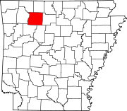 | |
| Town | ||
| Townships |
| |
| CDPs | ||
| Other unincorporated communities | ||
| Authority control databases: Geographic |
|---|