West Northamptonshire | |
|---|---|
 Coat of arms | |
| Motto(s): Ambition, Pride, Unity, Prosperity | |
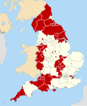
 West Northamptonshire shown within Northamptonshire | |
| Coordinates: 52°14′13″N 0°53′42″W / 52.237°N 0.895°W | |
| Sovereign state | United Kingdom |
| Country | England |
| Region | East Midlands |
| Ceremonial county | Northamptonshire |
| Incorporated | 1 April 2021 |
| Administrative HQ | Northampton |
| Government | |
| • Type | Unitary authority with leader and cabinet |
| • Body | West Northamptonshire Council |
| • Control | Conservative |
| • Leader | Jonathan Nunn (C) |
| • Chair | John Shephard |
| • Chief Executive | Anna Earnshaw |
| • House of Commons | 4 MPs |
| Area | |
| • Total | 530 sq mi (1,380 km2) |
| • Land | 532 sq mi (1,377 km2) |
| • Water | 1 sq mi (3 km2) |
| • Rank | 16th |
| Population (2021)[3] | |
| • Total | 426,462 |
| • Rank | 15th |
| • Density | 800/sq mi (310/km2) |
| Ethnicity (2021) | |
| • Ethnic groups | |
| Religion (2021) | |
| • Religion | List
|
| Time zone | UTC+0 (GMT) |
| • Summer (DST) | UTC+1 (BST) |
| Postcode area | |
| Dialling codes |
|
| ISO 3166 code | GB-WNH |
| GSS code | E06000062 |
| ITL code | TLF24 |
| GVA | 2021 estimate[5] |
| • Total | £13.2 billion |
| • Per capita | £30,905 |
| GDP (nominal) | 2021 estimate[5] |
| • Total | £14.7 billion |
| • Per capita | £34,385 |
| Website | westnorthants |


West Northamptonshire is a unitary authority area covering part of the ceremonial county of Northamptonshire, England, created in 2021.[6] By far the largest settlement in West Northamptonshire is the county town of Northampton. Its other significant towns are Daventry, Brackley and Towcester; the rest of the area is predominantly agricultural villages though it has many lakes and small woodlands and is passed through by the West Coast Main Line and the M1 and M40 motorways. The district includes the site of the Roman town of Bannaventa,[7] and the grade I listed Althorp House and its estate.[8]
History
West Northamptonshire was formed on 1 April 2021 through the merger of the three non-metropolitan districts of Daventry, Northampton, and South Northamptonshire, it absorbed the functions of these districts, plus those of the abolished Northamptonshire County Council.
In March 2018, following financial and cultural mismanagement by the cabinet and officers at Northamptonshire County Council, the then Secretary of State for Local Government, Sajid Javid, sent commissioner Max Caller into the council, who recommended the county council and all-district and borough councils in the county be abolished, and replaced by two unitary authorities, one covering the West, and one the North of the county.[9] These proposals were approved in April 2019. It meant that the districts of Daventry, Northampton and South Northamptonshire were merged to form a new unitary authority called West Northamptonshire, whilst the second unitary authority North Northamptonshire consists of the former Corby, East Northamptonshire, Kettering and Wellingborough districts.[10][11]
Governance
West Northamptonshire Council | |
|---|---|
 | |
| Type | |
| Type | |
| Leadership | |
Anna Earnshaw since 2020[14] | |
| Structure | |
| Seats | 93 |
 | |
Political groups |
|
| Elections | |
Last election | 6 May 2021 |
Next election | 1 May 2025 |
| Meeting place | |
 | |
| One Angel Square, 4 Angel Street, Northampton, NN1 1ED[15] | |
| Website | |
| westnorthants | |
West Northamptonshire Council provides both county-level and district-level services. The whole area is also covered by civil parishes, which form a second tier of local government.[16]
Political control
Since its creation in 2021, the Conservatives have held a majority of the seats on the council:[17]
| Party in control | Years | |
|---|---|---|
| Conservative | 2021–present | |
Leadership
The leader of the council from its first meeting following its creation in 2021 has been Jonathan Nunn, who was the last leader of the old Northampton Borough Council:
| Councillor | Party | From | To | |
|---|---|---|---|---|
| Jonathan Nunn | Conservative | 20 May 2021 | ||
Ian McCord, outgoing Conservative leader of the old South Northamptonshire District Council, had served as leader of the shadow authority set up to oversee the transition to the new arrangements.[18]
Composition
Following the 2021 election and subsequent changes up to January 2024, the composition of the council was:
| Party | Councillors | |
|---|---|---|
| Conservative | 63 | |
| Labour | 20 | |
| Liberal Democrats | 5 | |
| Independent | 4 | |
| Vacant | 1 | |
| Total | 93 | |
The next election is due in 2025.
Elections
Elections for a shadow authority were due to be held on Thursday 7 May 2020 but were postponed until 6 May 2021 due to the COVID-19 pandemic. New ward boundaries have been drawn up to take effect from the 2025 elections, which will reduce the number of councillors from 93 to 76, to be elected from 35 wards each electing one, two or three councillors. From 2025 elections will be held every four years.[19]
Premises
Council meetings are generally held at Northampton Guildhall, with the nearby former Northamptonshire County Council offices at One Angel Square serving as the council's headquarters.[20] The council also inherited offices at The Forum in Towcester from South Northamptonshire District Council and Lodge Road in Daventry from Daventry District Council. The Forum continues to be used as additional offices and for some council meetings, whilst Lodge Road has closed, being replaced by a smaller area office in Daventry.[21]
Demographics
Population

The West Northamptonshire population was estimated to be around 406,733 people in 2020, in 2011, off of previous administrative boundaries, the population of the West Northamptonshire area was around 375,101 people, with it being 345,589 people in 2001.[22]
Gender
In 2020, there was around an estimated 202,004 men and 204,729 women.[22]
Ethnicity
| Ethnic Group | 1991[23] | 2001[24] | 2011[25] | |||
|---|---|---|---|---|---|---|
| Number | % | Number | % | Number | % | |
| White: Total | 301,940 | 96.1% | 326,513 | 94.5% | 336,933 | 89.8% |
| White: British | – | – | 315,127 | 91.2% | 314,924 | 84% |
| White: Irish | – | – | 4,996 | 4,011 | ||
| White: Gypsy or Irish Traveller | – | – | – | – | 214 | |
| White: Other | – | – | 6,390 | 17,784 | ||
| Asian or Asian British: Total | 6,268 | 2% | 7,224 | 2.1% | 16,063 | 4.3% |
| Asian or Asian British: Indian | 2,918 | 3,915 | 6,471 | |||
| Asian or Asian British: Pakistani | 563 | 915 | 1,789 | |||
| Asian or Asian British: Bangladeshi | 1,215 | 1,818 | 3,474 | |||
| Asian or Asian British: Chinese | 847 | 1,495 | 2,005 | |||
| Asian or Asian British: Other Asian | 725 | 576 | 2,324 | |||
| Black or Black British: Total | 4,746 | 1.5% | 5,078 | 1.5% | 11,598 | 3.1% |
| Black or Black British: Caribbean | 2,877 | 3,077 | 6,837 | |||
| Black or Black British: African | 513 | 1,465 | 3,298 | |||
| Black or Black British: Other Black | 1,356 | 536 | 1,463 | |||
| Mixed or British Mixed: Total | – | – | 4,412 | 1.3% | 8,823 | 2.4% |
| Mixed: White and Black Caribbean | – | – | 2,009 | 3,819 | ||
| Mixed: White and Black African | – | – | 353 | 1,241 | ||
| Mixed: White and Asian | – | – | 1,130 | 1,947 | ||
| Mixed: Other Mixed | – | – | 920 | 1,816 | ||
| Other: Total | 1,283 | 0.4% | 867 | 0.3% | 1,684 | 0.4% |
| Other: Arab | – | – | – | – | 579 | |
| Other: Any other ethnic group | 1,283 | 0.4% | 867 | 1,105 | ||
| Total | 314,237 | 100% | 345,589 | 100% | 375,101 | 100% |
Age structure
| 0-9 years | 10-19 years | 20-29 years | 30-39 years | 40-49 years | 50-59 years | 60-69 years | 70-79 years | 80+ years |
|---|---|---|---|---|---|---|---|---|
| 52,453 | 48,857 | 45,494 | 52,919 | 54,387 | 57,322 | 43,181 | 34,676 | 17,865 |
Settlements and parishes
For a county-wide list for Northamptonshire see List of places in Northamptonshire
West Northamptonshire is entirely covered by civil parishes, of which there are 166.[26]
- Abthorpe, Adstone, Althorp, Arthingworth, Ashby St Ledgers, Ashton, Aston le Walls, Astrop, Aynho
- Badby, Barby, Blakesley, Blisworth, Boddington, Boughton, Brackley, Bradden, Brafield-on-the-Green, Braunston, Brington, Brixworth, Brockhall, Bugbrooke, Byfield
- Caldecote, Canons Ashby, Castle Ashby, Chacombe, Chapel Brampton, Charlton, Charwelton, Chipping Warden, Church Brampton, Church Stowe, Clay Coton Clipston, Cogenhoe, Cold Ashby, Cold Higham, Cosgrove, Coton, Cottesbrooke, Courteenhall, Creaton, Crick, Croughton, Culworth
- Daventry, Deanshanger, Denton, Dodford, Draughton
- East Farndon, East Haddon, Easton Neston, Edgcote, Elkington, Evenley, Everdon, Eydon
- Farthinghoe, Farthingstone, Flore, Fawsley
- Gayton, Grafton Regis, Grange Park, Great Brington, Great Oxendon, Greatworth, Greens Norton, Grimscote, Guilsborough
- Hackleton, Hanging Houghton, Hannington, Harlestone, Harpole, Hartwell, Haselbech, Hellidon, Helmdon, Hinton-in-the-Hedges, Holcot, Holdenby, Hollowell
- Kelmarsh, Kilsby, King's Sutton, Kislingbury
- Lamport, Lilbourne, Litchborough, Little Brington, Little Houghton, Long Buckby, Lower Catesby
- Maidford, Maidwell, Marston St. Lawrence, Marston Trussell, Middleton Cheney, Milton Malsor, Moreton Pinkney, Moulton
- Naseby, Nether Heyford, Newbottle, Newnham, Northampton, Norton
- Old, Old Stratford, Overthorpe, Overstone
- Passenham, Pattishall, Paulerspury, Pitsford, Potterspury, Preston Capes
- Quinton
- Radstone, Ravensthorpe, Roade, Rothersthorpe
- Scaldwell, Shutlanger, Sibbertoft, Silverstone, Slapton, Spratton, Stanford-on-Avon, Staverton, Stoke Bruerne, Sulby, Sulgrave, Syresham
- Teeton, Thenford, Thornby, Thorpe Mandeville, Tiffield, Towcester
- Upper Catesby, Upper Heyford, Upper Stowe
- Wappenham, Walgrave, Warkworth, Watford, Weedon Bec, Weedon Lois, Welford, Welton, West Haddon, Weston, Whilton, Whiston, Whitfield, Whittlebury, Wicken, Winwick, Woodend, Woodford Halse
- Yardley Gobion, Yardley Hastings, Yelvertoft
Arms
|
See also
- 2019–2023 structural changes to local government in England
- 2021 West Northamptonshire Council election
- North Northamptonshire, another district created in Northamptonshire in April 2021.
References
- ^ "Councillors and democracy". West Northamptonshire Council. Retrieved 12 February 2024.
- ^ "Mid-Year Population Estimates, UK, June 2021". Office for National Statistics. 21 December 2022. Retrieved 18 October 2023.
- ^ "Mid-Year Population Estimates, UK, June 2021". Office for National Statistics. 21 December 2022. Retrieved 18 October 2023.
- ^ a b UK Census (2021). "2021 Census Area Profile – West Northamptonshire Local Authority (E06000062)". Nomis. Office for National Statistics. Retrieved 12 February 2024.
- ^ a b Fenton, Trevor (25 April 2023). "Regional gross domestic product: local authorities". Office for National Statistics. Retrieved 12 February 2024.
- ^ "Northampton's parks and historic buildings may be managed by another council after unitary changes". Northampton Chronicle. 17 September 2018. Retrieved 27 July 2020.
- ^ Historic England. "Site of Bannaventa (1003879)". National Heritage List for England. Retrieved 28 August 2023.
- ^ Historic England. "Althorp House (1356626)". National Heritage List for England. Retrieved 28 August 2023.
- ^ "Northamptonshire County Council: statement". 27 March 2018. Retrieved 13 June 2018.
- ^ "Northamptonshire: Unitary authorities plan approved". BBC News. 14 May 2019. Retrieved 18 August 2020.
- ^ "AT LAST! Northamptonshire's new unitary councils are made law by parliament". Northampton Chronicle. 14 February 2020. Retrieved 18 August 2020.
- ^ "Council minutes, 18 May 2023". West Northamptonshire Council. Retrieved 24 January 2024.
- ^ "Council minutes, 20 May 2021". West Northamptonshire Council. 20 May 2021. Retrieved 21 June 2022.
- ^ Calkin, Sarah (11 August 2020). "Shadow unitary appoints first chief". Local Government Chronicle. Retrieved 24 January 2024.
- ^ Council, Northampton Borough. "Councillors agree next steps towards shadow authority preparations". www.northampton.gov.uk.
- ^ "Election Maps". Ordnance Survey. Retrieved 12 December 2023.
- ^ Area, West Northamptonshire Council-Northampton. "7 May 2020 Elections". www.northampton.gov.uk.
- ^ "Northamptonshire councillor wins appeal over Conservatives expulsion". BBC News. 29 April 2022. Retrieved 24 January 2024.
- ^ "The West Northamptonshire (Electoral Changes) Order 2024", legislation.gov.uk, The National Archives, SI 2025/65, retrieved 24 January 2024
- ^ "Contact us". West Northamptonshire Council. Retrieved 24 January 2024.
- ^ Heath, Martin (22 January 2024). "Office move 'will save £350k per year' - West Northants Council". BBC News. Retrieved 24 January 2024.
- ^ a b c "West Northamptonshire (Unitary District, United Kingdom) - Population Statistics, Charts, Map and Location". www.citypopulation.de. Retrieved 24 June 2022.
- ^ 1991 census data taken from NOMIS which was extracted using the 'local authorities: district / unitary (prior to April 2015)' geography type.
- ^ "Office of National Statistics; 2001 Census Key Statistics". webarchive.nationalarchives.gov.uk. Retrieved 7 September 2021.
- ^ "2011 Census: Ethnic Group, local authorities in England and Wales". webarchive.nationalarchives.gov.uk. Retrieved 15 December 2021.
- ^ "West Northamptonshire - with parishes". City Population. Retrieved 29 January 2024.
- ^ "Coat of Arms". West Northamptonshire Council. Retrieved 20 May 2023.