
West Bath, Maine | |
|---|---|
 New Meadows Inn, New Meadows River, 1915 | |
 West Bath, Maine Location within the state of Maine | |
| Coordinates: 43°52′18″N 69°51′32″W / 43.87167°N 69.85889°W | |
| Country | United States |
| State | Maine |
| County | Sagadahoc |
| Incorporated | 1844 |
| Area | |
| • Total | 15.00 sq mi (38.85 km2) |
| • Land | 11.80 sq mi (30.82 km2) |
| • Water | 3.20 sq mi (8.03 km2) |
| Elevation | 0 ft (0 m) |
| Population (2020) | |
| • Total | 1,910 |
| • Density | 161/sq mi (62.0/km2) |
| Time zone | UTC-5 (Eastern (EST)) |
| • Summer (DST) | UTC-4 (EDT) |
| ZIP code | 04530 |
| Area code | 207 |
| FIPS code | 23-81930 |
| GNIS feature ID | 0582801 |
West Bath is a town in Sagadahoc County, Maine, United States. The population was 1,910 at the 2020 census.[2] A sub-locality of West Bath is Winnegance. West Bath is part of the Portland–South Portland–Biddeford, Maine metropolitan statistical area.
YouTube Encyclopedic
-
1/3Views:4 8981 8194 189
-
Video QuickTour: Bath, Maine, Part 1
-
Bath, Maine-Downtown
-
Bath 4 Kids
Transcription
History
Winnegance Carrying Place, located between Winnegance Creek on the Kennebec River and Winnegance Bay on the New Meadows River, was a busy canoe portage for the Kennebec Abenaki Indians. The area was first a portion of Georgetown, incorporated in 1716, then of Bath, incorporated in 1781.[3] West Bath was set off and incorporated as a town on February 14, 1844. When the population was 603 in 1858, industries included a gristmill, sawmill and clapboard, shingle and lath machines. West Bath is today a suburb of Bath and Brunswick.[4]
Geography
According to the United States Census Bureau, the town has a total area of 15.00 square miles (38.85 km2), of which 11.90 square miles (30.82 km2) is land and 3.10 square miles (8.03 km2) is water.[1] Situated on part of a peninsula, West Bath is drained by Winnegance Creek and the New Meadows River estuary.
The town is crossed by U. S. Route 1. It borders the city of Bath to the northeast, town of Phippsburg to the southeast, and (separated by the New Meadows River) is near the towns of Harpswell to the southwest, and Brunswick to the northwest.
Demographics
| Census | Pop. | Note | %± |
|---|---|---|---|
| 1850 | 603 | — | |
| 1860 | 400 | −33.7% | |
| 1870 | 373 | −6.7% | |
| 1880 | 315 | −15.5% | |
| 1890 | 307 | −2.5% | |
| 1900 | 291 | −5.2% | |
| 1910 | 230 | −21.0% | |
| 1920 | 313 | 36.1% | |
| 1930 | 277 | −11.5% | |
| 1940 | 353 | 27.4% | |
| 1950 | 578 | 63.7% | |
| 1960 | 766 | 32.5% | |
| 1970 | 836 | 9.1% | |
| 1980 | 1,309 | 56.6% | |
| 1990 | 1,716 | 31.1% | |
| 2000 | 1,798 | 4.8% | |
| 2010 | 1,877 | 4.4% | |
| 2020 | 1,910 | 1.8% | |
| U.S. Decennial Census[5] | |||
2010 census
As of the census[6] of 2010, there were 1,877 people, 817 households, and 570 families residing in the town. The population density was 157.7 inhabitants per square mile (60.9/km2). There were 1,116 housing units at an average density of 93.8 per square mile (36.2/km2). The racial makeup of the town was 97.2% White, 0.5% African American, 0.7% Native American, 0.5% Asian, 0.1% Pacific Islander, 0.2% from other races, and 0.8% from two or more races. Hispanic or Latino of any race were 0.8% of the population.
There were 817 households, of which 25.3% had children under the age of 18 living with them, 55.2% were married couples living together, 10.4% had a female householder with no husband present, 4.2% had a male householder with no wife present, and 30.2% were non-families. 24.5% of all households were made up of individuals, and 8.5% had someone living alone who was 65 years of age or older. The average household size was 2.29 and the average family size was 2.69.
The median age in the town was 47.7 years. 19.1% of residents were under the age of 18; 6.1% were between the ages of 18 and 24; 20.1% were from 25 to 44; 36.8% were from 45 to 64; and 17.9% were 65 years of age or older. The gender makeup of the town was 47.9% male and 52.1% female.
2000 census
As of the census[7] of 2000, there were 1,798 people, 750 households, and 536 families residing in the town. The population density was 152.2 inhabitants per square mile (58.8/km2). There were 983 housing units at an average density of 83.2 per square mile (32.1/km2). The racial makeup of the town was 98.22% White, 0.33% African American, 0.39% Native American, 0.33% Asian, 0.22% from other races, and 0.50% from two or more races. Hispanic or Latino of any race were 0.44% of the population.
There were 750 households, out of which 28.5% had children under the age of 18 living with them, 60.3% were married couples living together, 7.7% had a female householder with no husband present, and 28.4% were non-families. 23.2% of all households were made up of individuals, and 6.8% had someone living alone who was 65 years of age or older. The average household size was 2.39 and the average family size was 2.80.
In the town, the population was spread out, with 22.5% under the age of 18, 5.3% from 18 to 24, 27.7% from 25 to 44, 32.2% from 45 to 64, and 12.2% who were 65 years of age or older. The median age was 42 years. For every 100 females, there were 99.6 males. For every 100 females age 18 and over, there were 101.3 males.
The median income for a household in the town was $45,326, and the median income for a family was $52,986. Males had a median income of $34,375 versus $27,448 for females. The per capita income for the town was $23,022. About 4.0% of families and 6.6% of the population were below the poverty line, including 9.0% of those under age 18 and 4.4% of those age 65 or over.
Education
West Bath is home to one elementary school, West Bath Elementary School.
Sites of interest
Notable people
- Jorunn Jacobsen Buckley, professor
- Thomas Buckley, anthropologist
References
- ^ a b "US Gazetteer files 2010". United States Census Bureau. Retrieved December 16, 2012.
- ^ "Census - Geography Profile: West Bath town, Sagadahoc County, Maine". Retrieved January 18, 2022.
- ^ Coolidge, Austin J.; John B. Mansfield (1859). A History and Description of New England. Boston, Massachusetts: A.J. Coolidge. pp. 353.
coolidge mansfield history description new england 1859.
- ^ Brief Description and History of West Bath, Maine
- ^ "Census of Population and Housing". Census.gov. Retrieved June 4, 2015.
- ^ "U.S. Census website". United States Census Bureau. Retrieved December 16, 2012.
- ^ "U.S. Census website". United States Census Bureau. Retrieved January 31, 2008.
External links
- Town of West Bath, Maine
- Patten Free Library
- Lower Kennebec Regional Land Trust
- New Meadows River Watershed Project
- Maine.gov – West Bath, Maine
- Maine Genealogy: West Bath, Sagadahoc County, Maine
Municipalities and communities of Sagadahoc County, Maine, United States | ||
|---|---|---|
| City | 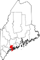 | |
| Towns | ||
| Unorganized territory | ||
| CDPs | ||
| Other villages | ||