
| Wattle Range Council South Australia | |||||||||||||||
|---|---|---|---|---|---|---|---|---|---|---|---|---|---|---|---|
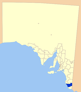 Position of the Wattle Range Council | |||||||||||||||
| Coordinates | 37°27′55″S 140°30′00″E / 37.4653°S 140.4999°E | ||||||||||||||
| Population | 11,888 (LGA 2021)[1] | ||||||||||||||
| • Density | 3,03/km2 (780/sq mi) | ||||||||||||||
| Established | 1997 | ||||||||||||||
| Area | 3,923.5 km2 (1,514.9 sq mi) | ||||||||||||||
| Mayor | Des Noll | ||||||||||||||
| Council seat | Millicent | ||||||||||||||
| Region | Limestone Coast[2] | ||||||||||||||
| State electorate(s) | MacKillop, Mount Gambier | ||||||||||||||
| Federal division(s) | Barker | ||||||||||||||
| Website | Wattle Range Council | ||||||||||||||
| |||||||||||||||
Wattle Range Council is a local government area in the Limestone Coast region of South Australia. It stretches from the coast at Beachport east to the Victorian border. It had a population of over 11,000 as at the 2016 Census.
The council is divided into four wards; Kintore, Riddoch, Sorby Adams and Corcoran wards, with two or more councillors representing each ward. The council seat is located at Millicent.[3]
YouTube Encyclopedic
-
1/3Views:6 0502 372444
-
Three Approaches to Treating Addiction by Dr. Bob Weathers
-
How To Buy Or Build A Dual Occupancy Property (Ep293)
-
East Grampians Aged Care Activities
Transcription
History
The aboriginal people of the region were composed of five powerful tribes, each occupying its own territory which was strictly defined, and territorial rights guarded jealously. Each had different dialects and the names of the tribes were Bungandidj, Pinegunga, Mootatunga, Wichitunga and Polingunga, of which the first was the most powerful.[4] The tract of country occupied by the Booandik extended from the mouth of the Glenelg River to Rivoli Bay North (Beachport) for about 30 miles inland.
European settlers first moved into the area in the late 1840s, and by the 1860s opened up tracts of land for farming cereal crops. Beachport became an important port during the 1880s, further increasing the population of the area.[4] The first local government areas were set up around the three towns of Millicent, Penola and Beachport in the late 19th century, with each operating independently of each other until 1997.
The Wattle Range Council was formed in 1997 from the amalgamation of the District Council of Beachport, the District Council of Millicent and the District Council of Penola.[5][6]
Geography
The council includes the towns and localities of Beachport, Burrungule, Comaum, Coonawarra, Furner, German Flat, Glencoe, Glenroy, Hatherleigh, Kalangadoo, Kangaroo Inn, Koorine, Krongart, Maaoupe, Magarey, Millicent, Moerlong, Monbulla, Mount Burr, Mount McIntyre, Nangwarry, Penola, Rendelsham, Rocky Camp, Sebastopol, Short, Southend, Thornlea, Wattle Range and Wattle Range East, and parts of Bool Lagoon, Bray, Canunda, Clay Wells, Nora Creina, Tantanoola and Wepar.[7]
Economy
The local economy is dependent on wide range of activities, with agriculture, fishing, forestry and tourism making up the major components.
Sheep and cattle farming are the prominent agricultural venture, with dairy farming common also. Cereal cropping is also prevalent in the nutrient-rich soils of the South East.[8]
Viticulture is well established in the council area, with one of South Australia's premier wine growing regions, the Coonawarra wine region, located in its bounds, with rich terra rossa soil aiding the wine quality.[9]
Forestry and milling have also been important to the district, with processing plants at Nangwarry and Millicent.
Tourism is a diverse, growing aspect of the economy, with seaside towns such as Beachport attracting tourists for the seaside atmosphere, and others such as Coonawarra, for the wine growing industry.[10] A niche tourism activity is cave diving in the water-filled caves and sinkholes present in the southern part of the council's area as well as in the adjoining local government area of the District Council of Grant. This activity attracts cave divers from around the globe. Popular sites include Fossil Cave, Pines and Tank Cave.[11][12]
Elected Members
| Ward | Elected Members | Position | |
|---|---|---|---|
| N/A[13] | Des Noll | Mayor | |
| Corcoran[13] | Glenn Brown | Deputy Mayor | |
| Sharon Cox | Councillor | ||
| John Drew | Councillor | ||
| Moira Neagle | Councillor | ||
| Graham Slarks | Councillor | ||
| Kintore [13] | Peter Dunnicliff | Councillor | |
| Kevin McGrath | Councillor | ||
| Riddoch [13] | Dean Burrow | Councillor | |
| Rick Paltridge | Councillor | ||
| Sorby Adams [13] | Deb Agnew | Councillor | |
| Dale Price | Councillor | ||
Wattle Range Council has a directly elected mayor.[13] A councillor is appointed by council as deputy mayor at the start of each term in office.
See also
References
- ^ Australian Bureau of Statistics (28 June 2022). "Wattle Range (Local Government Area)". Australian Census 2021 QuickStats. Retrieved 28 June 2022.
- ^ "Limestone Coast SA Government region" (PDF). The Government of South Australia. Retrieved 10 October 2014.
- ^ "Wattle Range Council". Retrieved 12 April 2016.
- ^ a b Manning Index, South East, retrieved 18 June 2007
- ^ Wattle Range Council, Home, archived from the original on 28 August 2007, retrieved 18 June 2007
- ^ "Thursday, 13 February 1997" (PDF). The Government Gazette of South Australia. Government of South Australia. Retrieved 22 November 2016.
- ^ "Location SA Map Viewer". Government of South Australia. Retrieved 12 April 2016.
- ^ Wattle Range Council, Primary Industries, archived from the original on 11 August 2007, retrieved 18 June 2007
- ^ WineDiva, Coonawarra region, retrieved 18 June 2007
- ^ Wattle Range Tourism, Home, retrieved 18 June 2007
- ^ "The Pines – 5L061". Richard "Harry" Harris. Archived from the original on 28 February 2005. Retrieved 9 October 2013.
- ^ "Tank Cave 5L230". Richard "Harry" Harris. Archived from the original on 23 September 2015. Retrieved 9 October 2013.
- ^ a b c d e f "Election Results 2014" (PDF). Local Government Association of South Australia. Retrieved 15 February 2016.